Prairie Township, Crawford County, Illinois
| Prairie Township | |
|---|---|
| Township | |
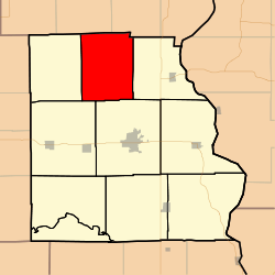 Location in Crawford County | |
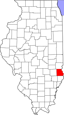 Crawford County's location in Illinois | |
| Coordinates: 39°07′15″N 87°47′30″W / 39.12083°N 87.79167°WCoordinates: 39°07′15″N 87°47′30″W / 39.12083°N 87.79167°W | |
| Country | United States |
| State | Illinois |
| County | Crawford |
| Established | November 5, 1867 |
| Area | |
| • Total | 40.83 sq mi (105.7 km2) |
| • Land | 40.68 sq mi (105.4 km2) |
| • Water | 0.14 sq mi (0.4 km2) 0.34% |
| Elevation | 545 ft (166 m) |
| Population (2010) | |
| • Total | 594 |
| • Density | 14.6/sq mi (5.6/km2) |
| Time zone | CST (UTC-6) |
| • Summer (DST) | CDT (UTC-5) |
| ZIP codes | 62413, 62433, 62442, 62454, 62478 |
| GNIS feature ID | 0429594 |
Prairie Township is one of ten townships in Crawford County, Illinois, USA. As of the 2010 census, its population was 594 and it contained 268 housing units.[1]
Geography
According to the 2010 census, the township has a total area of 40.83 square miles (105.7 km2), of which 40.68 square miles (105.4 km2) (or 99.63%) is land and 0.14 square miles (0.36 km2) (or 0.34%) is water.[1]
Unincorporated towns
(This list is based on USGS data and may include former settlements.)
Cemeteries
The township contains these five cemeteries: Cox, Dix, Eaton, Mount Pleasant and Stanfield.
School districts
- Hutsonville Community Unit School District 1
- Robinson Community Unit School District 2
Political districts
- Illinois' 15th congressional district
- State House District 109
- State Senate District 55
References
- "Prairie Township, Crawford County, Illinois". Geographic Names Information System. United States Geological Survey. Retrieved 2010-01-10.
- United States Census Bureau 2007 TIGER/Line Shapefiles
- United States National Atlas
- 1 2 "Population, Housing Units, Area, and Density: 2010 - County -- County Subdivision and Place -- 2010 Census Summary File 1". United States Census. Retrieved 2013-05-28.
External links
 |
Orange Township, Clark County | |
Melrose Township, Clark County | |
| Licking Township | |
Hutsonville Township | ||
| ||||
| | ||||
| Oblong Township | Robinson Township |
Municipalities and communities of Crawford County, Illinois, United States | ||
|---|---|---|
| City | ||
| Town | ||
| Villages | ||
| Townships | ||
| CDPs | ||
| Other unincorporated communities | ||
| Ghost town | ||
| Footnotes | ‡This populated place also has portions in an adjacent county or counties | |
This article is issued from Wikipedia - version of the 12/3/2013. The text is available under the Creative Commons Attribution/Share Alike but additional terms may apply for the media files.