Ibrahimpatnam mandal, Krishna district
| Ibrahimpatnam mandal ఇబ్రహీంపట్నం మండలం | |
|---|---|
| Mandal | |
|
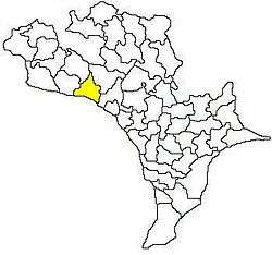
Mandal map of Krishna district showing Ibrahimpatnam mandal (in yellow) | |
 Ibrahimpatnam mandal Location in Andhra Pradesh, India | |
| Coordinates: 16°36′20″N 80°22′43″E / 16.60556°N 80.37861°ECoordinates: 16°36′20″N 80°22′43″E / 16.60556°N 80.37861°E | |
| Country | India |
| State | Andhra Pradesh |
| District | Krishna |
| Headquarters | Ibrahimpatnam |
| Area[1] | |
| • Total | 104.81 km2 (40.47 sq mi) |
| Population (2011)[2] | |
| • Total | 103,559 |
| • Density | 990/km2 (2,600/sq mi) |
| Languages | |
| • Official | Telugu |
| Time zone | IST (UTC+5:30) |
| Vehicle registration | AP |
Ibrahimpatnam mandal is one of the fifty mandals that constitute the Krishna district of the State of Andhra Pradesh in India. It is under the administration of the Vijayawada revenue division and the mandal headquarters are located at Ibrahimpatnam town.[3][1] The mandal is located on the banks of Krishna River and is bounded by Kanchikacherla, Veerullapadu, G. Konduru and Vijayawada (rural) mandals.[4] The mandal is also a part of the Andhra Pradesh Capital Region under the jurisdiction of APCRDA.[5]
Demographics
As of 2011 census, the mandal had a population of 103,559. The total population constitute, 50,895 males and 52,664 females —a sex ratio of 1035 females per 1000 males. 10,856 children are in the age group of 0–6 years, of which 5,552 are boys and 5,304 are girls. The average literacy rate stands at 77.59% with 71,926 literates.[2]
Towns and villages
As of 2011 census, the mandal has 18 settlements. It includes 3 census towns and 15 villages.[3][6]
The settlements in the mandal are listed below:
- Chilukuru
- Damuluru
- Elaprolu
- Gudurupadu
- Guntupalli (CT)
- Ibrahimpatnam (CT)
- Jupudi
- Kachavaram
- Kethanakonda
- Kondapalli (CT)
- Kotikalapudi
- Malkapuram
- Mulapadu
- N.Pothavaram
- Trilochanapuram
- Tummalapalem
- Zami Machavaram
- Zami Navi Pothavaram
Note: (CT)-Census town[7]
See also
References
- 1 2 "District Census Handbook - Krishna" (PDF). Census of India. p. 16,310. Retrieved 6 February 2016.
- 1 2 "Census 2011". The Registrar General & Census Commissioner, India. Retrieved 12 September 2014.
- 1 2 "Krishna District Mandals" (PDF). Census of India. pp. 492,526. Retrieved 21 January 2015.
- ↑ "Mandals in Krishna district". aponline.gov.in. Retrieved 15 September 2014.
- ↑ "Andhra Pradesh Capital Region Development Authority Act, 2014" (PDF). News19. Municipal Administration and Urban Development Department. 30 December 2014. Retrieved 9 February 2015.
- ↑ "Ibrahimpatnam mandal villages" (PDF). Chief Commissioner of Land Administration, Govt. of Andhra Pradesh. National Informatics Centre. p. 6. Retrieved 19 January 2015.
- ↑ "Some Concepts and Definitions" (PDF). Census of India 2011. Retrieved 19 January 2015.