Innisplain, Queensland
| Innisplain Queensland | |||||||||||||
|---|---|---|---|---|---|---|---|---|---|---|---|---|---|
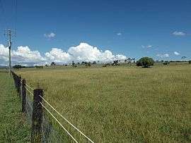
 Paddocks along Oaky Scrub Road, 2016 | |||||||||||||
 Innisplain | |||||||||||||
| Coordinates | 28°10′44″S 152°54′04″E / 28.179°S 152.901°ECoordinates: 28°10′44″S 152°54′04″E / 28.179°S 152.901°E | ||||||||||||
| Population | 463 (2011)[1] | ||||||||||||
| Postcode(s) | 4285 | ||||||||||||
| LGA(s) | Scenic Rim Region | ||||||||||||
| State electorate(s) | Beaudesert | ||||||||||||
| Federal Division(s) | Wright | ||||||||||||
| |||||||||||||
Innisplain is a rural locality in the Scenic Rim Region, Queensland, Australia.[2] In the 2011 census, Innisplain and surrounding localities had a population of 463 people.[1]
Geography

Fields, 2016
Part of the Logan River and the Mount Lindesay Highway marks the western boundary. The area is hilly with some land used for agriculture. The Sydney–Brisbane rail corridor passes through the area.
History
A railway station on the Beaudesert Shire Tramway was located at Innisplain, opening in 1903. A state school operated from 1921 to 1962.[3]
References
- 1 2 Australian Bureau of Statistics (31 October 2012). "Innisplain (SSC)". 2011 Census QuickStats. Retrieved 12 March 2016.
- ↑ "Innisplain (entry 45148)". Queensland Place Names. Queensland Government. Retrieved 12 March 2016.
- ↑ "Innisplain State School". Agency Details. Queensland State Archives. Retrieved 12 March 2016.
External links
![]() Media related to Innisplain, Queensland at Wikimedia Commons
Media related to Innisplain, Queensland at Wikimedia Commons
This article is issued from Wikipedia - version of the 4/2/2016. The text is available under the Creative Commons Attribution/Share Alike but additional terms may apply for the media files.