Warrill View, Queensland
| Warrill View Queensland | |||||||||||||
|---|---|---|---|---|---|---|---|---|---|---|---|---|---|
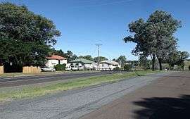 Cunningham Highway at Warrill View, 2015 | |||||||||||||
 Warrill View | |||||||||||||
| Coordinates | 27°49′27″S 152°36′57″E / 27.82417°S 152.61583°ECoordinates: 27°49′27″S 152°36′57″E / 27.82417°S 152.61583°E | ||||||||||||
| Population | 321 (2011 census)[1] | ||||||||||||
| Postcode(s) | 4307 | ||||||||||||
| Elevation | 65 m (213 ft) | ||||||||||||
| LGA(s) | Scenic Rim Region | ||||||||||||
| State electorate(s) | Beaudesert | ||||||||||||
| Federal Division(s) | Wright | ||||||||||||
| |||||||||||||
Warrill View is a rural town in the Scenic Rim Region, Queensland, Australia.[2] Warrill View is located in the Fassifern Valley farming area. At the 2011 Australia Census the town recorded a population of 321.[1]
The Cunningham Highway passes through Warrill View.
History
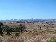
View towards the town as seen from Cunninghams Lookout, 2011
The name Warrill comes from the name of the local creek, whose name is allegedly an Aboriginal word meaning water or stream.[2] Warrill Creek is a tributary of the Bremer River.
Heritage listings
Warrill View has a number of heritage-listed sites, including:
- Cunningham Highway: Normanby Homestead[3]
References
- 1 2 Australian Bureau of Statistics (31 October 2012). "Warrill View (State Suburb)". 2011 Census QuickStats. Retrieved 12 July 2013.
- 1 2 "Warrill View (entry 36617)". Queensland Place Names. Queensland Government. Retrieved 13 September 2015.
- ↑ "Normanby Homestead (entry 600737)". Queensland Heritage Register. Queensland Heritage Council. Retrieved 12 July 2013.
External links
![]() Media related to Warrill View, Queensland at Wikimedia Commons
Media related to Warrill View, Queensland at Wikimedia Commons
This article is issued from Wikipedia - version of the 7/18/2016. The text is available under the Creative Commons Attribution/Share Alike but additional terms may apply for the media files.