Isle au Haut Light
|
| |
 | |
| Location | Isle au Haut, Maine |
|---|---|
| Coordinates | 44°3′53.076″N 68°39′4.952″W / 44.06474333°N 68.65137556°WCoordinates: 44°3′53.076″N 68°39′4.952″W / 44.06474333°N 68.65137556°W |
| Year first constructed | 1907 |
| Automated | 1934 |
| Foundation | Granite blocks |
| Construction | Granite and brick |
| Tower shape |
Conical (lower) Cylindrical (upper) |
| Markings / pattern |
Lower: gray Upper: white with black lantern |
| Focal height | 48 feet (15 m) |
| Original lens | 4th order Fresnel lens |
| Current lens | 9.8 inches (250 mm) solar powered |
| Range |
White: 8 nautical miles (15 km; 9.2 mi) Red: 6 nautical miles (11 km; 6.9 mi) |
| Characteristic | Fl R 4s with W sector |
| Fog signal | none |
| Admiralty number | J0068 |
| ARLHS number | USA-404 |
| USCG number | |
|
Isle au Haut Light Station | |
| Nearest city | Isle au Haut, Maine |
| Architect | US Army Corps of Engineers |
| MPS | Light Stations of Maine MPS |
| NRHP Reference # | 87002265[4] |
| Added to NRHP | January 21, 1988 |
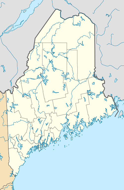
Isle au Haut Light, also called Robinson Point Light, is a lighthouse located at Robinson Point in Isle au Haut, Maine. The lighthouse was established in 1907.
History
The lighthouse tower and surrounding buildings at Isle au Haut Light Station were built in 1907 by the United States Army Corps of Engineers at a 20-acre (8.1 ha) site at Robinson Point purchased from Charles E. Robinson. The lighthouse tower was built slightly offshore, standing 40 feet (12 m) tall and consisting of a white granite and brick cylindrical upper section on a conical granite block foundation. The keeper's quarters are a two-and-a-half-story frame and stucco Victorian house connected to the tower by a catwalk. A boathouse, oil house, and storage shed were also built at the station.[2]
The lighthouse was automated in 1934 and the government sold the property except the tower back to Robinson. The Robinson family used the property as a summer home until they sold it to Jeff and Judi Burke in 1986. The Burkes converted the keeper's quarters into a bed and breakfast called "The Keeper's House," which they operated until 2007.[2][5][6]
Isle au Haut Light was added to the National Register of Historic Places as "Isle au Haut Light Station" in 1988.[4] The Coast Guard transferred the lighthouse to the Town of Isle au Haut in 1998 under the Maine Lights Program and the tower was completely restored in 1999.[7]
The lighthouse remains in service as of 2008. The current optic for the light is a 9.8 inches (250 mm) solar-powered lens which flashes red every four seconds with a white sector covering the safe channel. The original fourth order Fresnel lens is at the Maine Lighthouse Museum in Rockland, Maine.[2]
See also
References
- ↑ Light List, Volume I, Atlantic Coast, St. Croix River, Maine to Shrewsbury River, New Jersey (PDF). Light List. United States Coast Guard. 2009. p. 31.
- 1 2 3 4 "Historic Light Station Information and Photography: Maine". United States Coast Guard Historian's Office. 2009-08-08.
- ↑ Rowlett, Russ (2009-10-09). "Lighthouses of the United States: Eastern Maine". The Lighthouse Directory. University of North Carolina at Chapel Hill.
- 1 2 National Park Service (2009-03-13). "National Register Information System". National Register of Historic Places. National Park Service.
- ↑ Roberts, Bruce; Ray Jones (2002). American Lighthouses: A Definitive Guide. Globe Pequot. pp. 35–36. ISBN 978-0-7627-2269-3.
- ↑ Greenlaw, Linda (2003). The Lobster Chronicles: Life On a Very Small Island. Hyperion. pp. 58–60, 66. ISBN 0-7868-8591-2.
- ↑ Twin Lights Publishers; Jean Patey (2004). New England's Lighthouses: A Photographic Portrait. Twin Lights Publishers. p. 39. ISBN 1-885435-50-9.
