Jacksonburg, Ohio
| Jacksonburg, Ohio | |
|---|---|
| Village | |
|
Houses on State Route 744 | |
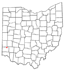 Location of Jacksonburg, Ohio | |
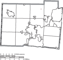 Location of Jacksonburg in Butler County | |
| Coordinates: 39°32′17″N 84°30′7″W / 39.53806°N 84.50194°WCoordinates: 39°32′17″N 84°30′7″W / 39.53806°N 84.50194°W | |
| Country | United States |
| State | Ohio |
| County | Butler |
| Township | Wayne |
| Area[1] | |
| • Total | 0.02 sq mi (0.05 km2) |
| • Land | 0.02 sq mi (0.05 km2) |
| • Water | 0 sq mi (0 km2) |
| Elevation[2] | 961 ft (293 m) |
| Population (2010)[3] | |
| • Total | 63 |
| • Estimate (2012[4]) | 63 |
| • Density | 3,150.0/sq mi (1,216.2/km2) |
| Time zone | Eastern (EST) (UTC-5) |
| • Summer (DST) | EDT (UTC-4) |
| FIPS code | 39-38192[5] |
| GNIS feature ID | 1064895[2] |

Jacksonburg is a village in Butler County, Ohio, United States. The population was 63 at the 2010 census.
History
Jacksonburg was founded on February 16, 1816.[6] The village was named after General Andrew Jackson, afterward seventh President of the United States.[7]
Geography
Jacksonburg is located at 39°32′17″N 84°30′7″W / 39.53806°N 84.50194°W (39.538153, -84.501896).[8]
According to the United States Census Bureau, the village has a total area of 0.02 square miles (0.05 km2), all land.[1]
Demographics
| Historical population | |||
|---|---|---|---|
| Census | Pop. | %± | |
| 1830 | 127 | — | |
| 1840 | 136 | 7.1% | |
| 1850 | 185 | 36.0% | |
| 1860 | 153 | −17.3% | |
| 1870 | 127 | −17.0% | |
| 1880 | 108 | −15.0% | |
| 1890 | 79 | −26.9% | |
| 1900 | 77 | −2.5% | |
| 1910 | 55 | −28.6% | |
| 1920 | 44 | −20.0% | |
| 1930 | 58 | 31.8% | |
| 1940 | 67 | 15.5% | |
| 1950 | 114 | 70.1% | |
| 1960 | 100 | −12.3% | |
| 1970 | 92 | −8.0% | |
| 1980 | 58 | −37.0% | |
| 1990 | 50 | −13.8% | |
| 2000 | 67 | 34.0% | |
| 2010 | 63 | −6.0% | |
| Est. 2015 | 64 | [9] | 1.6% |
2010 census
As of the census[3] of 2010, there were 63 people, 21 households, and 17 families residing in the village. The population density was 3,150.0 inhabitants per square mile (1,216.2/km2). There were 22 housing units at an average density of 1,100.0 per square mile (424.7/km2). The racial makeup of the village was 90.5% White, 4.8% Native American, and 4.8% from two or more races.
There were 21 households of which 33.3% had children under the age of 18 living with them, 42.9% were married couples living together, 23.8% had a female householder with no husband present, 14.3% had a male householder with no wife present, and 19.0% were non-families. 19.0% of all households were made up of individuals and 9.6% had someone living alone who was 65 years of age or older. The average household size was 3.00 and the average family size was 3.35.
The median age in the village was 29.8 years. 30.2% of residents were under the age of 18; 9.4% were between the ages of 18 and 24; 28.5% were from 25 to 44; 27% were from 45 to 64; and 4.8% were 65 years of age or older. The gender makeup of the village was 54.0% male and 46.0% female.
2000 census
As of the census[5] of 2000, there were 67 people, 22 households, and 17 families residing in the village. The population density was 3,436.6 people per square mile (1,293.4/km²). There were 22 housing units at an average density of 1,128.4 per square mile (424.7/km²). The racial makeup of the village was 97.01% White, and 2.99% from two or more races.
There were 22 households out of which 31.8% had children under the age of 18 living with them, 59.1% were married couples living together, 13.6% had a female householder with no husband present, and 18.2% were non-families. 18.2% of all households were made up of individuals and 4.5% had someone living alone who was 65 years of age or older. The average household size was 3.05 and the average family size was 3.50.
In the village the population was spread out with 28.4% under the age of 18, 9.0% from 18 to 24, 29.9% from 25 to 44, 19.4% from 45 to 64, and 13.4% who were 65 years of age or older. The median age was 36 years. For every 100 females there were 123.3 males. For every 100 females age 18 and over, there were 118.2 males.
The median income for a household in the village was $38,125, and the median income for a family was $38,750. Males had a median income of $30,417 versus $28,750 for females. The per capita income for the village was $11,771. None of the population is below the poverty line.
Historic population figures
- 1900—77
- 1910—55
- 1920—44
- 1930—58
- 1940—67
- 1950—114
- 1960—100
- 1970—92
- 1980—58
- 1990—50
Notable person
- James Middleton Cox, Governor of Ohio
References
- 1 2 "US Gazetteer files 2010". United States Census Bureau. Archived from the original on January 24, 2012. Retrieved 2013-01-06.
- 1 2 "US Board on Geographic Names". United States Geological Survey. 2007-10-25. Retrieved 2008-01-31.
- 1 2 "American FactFinder". United States Census Bureau. Retrieved 2013-01-06.
- ↑ "Population Estimates". United States Census Bureau. Archived from the original on June 17, 2013. Retrieved 2013-06-17.
- 1 2 "American FactFinder". United States Census Bureau. Archived from the original on September 11, 2013. Retrieved 2008-01-31.
- ↑ Bartlow, Bert Surene (1905). Centennial History of Butler County, Ohio. B. F. Bowen. p. 349.
- ↑ Overman, William Daniel (1958). Ohio Town Names. Akron, OH: Atlantic Press. p. 65.
- ↑ "US Gazetteer files: 2010, 2000, and 1990". United States Census Bureau. 2011-02-12. Retrieved 2011-04-23.
- ↑ "Annual Estimates of the Resident Population for Incorporated Places: April 1, 2010 to July 1, 2015". Retrieved July 2, 2016.
- ↑ "Census of Population and Housing". Census.gov. Archived from the original on May 11, 2015. Retrieved June 4, 2015.
Further reading
- Bert S. Barlow, W.H. Todhunter, Stephen D. Cone, Joseph J. Pater, and Frederick Schneider, eds. Centennial History of Butler County, Ohio. Hamilton, Ohio: B.F. Bowen, 1905.
- Jim Blount. The 1900s: 100 Years In the History of Butler County, Ohio. Hamilton, Ohio: Past Present Press, 2000.
- Butler County Engineer's Office. Butler County Official Transportation Map, 2003. Fairfield Township, Butler County, Ohio: The Office, 2003.
- A History and Biographical Cyclopaedia of Butler County, Ohio with Illustrations and Sketches of Its Representative Men and Pioneers. Cincinnati, Ohio: Western Biographical Publishing Company, 1882.
- Ohio. Secretary of State. The Ohio municipal and township roster, 2002-2003. Columbus, Ohio: The Secretary, 2003.
Municipalities and communities of Butler County, Ohio, United States | ||
|---|---|---|
| Cities |  | |
| Villages | ||
| Townships | ||
| CDPs | ||
| Unincorporated communities | ||
| Footnotes | ‡This populated place also has portions in an adjacent county or counties | |