Reily Township, Butler County, Ohio
| Reily Township, Butler County, Ohio | |
|---|---|
| Township | |
|
James P. Hidley Cottage, built 1860 | |
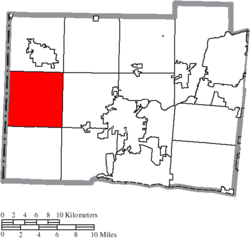 Location of Reily Township in Butler County | |
| Coordinates: 39°26′18″N 84°45′16″W / 39.43833°N 84.75444°WCoordinates: 39°26′18″N 84°45′16″W / 39.43833°N 84.75444°W | |
| Country | United States |
| State | Ohio |
| County | Butler |
| Area | |
| • Total | 36.7 sq mi (95.0 km2) |
| • Land | 36.7 sq mi (95.0 km2) |
| • Water | 0.0 sq mi (0.0 km2) |
| Elevation[1] | 879 ft (268 m) |
| Population (2010) | |
| • Total | 2,624 |
| • Density | 71/sq mi (27.6/km2) |
| Time zone | Eastern (EST) (UTC-5) |
| • Summer (DST) | EDT (UTC-4) |
| ZIP code | 45056 |
| Area code(s) | 513 |
| FIPS code | 39-66096[2] |
| GNIS feature ID | 1085818[1] |

Reily Township, one of thirteen townships in the county, is located in west-central Butler County, Ohio, United States. It had a population of 2,624 at the 2010 census,[3] up from 2,568 in 2000. There are no incorporated places in the township, but the communities of Bunker Hill, Newkirk, Scipio, St. Charles, and Woods Station are in the township. It is one full survey township in the Congress Lands and is 36.7 square miles (95.0 km2) in area.[3]
History
It was the eighth in order of creation, erected from St. Clair Township by the Butler County Commissioners (James Blackburn, Matthew Richardson, and James Smith) on December 7, 1807, with these boundaries:
- Beginning on the western boundary line of the county at the southwest corner of the fourth township in the first range; thence east with the township line to the southeast corner of the section number 32 of the fourth township in the second range; thence north with the sectional line to the north boundary of the said fourth township in the said second range; thence west with the township line to the western boundary line of the county aforesaid; thence south with the same to the place of beginning.
The first election of township officers was at Henry Burget's home on January 2, 1808.
Historic population figures
- 1900—1,113
- 1910—1,166
- 1920—1,051
- 1930—1,080
- 1940—1,157
- 1950—1,195
- 1960—1,629
- 1970—1,626
- 1980—2,177
- 1990—2,521
- 2000—2,568
- 2010—2,624
Geography
Located in the western part of the county, it borders the following townships:
- Oxford Township - north
- Milford Township - northeast corner
- Hanover Township - east
- Ross Township - southeast corner
- Morgan Township - south
- Whitewater Township, Franklin County, Indiana - southwest corner
- Springfield Township, Franklin County, Indiana - west
- Bath Township, Franklin County, Indiana - northwest corner
Name
The only Reily Township statewide, it is named for John Reily (1763–1850), the former Clerk of the Northwest Territory and the first Butler County clerk of courts.
Government
The township is governed by a three-member board of trustees, who are elected in November of odd-numbered years to a four-year term beginning on the following January 1. Two are elected in the year after the presidential election and one is elected in the year before it. There is also an elected township fiscal officer,[4] who serves a four-year term beginning on April 1 of the year after the election, which is held in November of the year before the presidential election. Vacancies in the fiscal officership or on the board of trustees are filled by the remaining trustees.
Public services
The township is in the Talawanda City School District.
Major highways include U.S. Route 27, the road between Cincinnati, Ohio, and Richmond, Indiana; State Route 129, which travels from Hamilton, Ohio, to the Indiana border; and State Route 732.
References
- 1 2 "US Board on Geographic Names". United States Geological Survey. 2007-10-25. Retrieved 2008-01-31.
- ↑ "American FactFinder". United States Census Bureau. Retrieved 2008-01-31.
- 1 2 "Geographic Identifiers: 2010 Demographic Profile Data (G001): Reily township, Butler County, Ohio". U.S. Census Bureau, American Factfinder. Retrieved February 21, 2014.
- ↑ §503.24, §505.01, and §507.01 of the Ohio Revised Code. Accessed 4/30/2009.
- Bert S. Barlow, W.H. Todhunter, Stephen D. Cone, Joseph J. Pater, and Frederick Schneider, eds. Centennial History of Butler County, Ohio. Hamilton, Ohio: B.F. Bowen, 1905.
- Jim Blount. The 1900s: 100 Years In the History of Butler County, Ohio. Hamilton, Ohio: Past Present Press, 2000.
- Butler County Engineer's Office. Butler County Official Transportation Map, 2003. Fairfield Township, Butler County, Ohio: The Office, 2003.
- A History and Biographical Cyclopaedia of Butler County, Ohio with Illustrations and Sketches of Its Representative Men and Pioneers. Cincinnati, Ohio: Western Biographical Publishing Company, 1882.
- Ohio. Secretary of State. The Ohio municipal and township roster, 2002-2003. Columbus, Ohio: The Secretary, 2003.
External links
Municipalities and communities of Butler County, Ohio, United States | ||
|---|---|---|
| Cities |  | |
| Villages | ||
| Townships | ||
| CDPs | ||
| Unincorporated communities | ||
| Footnotes | ‡This populated place also has portions in an adjacent county or counties | |