Judith River
| Judith River | |
|---|---|
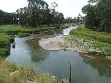 Judith River near Hanover Road | |
|
The Judith River | |
| Country | Fergus and Judith Basin County, Montana |
| Basin | |
| Main source | 46°50′57″N 110°16′10″W / 46.84917°N 110.26944°W[1] |
| River mouth |
2,408 feet (734 m)[1] 47°44′06″N 109°38′46″W / 47.73500°N 109.64611°WCoordinates: 47°44′06″N 109°38′46″W / 47.73500°N 109.64611°W[1] |
| River system | Missouri River |
| Features | |
| Tributaries |
|
The Judith River is a tributary of the Missouri River, approximately 124 mi (200 km) long, running through central Montana in the United States. It rises in the Little Belt Mountains and flows northeast past Utica and Hobson. It is joined by Dry Wolf Creek in northern Fergus County, and itself joins the Missouri in the White Cliffs Area approximately 18 mi (29 km) northwest of Winifred.
The river gives its name to the Judith River Group of the late Cretaceous, a notable area for excavation of dinosaur fossils that stretches from Montana into southeastern Alberta and southwestern Saskatchewan. The river was named by William Clark. William Clark came across a stream which he considered particularly clear and pretty, and named it the Judith River, in honor of a young girl back in Virginia he hoped would marry him some day. (In fact, ultimately she did; their grandson, Meriwether Lewis Clark, Jr., was a Colonel in the U.S. Army and later a founder, with his extended family, of the Kentucky Derby.)
It is also known for its large amount of Cretaceous dinosaur fossils, including those of Tyrannosaurus, Styracosaurus and Edmontosaurus.
The Judith is a Class I river from the confluence with Big Spring Creek to its confluence with the Missouri River for public access for recreational purposes.[2]
History
The Crow tribe called this waterway Buluhpa’ashe, “Plum river.” Capt. Meriwether Lewis named this central Montana river the Bighorn. On May 20, 1805, Capt. William Clark renamed it in honor of his future wife, Julia (Judith) Hancock. Beginning in the 1880s, the area surrounding the Judith River at Judith Landing was home to 2 large ranching operations: the DHS Ranch of A. J. and Erwin Davis, Samuel T. Hauser, and Granville Stuart; and the PN Ranch of Thomas C. Power and G. R. Norris.[3]
White Eagle, "the last major Chief of the Gros Ventre people", died "at the mouth of the Judith River" on February 9, 1881.[4]
See also
External links
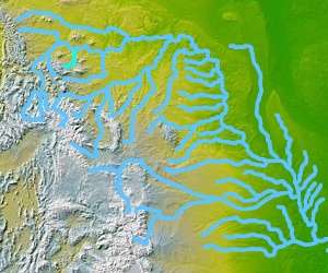
- Montana relief map showing Judith River
- Additional Information and Photos of the Judith River
- Montana Historical Society
Notes
- 1 2 3 "Judith River". Geographic Names Information System. United States Geological Survey.
- ↑ Stream Access in Montana
- ↑ Aarstad, Rich, Ellie Arguimbau, Ellen Baumler, Charlene Porsild, and Brian Shovers. Montana Place Names from Alzada to Zortman. Montana Historical Society Press.
- ↑ Smith, Jeffrey J. (2003). Montana Book of Days-365 Days-365 Stories-The Short Course in Montana History. Missoula, MT: Historic Montana Publishing. p. 42. ISBN 0966335562.