Blaine County, Montana
| Blaine County, Montana | |
|---|---|
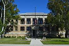 Blaine County Courthouse in Chinook | |
 Location in the U.S. state of Montana | |
 Montana's location in the U.S. | |
| Founded | 1912 |
| Named for | James G. Blaine |
| Seat | Chinook |
| Largest city | Chinook |
| Area | |
| • Total | 4,239 sq mi (10,979 km2) |
| • Land | 4,228 sq mi (10,950 km2) |
| • Water | 11 sq mi (28 km2), 0.3% |
| Population (est.) | |
| • (2015) | 6,577 |
| • Density | 1.5/sq mi (1/km²) |
| Congressional district | At-large |
| Time zone | Mountain: UTC-7/-6 |
| Website |
www |
Blaine County is a county in the U.S. state of Montana. As of the 2010 census, the population was 6,491.[1] Its county seat is Chinook.[2] The county was named in honor of James G. Blaine, former United States Secretary of State. It is south of the Canada–US border with Saskatchewan.
History
In 1912 Blaine, Phillips and Hill counties withdrew from Chouteau County to form their own counties. The original boundary of Blaine County included a portion of land in the west that is included in Phillips County.
Geography
According to the U.S. Census Bureau, the county has a total area of 4,239 square miles (10,980 km2), of which 4,228 square miles (10,950 km2) is land and 11 square miles (28 km2) (0.3%) is water.[3]
The majority of Fort Belknap Indian Reservation is located in the southeastern part of the county.[4]
Features of the area include the Milk River, Bears Paw Mountains, and the Little Rocky Mountains.
| Wikimedia Commons has media related to Blaine County, Montana. |
Adjacent counties and rural municipalities
- Hill County, Montana - west
- Chouteau County, Montana - southwest
- Fergus County, Montana - south
- Phillips County, Montana - east
- Reno No. 51, Saskatchewan - northwest
- Frontier No. 19, Saskatchewan - north
- Lone Tree No. 18, Saskatchewan - northeast
National protected areas
- Black Coulee National Wildlife Refuge
- Nez Perce National Historical Park (part)
- Upper Missouri River Breaks National Monument (part)
Demographics
| Historical population | |||
|---|---|---|---|
| Census | Pop. | %± | |
| 1920 | 9,057 | — | |
| 1930 | 9,006 | −0.6% | |
| 1940 | 9,566 | 6.2% | |
| 1950 | 8,516 | −11.0% | |
| 1960 | 8,091 | −5.0% | |
| 1970 | 6,727 | −16.9% | |
| 1980 | 6,999 | 4.0% | |
| 1990 | 6,728 | −3.9% | |
| 2000 | 7,009 | 4.2% | |
| 2010 | 6,491 | −7.4% | |
| Est. 2015 | 6,577 | [5] | 1.3% |
| U.S. Decennial Census[6] 1790-1960[7] 1900-1990[8] 1990-2000[9] 2010-2015[1] | |||
2000 census
As of the census[10] of 2000, there were 7,009 people, 2,501 households, and 1,793 families residing in the county. The population density was 2 people per square mile (1/km²). There were 2,947 housing units at an average density of <1/km² (1/sq mi). The racial makeup of the county was 52.58% White, 0.17% Black or African American, 45.37% Native American, 0.09% Asian, 0.03% Pacific Islander, 0.23% from other races, and 1.54% from two or more races. 1.00% of the population were Hispanic or Latino of any race. 18.8% were of German and 8.1% Norwegian ancestry. 91.7% spoke English, 3.8% German and 2.0% Dakota as their first language.
There were 2,501 households out of which 36.00% had children under the age of 18 living with them, 52.30% were married couples living together, 14.40% had a female householder with no husband present, and 28.30% were non-families. 26.00% of all households were made up of individuals and 10.80% had someone living alone who was 65 years of age or older. The average household size was 2.78 and the average family size was 3.36.
In the county the population was spread out with 32.60% under the age of 18, 8.00% from 18 to 24, 24.80% from 25 to 44, 21.60% from 45 to 64, and 12.90% who were 65 years of age or older. The median age was 34 years. For every 100 females there were 97.50 males. For every 100 females age 18 and over, there were 96.30 males.
The median income for a household in the county was $25,247, and the median income for a family was $30,616. Males had a median income of $23,627 versus $20,469 for females. The per capita income for the county was $12,101. About 23.40% of families and 28.10% of the population were below the poverty line, including 36.50% of those under age 18 and 19.90% of those age 65 or over.
2010 census
As of the 2010 United States Census, there were 6,491 people, 2,357 households, and 1,604 families residing in the county.[11] The population density was 1.5 inhabitants per square mile (0.58/km2). There were 2,843 housing units at an average density of 0.7 per square mile (0.27/km2).[12] The racial makeup of the county was 49.4% American Indian, 48.2% white, 0.1% black or African American, 0.1% Asian, 0.2% from other races, and 2.0% from two or more races. Those of Hispanic or Latino origin made up 1.8% of the population.[11] In terms of ancestry, 23.0% were German, 9.2% were Norwegian, 6.6% were Irish, 5.7% were English, and 2.0% were American.[13]
Of the 2,357 households, 39.2% had children under the age of 18 living with them, 45.6% were married couples living together, 16.0% had a female householder with no husband present, 31.9% were non-families, and 28.7% of all households were made up of individuals. The average household size was 2.66 and the average family size was 3.28. The median age was 35.1 years.[11]
The median income for a household in the county was $37,034 and the median income for a family was $40,890. Males had a median income of $32,320 versus $28,986 for females. The per capita income for the county was $16,813. About 23.6% of families and 29.0% of the population were below the poverty line, including 44.6% of those under age 18 and 10.6% of those age 65 or over.[14]
Economy
The main industry in Blaine County is agriculture.[15] The main employers on the Reservation are the Gros Ventre and Assiniboine tribes.[16]
Education
Fort Belknap College is located on the Fort Belknap Indian Reservation. Harlem High School is located in Harlem home of the Wild cats Class B. Chinook High School is located in Chinook home of the mighty Beeters(Sugar Beeters)Class C. Turner High School is located in Turner their mascot is the Tornados Class C.
Communities
Cities
Census-designated places
Unincorporated communities
See also
- List of cemeteries in Blaine County, Montana
- List of lakes in Blaine County, Montana
- List of mountains in Blaine County, Montana
- National Register of Historic Places listings in Blaine County, Montana
References
- 1 2 "State & County QuickFacts". United States Census Bureau. Retrieved September 14, 2013.
- ↑ "Find a County". National Association of Counties. Archived from the original on 2011-05-31. Retrieved 2011-06-07.
- ↑ "2010 Census Gazetteer Files". United States Census Bureau. August 22, 2012. Retrieved November 27, 2014.
- ↑ Merrill, Andrea; Judy Jacobson (1997). Montana almanac. Helena, Montana: Falcon Publishing. p. 7. ISBN 1-56044-493-2.
- ↑ "Annual Estimates of the Resident Population for Incorporated Places: April 1, 2010 to July 1, 2015". Retrieved May 20, 2016.
- ↑ "U.S. Decennial Census". United States Census Bureau. Archived from the original on May 11, 2015. Retrieved November 27, 2014.
- ↑ "Historical Census Browser". University of Virginia Library. Retrieved November 27, 2014.
- ↑ "Population of Counties by Decennial Census: 1900 to 1990". United States Census Bureau. Retrieved November 27, 2014.
- ↑ "Census 2000 PHC-T-4. Ranking Tables for Counties: 1990 and 2000" (PDF). United States Census Bureau. Retrieved November 27, 2014.
- ↑ "American FactFinder". United States Census Bureau. Archived from the original on 2013-09-11. Retrieved 2008-01-31.
- 1 2 3 "DP-1 Profile of General Population and Housing Characteristics: 2010 Demographic Profile Data". United States Census Bureau. Retrieved 2016-01-09.
- ↑ "Population, Housing Units, Area, and Density: 2010 - County". United States Census Bureau. Retrieved 2016-01-09.
- ↑ "DP02 SELECTED SOCIAL CHARACTERISTICS IN THE UNITED STATES – 2006-2010 American Community Survey 5-Year Estimates". United States Census Bureau. Retrieved 2016-01-09.
- ↑ "DP03 SELECTED ECONOMIC CHARACTERISTICS – 2006-2010 American Community Survey 5-Year Estimates". United States Census Bureau. Retrieved 2016-01-09.
- ↑ Maxim Technologies. "Pre-Disaster Mitigation Plan" (PDF). Retrieved 31 May 2011.
- ↑ State of Montana, DLI. "Demographic & Economic Information for Fort Belknap Reservation" (PDF). Retrieved 31 May 2011.
Further reading
- Noyes, Al. J. (1917). In the land of Chinook; or, The story of Blaine County. Helena, MT: State Publishing Co. Retrieved 2014-05-21.
External links
 |
Reno No. 51, Saskatchewan | Frontier No. 19, Saskatchewan | Lone Tree No. 18, Saskatchewan | |
| Hill County | |
Phillips County | ||
| ||||
| | ||||
| Chouteau County | Fergus County |
Municipalities and communities of Blaine County, Montana, United States | ||
|---|---|---|
| Cities | | |
| CDPs | ||
| Unincorporated communities | ||
| Indian reservations | ||
| Footnotes | ‡This populated place also has portions in an adjacent county or counties | |
Coordinates: 48°26′N 108°58′W / 48.44°N 108.96°W