Kanchanpur District
| Kanchanpur कञ्चनपुर जिल्ला | |
|---|---|
| District | |
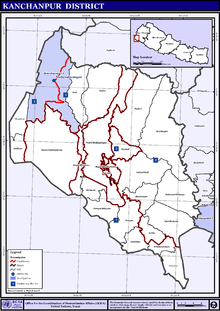
 Location of Kanchanpur | |
| Country | Nepal |
| Region | Far-Western (Sudur Pashchimanchal) |
| Zone | Mahakali |
| Established | 1860 |
| Headquarters | Mahendranagar |
| Area | |
| • Total | 1,610 km2 (620 sq mi) |
| Population (2011) | |
| • Total | 451,248 |
| • Density | 280/km2 (730/sq mi) |
| Time zone | NPT (UTC+5:45) |
| Main language(s) | Kumauni / Doteli(70%), Rana Tharu (20%), Nepali language (7%), others (3%) |
Kanchanpur District (Nepali: कञ्चनपुर जिल्ला![]() Listen , a part of Province No. 7 in Terai plain, is one of seventy-five districts of Nepal. The district, with Bhimdatta as its district headquarters, covers an area of 1,610 km and had a population of 134,868 in 2001 and 171,304 in 2011.[1][2] It is located in southern-west of Nepal. It is bordered with Kailali district in east, Dadeldhura district in north and with modern-day india in south and west.
Listen , a part of Province No. 7 in Terai plain, is one of seventy-five districts of Nepal. The district, with Bhimdatta as its district headquarters, covers an area of 1,610 km and had a population of 134,868 in 2001 and 171,304 in 2011.[1][2] It is located in southern-west of Nepal. It is bordered with Kailali district in east, Dadeldhura district in north and with modern-day india in south and west.
Before the reunification of Nepal by Gorkha King PN Shah, this district was the part of Doti Kingdom. Nepal lost it to the East India Company during the Partition of Nepal after Anglo-Nepalese war (1814-1816) between the then Kingdom of Nepal and East india Company followed by Sugauli Treaty. Later on after treaty of 1860, Nepal recovered this land along with Kailali, Banke and Bardiya. Its first headquarters was Belauri Municipality and the current headquarter Mahendranagr was declared in 2019 B.S.
The majority of population is occupied by ethnic Tharu community and minor group are the peoples that have migrated from northern hilly region. The district is renowned for Shuklaphanta Wildlife Reserve and 1456.97 meters long multispan suspension bridge over Mahakali River.
Jhilmila Lake, Bedkot Lake, Bandatal, Shovatal and Vishnu Temple are the other places of tourist attraction.
Geographical Location
It expands from 28 degree 38 minutes to 29 degree 28 minutes Northern latitudes and 80 degree 03 minutes to 80 degree 33 minutes Eastern Longitudes.[3]
| Climate Zone[4] | Elevation Range | % of Area |
|---|---|---|
| Lower Tropical | below 300 meters (1,000 ft) | 85.2% |
| Upper Tropical | 300 to 1,000 meters 1,000 to 3,300 ft. |
13.0% |
| Subtropical | 1,000 to 2,000 meters 3,300 to 6,600 ft. |
1.8% |
Municipalities and Village Development Committees (VDC)
- Baise Bichwa
- Bedkot Municipality
- Belauri Municipality
- Beldandi Municipality
- Bhimdatta Municipality
- Dekhatbhuli
- Dodhara-Chandani Municipality
- Jhalari-Pipaladi Municipality
- Krishnapur Municipality
- Punarwas Municipality
- Raikawar Bichawa
- Sankarpur
Communication and Media
FM Stations and News Papers of Kanchanpur District
- Suklaphanta FM 99.4 MHz[5]
- Radio Mahakali FM 96.2 MHz[6]
- Dishanirdesh Kanchan Post Weekly
- Farwest Times
- Chure Times
- Mahendranagar Post
- Abhiyan Daily
- Paschim Nepal Daily
- Dainik Khabar Daily
- New Janakranti Daily
- Radio Nagarik FM 104.3 MHz[7]
- Radio Rastriya 89.8 MHz[8]
- Radio Barasinga 102.2 MHz
- Radio Paschim Nepal 91.0 MHz
- Radio Kanchanpur 90.2 MHz[9]
- Radio Pahichaan FM 105.3 MHz
- Radio Sudur Sanchar 100.4 MHz[10]
- Radio Belauri 105 MHz[11]
- Belauri Post Weekly
- Prabhu FM 102.5 MHz
Lakes In Kanchanpur District
- Banda lake
- Betkot lake
- Pyara lake
- Jhilmila lake
- Shova lake
References
- ↑ "National Population and Housing Census 2011(National Report)" (PDF). Central Bureau of Statistics. Government of Nepal. November 2012. Retrieved 28 July 2015.
- ↑ "Districts of Nepal (Population, Area & Capital)". Statoids. 7 December 2012. Retrieved 7 December 2012. External link in
|publisher=(help) - ↑ "District Development Committee, Kanchanpur".
- ↑ The Map of Potential Vegetation of Nepal - a forestry/agroecological/biodiversity classification system (PDF), Forest & Landscape Development and Environment Series 2-2005 and CFC-TIS Document Series No.110., 2005, ISBN 87-7903-210-9, retrieved Nov 22, 2013
- ↑ "Suklaphanta FM 99.4 MHz".
- ↑ "Radio Mahakali FM 96.2 MHz".
- ↑ "Radio Nagarik FM 104.3 MHz".
- ↑ "Radio Rastriya 89.8 MHz".
- ↑ "Radio Kanchanpur 90.2 MHz".
- ↑ "Radio Sudur Sanchar 100.4 MHz".
- ↑ "Radio Belauri 105 MHz".
External links
| Wikimedia Commons has media related to Kanchanpur District. |
See also

Coordinates: 28°50′N 80°20′E / 28.833°N 80.333°E