Khairpur
| Khairpur | |
|---|---|
| City | |
|
Faiz Mahal | |
 Khairpur | |
| Coordinates: 27°32′N 68°46′E / 27.533°N 68.767°ECoordinates: 27°32′N 68°46′E / 27.533°N 68.767°E | |
| Country | Pakistan |
| Province | Sindh |
| District | Khairpur |
| Population | |
| • Estimate (2006) | 127,857 |
| Time zone | PST (UTC+5) |
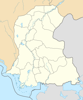
Khairpur (Urdu: خيرپُور), (Sindhi: خیرپور), (khīr´pūr) is a city and the capital of the Khairpur District, in Sindh Province, Pakistan. It is the twelfth largest city in the province and was founded in 1783 by Mir Sohrab Khan, who established the Khairpur branch of the Talpur clan. The settlement was selected as the seat of the Mirs of northern Sindh. It was the capital of the former princely state of Khairpur. The great mystic Sufi Sachal Sarmast came from this city, which is noted for its dates, known in the Sindhi language as Khark, and in Urdu as Khajoor. It has 8 talukas, 76 Union councils, 11 towns, 6800 Villages and total population 1546587 (Male 810448 and Female Population 736139) according to (Census) 1998.[1] Its best known cities are Khairpur, Ranipur Riyasat Thari Mirwah, Karoondi, Pacca Chang, Bhangu Behan, Gambat, Kot Diji and Sobhodero. There is one university named Shah Abdul Latif University as well as following Colleges in Khairpur
- Mehran University College Of Engineering And Technology SZAB Campus Khairpur ,
- Khairpur College of Agricultural Engineering and Technology (KCAET) at Khairpur,
- IBA Community College Khairpur ,
- Govt: College Of Technology Khairpur Mir's (GCT KHP), Khairpur, Pakistan,
- LUMHS Khairpur Medical College.
Demographics
At the 1998 census, the population of the city of Khairpur was 102,188 having increased from 61,447 at the 1981 census. The city had an estimated population of 127,857 in 2006.
- Religion:
- Islam: 96.86%
- Hinduism: 2.93%
- Christianity: 0.09%
- Ahmaddiya: 0.07%
- Others: 0.04%
- Languages:
Roads/Highways
National Highway is main route for various transportation vehicles and Mehran Highway which connects Nawabshah and Khairpur Districts.
Historic Places
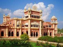
It has some historic buildings notably the Faiz Mahal, Kot Diji Fort
Religions
In Khairpur, Muslims form the largest group. There is a reasonable Hindu population. Sikh community is also present in Khairpur.
Economy
The city is situated along the Khairpur East Canal, 11 miles (18 km) south of the Indus River. It is connected by rail with Peshawar and Karachi and by road with Sukkur and Karachi. After the establishment of the state of Pakistan in 1947, Khairpur developed industrially, with textile, silk, leather goods, silk clothing, matches, soap, shoes, cigarettes and carpet manufactures.
See also
References
Further reading
External links
 Khairpur travel guide from Wikivoyage
- Khairpur diaries: Where women earn and women rule
- The golden harvest of Khairpur by Zofeen Ebrahim
