Mirpur, Azad Kashmir
| Mirpur میر پور | |
|---|---|
| New Mirpur City | |
 | |
 Mirpur 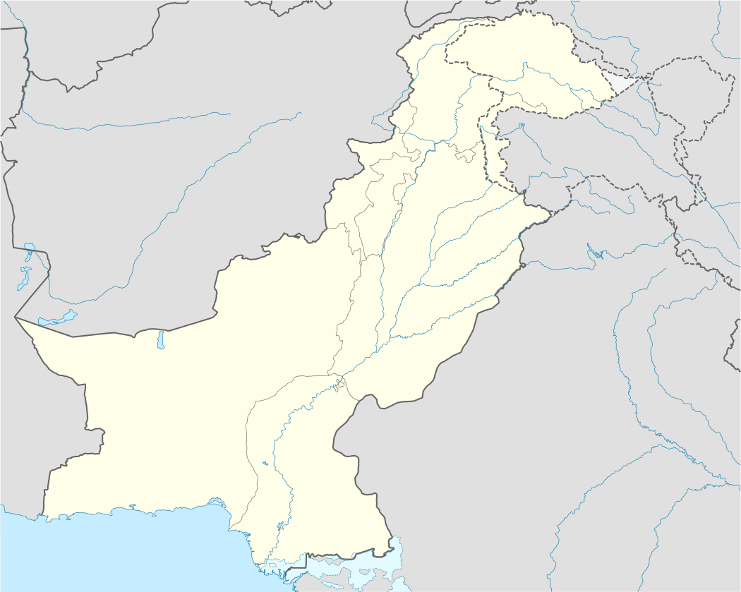 Mirpur | |
| Coordinates: 33°9′N 73°44′E / 33.150°N 73.733°ECoordinates: 33°9′N 73°44′E / 33.150°N 73.733°E | |
| Country |
|
| Territory |
|
| District | Mirpur District |
| Area | |
| • Total | 1,010 km2 (390 sq mi) |
| Elevation | 458 m (1,503 ft) |
| Population (2015) | |
| • Total | 754,482 |
| • Density | 746/km2 (1,930/sq mi) |
| Time zone | PST (UTC+5) |
| Calling code | 05827 |
| Number of towns | 3 |
| Number of Union councils | 21 |
Mirpur (Urdu, Punjabi: مِيرپُور or more commonly known as New Mirpur City) is the capital of Mirpur district and is the largest city of Azad Kashmir. The city itself has gone through a process of modernization, while most of the surrounding area remains agricultural. Mirpur is known for its grand buildings and large bungalow-houses primarily funded through its ex-pat community, which comes mainly from the United Kingdom, Europe, Hong Kong, Middle East and North America. The main crop cultivated during summer is millet and pulses. However, there are places where other crops such as wheat, maize and vegetables are also grown. The produce of quality rice from the paddy fields of khari Sharif between Upper Jhelum Canal and Jhelum river are very famous and popular for its aroma and taste. The production of electricity, through Mangla Dam makes this district somewhat unique in the entire region which provides energy needs for Azad Jammu and Kashmir and Northern Punjab province.
A significant portion of the population from the district migrated to the United Kingdom in mid to late 1950s and in early 1960s – mostly to West Yorkshire, East Midlands, West Midlands, Luton, Peterborough, Derby and East London. 70% of the British Pakistanis are Mirpuris.[1] For this reason Mirpur is sometimes known as "Little England". Many products from the UK are found in this city. Many shops in the city accept the Pound sterling.[2]
History
The area that is now Mirpur has always been a crossroad for major invasions of the South Asia and has formed part of various empires over time including the role of an outlying region of the conquests of Alexander the Great, the Kingdom of Gandhara, the Mauryan empire, the Kushan empire, the Sultanate of Ghazni, the Delhi Sultanate and the Mughal empire amongst others.
The Mirpur city itself was founded in around 1640 AD or 1050AH by the Ghakhar chief Miran Shah Ghazi. The Imperial Gazetteer of India Provincial Series Kashmir and Jammu (1909) provides this information about Mirpur history as "it is said to have been founded by Miran Shah Ghazi and Sultan Fateh Khan". An alternate view is that the city was founded by Mira Shah Gazi and Gosain Bodhpuri, both regarded as saints. The word 'Mir' was taken from the name of the former while 'Pur’ from the latter.[3]
In 997 CE, Sultan Mahmud Ghaznavi, took over the Ghaznavid dynasty empire established by his father, Sultan Sebuktegin, In 1005 he conquered the Shahis in Kabul in 1005. The Delhi Sultanate and later Mughal Empire ruled the region. The Punjab region became predominantly Muslim due to missionary Sufi saints whose dargahs dot its landscape
The area that is now Mirpur has been historically associated with Pothohar. Though modern demarcation of Potohar devised by British excludes Mirpur by using Jhelum river as the eastern boundary. By the end of the 18th century, Gakhar power in Pothohar had declined. Mirpur had become part of Chibb ruled state of Khari Khariyali with capital at Mangla Fort. With the rise of Sikh power in Punjab, Maharaja Ranjit Singh established his supremacy and set his eyes on the Chibh states of Bhimber and Khari Khariyali. In 1810, a force was sent against Raja Sultan Khan of Bhimber and was met with fierce resistance. However, in 1812 another Sikh army under prince Kharak Singh defeated Sultan Khan and the Bhimber state was annexed as Jagir of Kharak Singh. Around the same time, Ranjit Singh acquired Gujrat and invaded Khari Khariyali ruled by Raja Umar Khan. Raja Umar Khan made peace with Ranjit Singh. But before a settlement could be made, he died and the state and Mirpur became part of Ranjit Singh's territories.[4]
In 1816, Ranjit Singh annexed Jammu state and in 1820 awarded Jammu to his commander Gulab Singh who hailed from Jammu and was under the service of Ranjit Singh for the past eight years. Between 1831–39 Ranjit Singh bestowed on Gulab Singh the royalty of the salt mines in northern Punjab, and the northern Punjab towns including Bhera, Jhelum, Rohtas, Mirpur and Gujrat. Gulab Singh kept on expanding his kingdom and in 1840 Baltistan was made subject to Jammu and Gilgit fell to a Sikh force from Kashmir in 1842. The state of Kashmir was annexed by Ranjit Singh in 1819. However the rebellion in Hazara in the beginning of 1846, compelled the country to be transferred to Raja Gulab Singh of Jammu as well. As an aftermath of the First Anglo-Sikh War and the Treaty of Lahore, The Treaty of Amritsar was signed between the British Government and Raja Gulab Singh of Jammu on March 16, 1846. The British Government sold Kashmir to the Raja of Jammu for 75 lakhs Nanak Shahi Rupees. This treaty transferred him all the hill states between Ravi and Indus. The transfer included Kashmir, Hazara and the southern hill states (including former Khari Khariyali Thus sealing the fate of Mirpur with the new state of Jammu and Kashmir.[4]
Early Mirpur
Mirpur was historically a part of the Punjab region. However it became a part of the Jammu division of the princely state of Jammu and Kashmir in a deal between the rulers of that state and the British. Since Mirpur lies at the point where the Jhelum River breaks out of the heavily forested foothills of the Pir Panjal mountains into the plains of the largely treeless Punjab. It was an ideal spot for the construction of the boats used to carry goods down the five rivers of the Punjab to the Indus River and onto the seaports in the Indus delta. Traders have been operating from there across the Indian Ocean for over three thousand years. Most of the crew on the boats trading up and down the Punjab and Indus River system were drawn from Mirpur, as training as a boat-builder was a necessary prerequisite for becoming a boatman.
British rule
With the arrival of British rule, the thriving river trade was decimated due to the construction of railway lines from Bombay and Karachi into the interior of the Punjab. Moving goods by rail was both cheaper and quicker, and hundreds of Mirpuri boatmen found themselves out of a job.
At the same time long-distance ocean trade was shifting from sail to steam. There was a huge demand for men who were prepared to work in the hot, dirty and dangerous stokeholds of the new coal-fired steamers. European seamen avoided such jobs whenever they possibly could. They preferred to work on deck. But in the 1870s Mirpuri ex-river boatmen were desperately searching for a new source of income. Although unfamiliar with stoking coal-fired boilers, they were prepared to learn and quickly gained jobs as engine-room stokers on new steamships sailing out of Karachi and Bombay, a position they retained until coal-fired ships were finally phased out of service at the end of the Second World War. Many Mirpuris fought in Burma during the Second World War.
Indo-Pakistan War of 1947
In the wake of the Indo-Pakistani War of 1947, a number of militant campaigns were organised all around the Western mountains of Kashmir and Jummu, including Poonch, Muzafarabad and Mirpur to forcibly usurp Kashmir from Dogra ruler Maharaja Hari Singh.
On the Mirpur front, Col Khan of Mong played a leading role in the campaign with the strategic aim to cut off the India's supply line into the rest of Kashmir. In October 1947, Col Khan ambushed two Dogra despatch-riders at Puranian Hattian on their motorcycle armed with one sten gun.[5] This gun was used to raid Gobindpur Police Station a few nights later. This raid provided further supplies and consolidated their position. A number of further attacks ensued leading up to the Battle of Mirpur where five attacks were organised. On 25 November, finding the situation beyond control, Wazir Wazarat Mirpur, Rao Rattan Singh and Brig Karki from Nepal decided to abandon town at 1400 hours.[5]
Post war
After World War II a new set of opportunities opened up. Britain's economy was just setting off on what proved to be a long post-war boom, and there was an acute short of labour in the foundries of the Midlands, and the textile mills of Yorkshire and Lancashire. Now it was the turn of ex-seamen to become industrial workers in Britain. So when the Mangla Dam was about to be constructed in 1960, the affectees of the dam who were going to be deprived of their agricultural land were afforded the opportunity to migrate to the United Kingdom and to join those of their kinsfolk who long before had established themselves in Britain.
As a result, Mirpur is one of the principal sources of migration from the State of Azad Kashmir to Europe, and especially to Britain, so much so that out of a million migrants from the state of Azad Kashmir and Pakistan, most of them i.e. 82%. Although it is widely believed that the principal reason for this outflow was the construction of the Mangla Dam, which in no doubt is true, but the fact is that long before construction of dam, a sizable mirpuri community existed in the UK.
Hindu and Sikh communities
Before the independence of Pakistan in 1947, the Mirpur District had significant populations of Hindu and Sikhs in the principal towns of Mirpur, Kotli and Bhimber. Refugees from Jhelum in Western Punjab had taken refuge in Mirpur town, causing the non-Muslim population to increase to 20,000. Tribesmen and Pakistani military members moved into the town, seizing the city. Many Hindus and Sikhs were killed and some of their women kidnapped by Pathan tribesmen and locals. Around 5,000 were made prisoners in Alibeg. About 2500 Hindus or Sikhs escaped to the Jammu and Kashmir. In March 1948, the ICRC rescued 1,600 of the survivors from Alibeg, who were resettled to Jammu and other areas of India.[6][7]
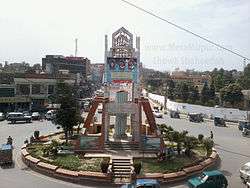
Mirpur City
Mirpur city is situated at 459 meters above sea-level and is linked with the main Peshawar-Lahore Grand Trunk road at Dina Tehsil. It is the headquarters of Mirpur District, which comprises two sub-divisions, Mirpur and Dadyal.Mirpur is now one of the largest city of Azad kashmir[8] The building of the new city in late 1960s paved the way for New Mirpur situated on the bank of Mangla lake.The project of 4 star hotel PC has been completed. And the government is planning to make the second rotating hotel of Pakistan in Mirpur,Azad Kashmir
In fact the remains of the old city (old Mirpur) are underneath the waters of the Mangla Lake; during the colder months of March and April, the water level recedes to such an extent that one can travel on motorcycle on old Mirpur road which still exists. Holy Shrines of Syed Abdul Karim and Meeran Shah Ghazi become visible and so do the remnants of a Sikh Gurdwara as well as a Hindu Mandir possibly dedicated to the "Mangla Mata" (Mangla mother goddess). The remains of old houses, water wells, Graveyards reappear too. People from surrounding areas visit old Mirpur during these months to pay homage to their ancient land they lived on and pray on graveyards of their loved ones. Urs Mubarak of Meeran Shah and Syed Abdul Kareem are also arranged in these months in old Mirpur.
The remains of old Mirpur depict a silhouette of pre-independence city when many faiths co-existed side by side. However, after division of the State of Jammu Kashmir, the non-Muslim community consisting of Hindus, Buddhists and Sikhs fled to Jammu. The New Mirpur city has been well planned with construction of modern designed buildings and ample roads serving each part of city. The affluence brought on by emigration mainly to the UK is reflected by the structure and grandiose of the residential houses. There are tell-tale signs of inward investment by the expatriate community living in the United Kingdom, Europe, North America and the Middle East. The city has a number of good hotels, restaurants, shopping malls and other urban facilities.
Industry
The Government of Azad Jammu and Kashmir has successfully endeavoured to develop Mirpur as an industrial place and promote private investment for establishing, foam, polypropylene, synthetic yarn, motorbikes and scooter, textile, vegetable Oil (Ghee), wood and sawmills, soap, cosmetics, marble, ready-made garments, matches and rosin, turpentine industrial units in the area.incase we can say that whole of the economy depends on mirpur generated economy of azad kashmir However, much of the infrastructure still needs improvement to obtain very high quality products.
As part of the relief/compensation package in the wake of Mangla Dam Raising Project, a new city is being developed along the south eastern outskirts of Mirpur with that the main city of Mirpur azad kasmir is now doubled from before . Civil works at huge scale are going on around the whole district, by the Pakistani and Chinese contractors for raising the dam. Four towns in the district have been planned besides the new city, to resettle the population affected by the project.
Education
English language is common in educational institutes. Previously the University of Azad Jammu & Kashmir was the only institution for higher studies but in the last decade there are significant changes in the educational infrastructure. Mirpur University of Science and Technology (MUST) and recently Akson College of Health Science(College of Pharmacy), Mohtarma Benazir Bhutto Shaheed Medical College have been formed.
AJK Board of Intermediate and Secondary Education, Mirpur is responsible for the studies at lower levels. In addition to the state-run schools and colleges, Mirpur has a well-developed private sector providing the education to all sects of the society. Some of these include:
- Mohi ud Din Islamic Institute of Pharmaceutical Sciences
- Mohi-ud-Din Islamic Medical College
- Mohtarma Benazir Bhutto Shaheed Medical College, Mirpur Azad Kashmir
- Mirpur University of Science and Technology (MUST)
- Punjab College, Mirpur
- Kashmir Model College Mirpur (KMC)
- The Nimble School Mirpur
- Roots School System
- The City School
- Sevent College Mirpur
- Quaid Science College Mirpur
- Mirpur Public High School
Sport
Football, Cricket and Volleyball are popular in Mirpur. Mirpur has a Cricket stadium "Quaid-e-Azam Stadium". There are registered sports clubs:A-5 Cricket Club, Al-Siraj Cricket Club, South Asia Cricket Club, Pilot Football Club, Youth Football Club and Kashmir National FC. Pilot FC is the current champion of the District Football Association Cup (DFA Cup). The district football team of Mirpur take part in the All AJK Football Championship and win that championship many times.
Transport
CNG auto rickshaws are very popular mode of transport for short routes within the city. The city's transport system links it to a number of destinations in Azad Kashmir notably Bhimber, Jatlan, Chakswari, Dadyal, Kotli and Khoi Ratta and to major cities in Pakistan as well as including services to Gujrat, Jhelum, Kharian, Gujranwala, Lahore and Rawalpindi. There is no railway station in Mirpur. The closest station is in mangla City, Azad kashmir.
The promise of a rail extension to Mirpur has been fulfilled.
Islamabad Airport which services the Mirpur region is 130 km away. Sialkot International Airport is 110 kilometres away
Mirpur airport
An international airport has been planned. The location of the airport has not been determined though construction workers have been thinking of possible locations near Mirpur such as Mangla, Jatlan and Bhalwhara. In August 2013 the national assembly and the prime minister approved confirmation of the airport. It was determined that the airport would be constructed in two years after funding had been made[9]
Shopping
The shopping capital of Azad Kashmir, Mirpur has a shopping area, centred around Chowk Shaheed, Mian Mohammed Road, Puranian /hattian, Nangi and Allama Iqbal Road
Food
Mirpur has food centers and restaurants. Samosa and fish are specialties. In terms of restaurants, there is a variety of food areas from takeaways to high class restaurants. There is a Thai restaurant. there are also a variety of restaurants specializing in local Pothwari/Punjabi dishes.
Language and demographics
Pahari and potwari are the predominant languages of the city, followed by Punjabi, Other languages spoken include Urdu and English.
According to the 1998 census Mirpur had a population of approximately 100,000. Mirpur's original population comprises different tribes similar to that of Punjab. However, since 1947, Pahari people emigrated from the neighbouring Rajouri and Poonch districts of the Indian administered Jammu and Kashmir. A majority of Mirpuris living abroad reside in England.[10]
Culture
Mirpur (to the west and south) borders the Potohar plateau.
Cultural events
Saif Ul Malook Festival
The Saif Ul Malook Festival takes place annually in April, usually in the city centre. It is an event celebrating the anniversary of Baba Pir-e-Shah Ghazi Qalandar (Damrian Wali Sarkar) who was the spiritual guide/teacher of Mian Muhammad Bakhsh, the Sufi saint and Potwari poet famous for his poetic piece Saif ul Malook.
Rathoa Mehla
The Rathoa Mehla takes place annually in summer, in the Rathoa Town near the Dam front. It is an event celebrating culture value peace and tolerance.
Pahari Mushahira
Pahari Mushahira is a literary event in which poets from all over Azad Kashmir present their poems to general audience. Pahari Mushahira are celebrated regularly in Mirpur city as part of the campaign of Alami Pahari Adabi Sangat for the preservation and rehabilitation of the Pahari language and the Culture of Jammu and Kashmir.
Development
In recent times Mirpur city has seen many new developments. Some of the schemes approved and under construction include:
- New Bong Escape Hydropower Project, Pakistan's first private Hydel power.
- Mangla Dam upraising
Tourism
Places of interest in Mirpur are:
- Khari Sharif Darbar
- Pir Sayed Naik Alam Shah Darbar - Syed Naik Alam Shah Road - Sangot
- Mangla Dam
- Ramkot Fort
Geography and climate
Mirpur is bounded on the north and east by Kotli District, on the west by Pothohar and on the south by Bhimber.
Climate
The Köppen-Geiger
climate classification is BWh. The average annual temperature is 27.4 °C in Mirpur. In a year, the average rainfall is 109 mm. Mirpur is the breadbasket of Azad Jammu and Kashmir and has a climate similar to that of the neighbouring Potohar and Punjab region.
Since it is located at the extreme south of the state Jammu & Kashmir, the climate is extremely hot and dry during summer – making it very similar to the Pakistani areas of Jehlum and Gujar Khan. Most of its bushy landscapes, stretching from Bhimber to Dadyal, are barren – leaving only a small stretch of fertile land but highly productive land in the surrounding of Mangla water. A crop cultivated during the spring/summer season is millet. There are a few farms that grow vegetables and wheat, especially when the dam water subsides during the winter season.
| Mirpur | ||||||||||||||||||||||||||||||||||||||||||||||||||||||||||||
|---|---|---|---|---|---|---|---|---|---|---|---|---|---|---|---|---|---|---|---|---|---|---|---|---|---|---|---|---|---|---|---|---|---|---|---|---|---|---|---|---|---|---|---|---|---|---|---|---|---|---|---|---|---|---|---|---|---|---|---|---|
| Climate chart (explanation) | ||||||||||||||||||||||||||||||||||||||||||||||||||||||||||||
| ||||||||||||||||||||||||||||||||||||||||||||||||||||||||||||
| ||||||||||||||||||||||||||||||||||||||||||||||||||||||||||||
Surroundings
- Balah-Galah is one of the communities of Mirpur, Azad Kashmir. It is located between the larger villages of Bhurkay and Sangot. .
- Bhalot is a village near the sector B5 district of Mirpur.
- Bhimber is 50 km from Mirpur.
- Chakswari Approximately 40 km from Mirpur city, it is fast becoming a commercial area of the district
- Dadyal is a Tehsil of the Mirpur District, 65 km from Mirpur at north, the 2nd largest city after Mirpur in AJK.
- Islamgarh Islamgarh is North East of Mirpur city. Travel distance is 30 km.
- Jandi Chontra a popular scenic spot 67 km from Mirpur in Bhimber District, the Shrine of the Sufi Saint Hazrat Sheikh Baba Shadi Shaheed is here.
- Jangian Kotla is near the river Jehlum and is approximately 20 km south of Mirpur.
- Kakra Town is 12–15 km from Mirpur.
- Khari Sharif 8 km from Mirpur, it is famous for its Sufi shrines.
- Kotli is 101 km. from Mirpur, the area is hilly and beautiful views of valleys.
- Khaliqabad is 6 km from Mirpur it is an intersection for the main road leaving Mirpur city.
- Mangla town is 16 km from Mirpur, it is at the mouth of the Mangla Dam for which it is famous.
- Football Chowk, in sector D4, is on the outskirts of Mirpur city.
- Mehmunpur Rajgan, 15 km from Mirpur city near Pul Manda.
- Sahalia 70 km from Mirpur city.
Notable people of Mirpur
- Baba Shadi Shaheed
- Chaudhry Abdul Majid
- Sultan Mehmood Chaudhry
- Mohammad Sharif Chattar educationist, botanist, author, poet
- Nazir Ahmed, Baron Ahmed - Member of the British House of Lords.
- Mian Muhammad Bakhsh - Sufi saint, Poet
- Choudhry Muhammad Yousaf - an educator and former Secretary of Education in Azad Kashmir.
- Afaq Raheem – A first-class Pakistani cricketer.
- Dr. Moeed Pirzada- A well known journalist and anchor person.
- Major General Jamil Rahmat Vance - A serving General in Pakistan army.
Twin cities
See also
- British Mirpuri community
- Chowk Shaheedan
- Maqbool Butt
- Mirpur Development Authority (MDA)
- Mirpur Punjabi
- Pahari
References
- ↑ Jul 20, 2005 12:00am (2005-07-20). "Introspection grips British Muslims - Newspaper". Dawn.Com. Retrieved 2015-08-13.
- ↑ "Inside Pakistan's 'Little Britain' as overseas nationals get vote". BBC News. 4 March 2012.
- ↑ Azad Kashmir - Kashmiri Development Foundation
- 1 2 History of Panjab Hill States, Hutchison, Vogel 1933
- 1 2 Regimental History Cell, History of the Azad Kashmir Regiment, Volume 1 (1947-1949), Azad Kashmir Regimental Centre, NLC Printers, Rawalpindi,1997
- ↑ "Mirpur 1947 – the untold story :". Web.archive.org. 2007-03-16. Archived from the original on November 2, 2013. Retrieved 2015-08-13.
- ↑ "Uday India". Web.archive.org. Archived from the original on September 8, 2011. Retrieved 2015-08-13.
- ↑ Internet Archive Wayback Machine. Web.archive.org (2009-10-27). Retrieved on 2011-12-17.
- ↑ "AJK: International Airport to be constructed in Mirpur, says Majeed". GlobalPost. 2013-04-09. Retrieved 2015-08-13.
- ↑ Moss, Paul (30 November 2006). "The limits to integration". BBC News. Retrieved 1 May 2010.
- ↑ [en.climate-data.org/location/487079/ "Climate chart of Chiniot"] Check
|url=value (help). My Weather. Retrieved 15 August 2011. - ↑ Partner Cities – Birmingham City Council. Birmingham.gov.uk (2009-08-13). Retrieved on 2011-12-17.
- ↑ Life in the Community. Bradford Metropolitan District Council