Kiowa Township, Barber County, Kansas
| Kiowa Township | |
|---|---|
| Township | |
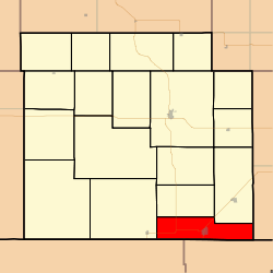 Location in Barber County | |
| Coordinates: 37°01′06″N 098°26′16″W / 37.01833°N 98.43778°WCoordinates: 37°01′06″N 098°26′16″W / 37.01833°N 98.43778°W | |
| Country | United States |
| State | Kansas |
| County | Barber |
| Area | |
| • Total | 48 sq mi (124.32 km2) |
| • Land | 47.85 sq mi (123.93 km2) |
| • Water | 0.15 sq mi (0.39 km2) 0.31% |
| Elevation | 1,296 ft (395 m) |
| Population (2000) | |
| • Total | 1,164 |
| • Density | 24.3/sq mi (9.4/km2) |
| GNIS feature ID | 0470549 |
Kiowa Township is a township in Barber County, Kansas, USA. As of the 2000 census, its population was 1,164.
Geography
Kiowa Township covers an area of 48 square miles (120 km2) and contains one incorporated settlement, Kiowa. According to the USGS, it contains one cemetery, Riverview.
Transportation
Kiowa Township contains one airport or landing strip, Kiowa Airport. Kiowa Airport is closed, it is on the west side of Kiowa. It has feed stacked on it. There are two grass private landing strips on the east side of Kiowa. One a 1/2 mile. The other 1 mile.
References
External links
Municipalities and communities of Barber County, Kansas, United States | ||
|---|---|---|
| Cities | 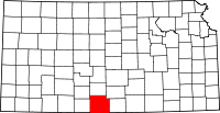 | |
| Unincorporated communities | ||
| Townships | ||
This article is issued from Wikipedia - version of the 11/8/2016. The text is available under the Creative Commons Attribution/Share Alike but additional terms may apply for the media files.