Hazelton, Kansas
| Hazelton, Kansas | |
|---|---|
| City | |
 Location within Barber County and Kansas | |
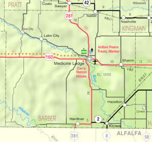 KDOT map of Barber County (legend) | |
| Coordinates: 37°5′24″N 98°24′8″W / 37.09000°N 98.40222°WCoordinates: 37°5′24″N 98°24′8″W / 37.09000°N 98.40222°W | |
| Country | United States |
| State | Kansas |
| County | Barber |
| Area[1] | |
| • Total | 0.57 sq mi (1.48 km2) |
| • Land | 0.57 sq mi (1.48 km2) |
| • Water | 0 sq mi (0 km2) |
| Elevation | 1,362 ft (415 m) |
| Population (2010)[2] | |
| • Total | 93 |
| • Estimate (2015)[3] | 93 |
| • Density | 160/sq mi (63/km2) |
| Time zone | Central (CST) (UTC-6) |
| • Summer (DST) | CDT (UTC-5) |
| ZIP code | 67061 |
| Area code | 620 |
| FIPS code | 20-31150[4] |
| GNIS feature ID | 0470537[5] |
Hazelton is a city in Barber County, Kansas, United States. As of the 2010 census, the city population was 93.[6]
History
Hazelton was founded in 1883.[7] It was named for its founder, Rev. J. Hazelton, a pioneer settler.[8][9]
The first post office in Hazelton was established in October 1883.[10]
Geography
Hazelton is located at 37°5′24″N 98°24′8″W / 37.09000°N 98.40222°W (37.089862, -98.402261).[11] According to the United States Census Bureau, the city has a total area of 0.57 square miles (1.48 km2), all of it land.[1]
Demographics
| Historical population | |||
|---|---|---|---|
| Census | Pop. | %± | |
| 1890 | 319 | — | |
| 1900 | 143 | −55.2% | |
| 1910 | 315 | 120.3% | |
| 1920 | 281 | −10.8% | |
| 1930 | 299 | 6.4% | |
| 1940 | 260 | −13.0% | |
| 1950 | 250 | −3.8% | |
| 1960 | 246 | −1.6% | |
| 1970 | 176 | −28.5% | |
| 1980 | 143 | −18.7% | |
| 1990 | 128 | −10.5% | |
| 2000 | 144 | 12.5% | |
| 2010 | 93 | −35.4% | |
| Est. 2015 | 93 | [3] | 0.0% |
| U.S. Decennial Census | |||
2010 census
As of the census[2] of 2010, there were 93 people, 45 households, and 32 families residing in the city. The population density was 163.2 inhabitants per square mile (63.0/km2). There were 58 housing units at an average density of 101.8 per square mile (39.3/km2). The racial makeup of the city was 90.3% White, 1.1% African American, 1.1% Native American, 3.2% from other races, and 4.3% from two or more races. Hispanic or Latino of any race were 9.7% of the population.
There were 45 households of which 22.2% had children under the age of 18 living with them, 62.2% were married couples living together, 6.7% had a female householder with no husband present, 2.2% had a male householder with no wife present, and 28.9% were non-families. 28.9% of all households were made up of individuals and 11.1% had someone living alone who was 65 years of age or older. The average household size was 2.07 and the average family size was 2.47.
The median age in the city was 49.9 years. 16.1% of residents were under the age of 18; 9.7% were between the ages of 18 and 24; 16.2% were from 25 to 44; 35.5% were from 45 to 64; and 22.6% were 65 years of age or older. The gender makeup of the city was 57.0% male and 43.0% female.
2000 census
As of the census[4] of 2000, there were 144 people, 55 households, and 40 families residing in the city. The population density was 253.4 people per square mile (97.5/km²). There were 67 housing units at an average density of 117.9 per square mile (45.4/km²). The racial makeup of the city was 86.81% White, 2.08% African American, 3.47% Native American, 5.56% from other races, and 2.08% from two or more races. Hispanic or Latino of any race were 6.25% of the population.
There were 55 households out of which 29.1% had children under the age of 18 living with them, 67.3% were married couples living together, 1.8% had a female householder with no husband present, and 25.5% were non-families. 23.6% of all households were made up of individuals and 12.7% had someone living alone who was 65 years of age or older. The average household size was 2.62 and the average family size was 3.12.
In the city the population was spread out with 28.5% under the age of 18, 4.9% from 18 to 24, 23.6% from 25 to 44, 24.3% from 45 to 64, and 18.8% who were 65 years of age or older. The median age was 41 years. For every 100 females there were 114.9 males. For every 100 females age 18 and over, there were 119.1 males.
The median income for a household in the city was $28,125, and the median income for a family was $33,750. Males had a median income of $21,667 versus $22,500 for females. The per capita income for the city was $12,745. There were 5.4% of families and 16.5% of the population living below the poverty line, including 32.6% of under eighteens and 15.4% of those over 64.
References
- 1 2 "US Gazetteer files 2010". United States Census Bureau. Archived from the original on 2012-07-14. Retrieved 2012-07-06.
- 1 2 "American FactFinder". United States Census Bureau. Retrieved 2012-07-06.
- 1 2 "Annual Estimates of the Resident Population for Incorporated Places: April 1, 2010 to July 1, 2015". Retrieved July 2, 2016.
- 1 2 "American FactFinder". United States Census Bureau. Archived from the original on 2013-09-11. Retrieved 2008-01-31.
- ↑ "US Board on Geographic Names". United States Geological Survey. 2007-10-25. Retrieved 2008-01-31.
- ↑ "2010 City Population and Housing Occupancy Status". U.S. Census Bureau. Archived from the original on July 21, 2011. Retrieved March 6, 2011.
- ↑ Kansas State Historical Society (1916). Biennial Report of the Board of Directors of the Kansas State Historical Society. Kansas State Printing Plant. p. 144.
- ↑ Gannett, Henry (1905). The Origin of Certain Place Names in the United States. Govt. Print. Off. p. 153.
- ↑ "Profile for Hazelton, Kansas". ePodunk. Retrieved 4 June 2014.
- ↑ "Kansas Post Offices, 1828-1961". Kansas Historical Society. Archived from the original on October 9, 2013. Retrieved 18 June 2014.
- ↑ "US Gazetteer files: 2010, 2000, and 1990". United States Census Bureau. 2011-02-12. Retrieved 2011-04-23.
External links
| Wikimedia Commons has media related to Hazelton, Kansas. |
- City
- Schools
- USD 255, local school district
- Historical
- Hazelton, Barber County, Kansas Barber County, Kansas: History and Genealogy
- Maps
- Hazelton City Map, KDOT
Municipalities and communities of Barber County, Kansas, United States | ||
|---|---|---|
| Cities | 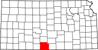 | |
| Unincorporated communities | ||
| Townships | ||