Kotzebue, Alaska
| Kotzebue, Alaska Qikiqtaġruk | |
|---|---|
| City | |
|
Aerial view of Kotzebue | |
| Motto: "Gateway to the Arctic" | |
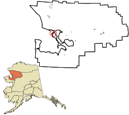 Location in Northwest Arctic Borough and the state of Alaska. | |
| Coordinates: 66°53′50″N 162°35′8″W / 66.89722°N 162.58556°WCoordinates: 66°53′50″N 162°35′8″W / 66.89722°N 162.58556°W | |
| Country | United States |
| State | Alaska |
| Borough | Northwest Arctic |
| Incorporated | October 14, 1958[1] |
| Government | |
| • Mayor | Gayle Ralston |
| • State senator | Donny Olson (D) |
| • State rep. | Benjamin Nageak (D) |
| Area | |
| • Total | 28.7 sq mi (74.2 km2) |
| • Land | 27.0 sq mi (69.9 km2) |
| • Water | 1.7 sq mi (4.3 km2) |
| Elevation | 20 ft (6 m) |
| Population (2010) | |
| • Total | 3,201 |
| • Density | 110/sq mi (43/km2) |
| [2] | |
| Time zone | AKST (UTC-9) |
| • Summer (DST) | AKDT (UTC-8) |
| ZIP code | 99752 |
| Area code | 907 |
| FIPS code | 02-41830 |
| GNIS feature ID | 1413378 |
| Website | City of Kotzebue, Alaska |

Kotzebue /ˈkoʊtsʌˌbjuː/ or Kikiktagruk (Qikiqtaġruk /qikiqtaʁʐuk/ in Iñupiaq) is a city in the Northwest Arctic Borough in the U.S. state of Alaska. It is the borough's seat, by far its largest community and the economic and transportation hub of the subregion of Alaska encompassing the borough. The population of the city was 3,201 as of the 2010 census.
History
Etymology and prehistory
There is archaeological evidence that Inupiat people have lived at Kotzebue since at least the 15th century. Owing to its location and relative size, Kotzebue served as a trading and gathering center for the various communities in the region. The Noatak, Selawik and Kobuk Rivers drain into the Kotzebue Sound near Kotzebue to form a center for transportation to points inland. In addition to people from interior villages, inhabitants of the Russian Far East came to trade at Kotzebue. Furs, seal-oil, hides, rifles, ammunition, and seal skins were some of the items traded. People also gathered for competitions like the current World Eskimo Indian Olympics. With the arrival of the whalers, traders, gold seekers, and missionaries the trading center expanded.
Kotzebue was originally known as Qikiqtaġruk, which means "big island" in Iñupiatun, the language of the Iñupiat. Kotzebue gets its name from the Kotzebue Sound, which was named after Otto von Kotzebue, a Baltic German who explored the sound while searching for the Northwest Passage in the service of Russia in 1818.
19th century
Reindeer herding was introduced in the area in 1897. Although Alaska had caribou, the wild form of reindeer, the domesticated reindeer were brought to Alaska from Asia.
A United States post office was established in 1899.[3]
20th and 21st century
Kotzebue was a filming location for the 1991 film Salmonberries.
On September 2, 2015, U.S. President Barack Obama gave a speech on Climate Change, in Kotzebue, becoming the first sitting president to visit a site north of the Arctic Circle.[4][5]
Geography
Kotzebue lies on a gravel spit at the end of the Baldwin Peninsula in the Kotzebue Sound. It is located at 66°53′50″N 162°35′8″W / 66.89722°N 162.58556°W (66.897192, −162.585444),[6] approximately 30 miles (48 km) from Noatak, Kiana, and other nearby smaller communities. It is 33 miles (53 km) north of the Arctic Circle on Alaska's western coast.
According to the United States Census Bureau, the city has a total area of 28.7 square miles (74 km2), of which 27.0 square miles (70 km2) is land, and 1.6 square miles (4.1 km2), or 5.76%, is water.
Kotzebue is home to the NANA Regional Corporation, one of thirteen Alaska Native Regional Corporations created under the Alaska Native Claims Settlement Act of 1971 (ANCSA) in settlement of Alaska Native land claims.
Kotzebue is a gateway to Kobuk Valley National Park and other natural attractions of northern Alaska. A Northwest Arctic Heritage Center is located in the town to acclimate National Park Service travelers. Nearby Selawik National Wildlife Refuge also maintains office space in the town. [7]
Climate
Kotzebue has a very dry subarctic climate (Köppen Dfc) bordering on the Tundra climate, with long, somewhat snowy, and very cold winters, and short, mild summers. Monthly daily average temperatures range from −3.5 °F (−19.7 °C) in February to 54.7 °F (12.6 °C) in July, with an annual mean of 21.8 °F (−5.7 °C). Days of above 70 °F (21 °C) can be expected an average of five days per summer.[8] Precipitation is both most frequent and greatest during the summer months, averaging 10.1 inches (257 mm) per year. Snowfall usually falls in light bouts, averaging 39 inches (99 cm) a season. Extreme temperatures have ranged from −58 °F (−50 °C) to 85 °F (29 °C), with the latter occurring as recently as June 19, 2013.
| Climate data for Kotzebue, Alaska | |||||||||||||
|---|---|---|---|---|---|---|---|---|---|---|---|---|---|
| Month | Jan | Feb | Mar | Apr | May | Jun | Jul | Aug | Sep | Oct | Nov | Dec | Year |
| Record high °F (°C) | 39 (4) |
40 (4) |
39 (4) |
48 (9) |
71 (22) |
85 (29) |
85 (29) |
80 (27) |
69 (21) |
57 (14) |
40 (4) |
37 (3) |
85 (29) |
| Average high °F (°C) | 3.7 (−15.7) |
3.0 (−16.1) |
7.2 (−13.8) |
19.6 (−6.9) |
37.8 (3.2) |
50.8 (10.4) |
60.0 (15.6) |
56.7 (13.7) |
46.4 (8) |
27.5 (−2.5) |
13.3 (−10.4) |
6.0 (−14.4) |
27.67 (−2.41) |
| Average low °F (°C) | −8.6 (−22.6) |
−9.9 (−23.3) |
−7.7 (−22.1) |
3.3 (−15.9) |
25.3 (−3.7) |
38.8 (3.8) |
49.4 (9.7) |
47.4 (8.6) |
37.2 (2.9) |
18.8 (−7.3) |
3.2 (−16) |
−6.4 (−21.3) |
15.9 (−8.93) |
| Record low °F (°C) | −55 (−48) |
−52 (−47) |
−58 (−50) |
−44 (−42) |
−12 (−24) |
20 (−7) |
30 (−1) |
26 (−3) |
13 (−11) |
−19 (−28) |
−37 (−38) |
−49 (−45) |
−58 (−50) |
| Average precipitation inches (mm) | .55 (14) |
.42 (10.7) |
.38 (9.7) |
.41 (10.4) |
.33 (8.4) |
.57 (14.5) |
1.43 (36.3) |
2.00 (50.8) |
1.70 (43.2) |
.95 (24.1) |
.71 (18) |
.60 (15.2) |
10.05 (255.3) |
| Average snowfall inches (cm) | 5.6 (14.2) |
4.3 (10.9) |
3.9 (9.9) |
3.9 (9.9) |
1.2 (3) |
trace | trace | trace | 1.0 (2.5) |
5.8 (14.7) |
6.5 (16.5) |
7.1 (18) |
39.3 (99.8) |
| Average precipitation days (≥ 0.01 in) | 8.5 | 6.9 | 6.7 | 6.5 | 5.5 | 5.9 | 9.9 | 14.0 | 12.3 | 10.9 | 9.5 | 9.6 | 106.2 |
| Average snowy days (≥ 0.1 in) | 7.8 | 6.5 | 6.0 | 6.5 | 2.1 | .1 | 0 | 0 | 1.1 | 7.4 | 8.6 | 8.9 | 55.0 |
| Source: NOAA (normals, 1971−2000),[8] Weather.com (extremes) [9] | |||||||||||||
Demographics
| Historical population | |||
|---|---|---|---|
| Census | Pop. | %± | |
| 1910 | 103 | — | |
| 1920 | 230 | 123.3% | |
| 1930 | 291 | 26.5% | |
| 1940 | 372 | 27.8% | |
| 1950 | 623 | 67.5% | |
| 1960 | 1,290 | 107.1% | |
| 1970 | 1,696 | 31.5% | |
| 1980 | 2,090 | 23.2% | |
| 1990 | 2,751 | 31.6% | |
| 2000 | 3,082 | 12.0% | |
| 2010 | 3,201 | 3.9% | |
| Est. 2015 | 3,277 | [10] | 2.4% |
As of the census[12] of 2000, there were 3,082 people, 889 households, and 656 families residing in the city. The population density was 114.1 people per square mile (44.1/km²). There were 1,007 housing units at an average density of 37.3 per square mile (14.4/km²). The racial makeup of the city was 71.19% Native American, 19.47% White, 1.82% Asian, 0.32% Black or African American, 0.06% Pacific Islander, 0.78% from other races, and 6.36% from two or more races. Hispanic or Latino of any race were 1.17% of the population.
There were 889 households out of which 50.4% had children under the age of 18 living with them, 46.1% were married couples living together, 17.4% had a female householder with no husband present, and 26.1% were non-families. 19.3% of all households were made up of individuals and 2.0% had someone living alone who was 65 years of age or older. The average household size was 3.40 and the average family size was 3.93.
In the city the age distribution of the population shows 39.8% under the age of 18, 8.5% from 18 to 24, 30.4% from 25 to 44, 17.2% from 45 to 64, and 4.1% who were 65 years of age or older. The median age was 26 years. For every 100 females there were 102.0 males. For every 100 females age 18 and over, there were 104.5 males.
The median income for a household in the city was $57,163, and the median income for a family was $58,068. Males had a median income of $42,604 versus $36,453 for females. The per capita income for the city was $18,289. About 9.2% of families and 13.1% of the population were below the poverty line, including 14.9% of those under age 18 and 6.0% of those age 65 or over.
Infrastructure
Transportation
Kotzebue's Ralph Wien Memorial Airport is the one airport in the Northwest Arctic Borough with regularly scheduled large commercial passenger aircraft service to and from Ted Stevens Anchorage International Airport and the Nome Airport.
Health care
Kotzebue is home to the Maniilaq Association, a tribally-operated health and social services organization named after Maniilaq and part of the Alaska Native Tribal Health Consortium. Maniilaq Health Center is the primary health care facility for the residents of the Northwest Arctic Borough. The facility houses an emergency room with local and medevac support for accident/trauma victims, as well as an ambulatory care clinic, dental and eye care clinics, a pharmacy, a specialty clinic, and an inpatient wing with 17 beds for recovering patients.
Health care providers at Maniilaq Health Center provide telemedicine support to Community Health Aides (CHAPs) in the outlying villages of the Northwest Arctic Borough. The CHAPs, who work in village-based clinics, are trained in basic health assessment and can treat common illnesses. For more complicated cases, the CHAPs communicate with Maniilaq Health Center medical staff via phone, video-conference, and digital images.
Media
The Arctic Sounder is a weekly newspaper published by Alaska Media, LLC, which covers Kotzebue and the rest of the Northwest Arctic Borough along with the North Slope Borough (and its hub community of Barrow).
KOTZ, broadcasting at 720 on the AM dial, is the public radio station serving Kotzebue, one of two Class A clear-channel stations in the United States at that frequency (the other being Chicago's WGN). KOTZ operates an extensive translator network serving the rest of the borough.
Notable people
- John Baker, winner of the 2011 Iditarod Trail Sled Dog Race; his finishing time that year established a race record, which stood until broken by Dallas Seavey three years later.
- Reggie Joule, who represented Kotzebue and surrounding area in the Alaska House of Representatives for eight terms followed by a single term as borough mayor, achieved minor national fame during the 1970s and 1980s for his exploits in the World Eskimo Indian Olympics, including two appearances on The Tonight Show Starring Johnny Carson
- Seth Kantner, novelist
- Segundo Llorente, Spanish-born Jesuit, philosopher, author and politician
- Adam Stennett, painter
References
- ↑ 1996 Alaska Municipal Officials Directory. Juneau: Alaska Municipal League/Alaska Department of Community and Regional Affairs. January 1996. p. 86.
- ↑ "2010 City Population and Housing Occupancy Status". U.S. Census Bureau. Archived from the original on July 26, 2011. Retrieved May 14, 2012.
- ↑ Dickerson, Ora B. (1989) 120 Years of Alaska Postmasters, 1867-1987, p. 44. Scotts, Michigan: Carl J. Cammarata
- ↑ "Obama, Visiting Arctic, Will Pledge Aid to Alaskans Hit by Climate Change". New York Times. September 2, 2015. Retrieved September 2, 2015.
- ↑ "In Alaska, Obama becomes 1st president to enter the Arctic". Yahoo News. September 3, 2015. Retrieved September 3, 2015.
- ↑ "US Gazetteer files: 2010, 2000, and 1990". United States Census Bureau. 2011-02-12. Retrieved 2011-04-23.
- ↑ "Kobuk Valley National Park". U.S. National Park Service. January 20, 2011. Retrieved July 28, 2011.
- 1 2 "Climatology of the United States No. 20 1971−2000: KOTZEBUE WIEN AP, AK" (PDF). National Oceanic and Atmospheric Administration. 2004. Retrieved 2011-01-18.
- ↑ "Average Weather for Kotzebue, AK − Temperature and Precipitation". Weather.com. Retrieved 2011-01-18.
- ↑ "Annual Estimates of the Resident Population for Incorporated Places: April 1, 2010 to July 1, 2015". Retrieved July 2, 2016.
- ↑ "Census of Population and Housing". Census.gov. Archived from the original on May 11, 2015. Retrieved June 4, 2015.
- ↑ "American FactFinder". United States Census Bureau. Archived from the original on September 11, 2013. Retrieved 2008-01-31.
Further reading
- Anderson, Douglas D., and Robert A. Henning. The Kotzebue Basin. Alaska geographic, v. 8, no. 3. Anchorage: Alaska Geographic Society, 1981. ISBN 0-88240-157-2
- Giddings, J. Louis, and Douglas D. Anderson. Beach Ridge Archeology of Cape Krusenstern Eskimo and Pre-Eskimo Settlements Around Kotzebue Sound, Alaska. Washington, D.C.: National Park Service, U.S. Dept. of the Interior, 1986.
- Lucier, Charles V., and James W. VanStone. Traditional Beluga Drives of the Iñupiat of Kotzebue Sound, Alaska. Fieldiana, new ser., no. 25. Chicago: Field Museum of Natural History, 1995.
External links
| Wikimedia Commons has media related to Kotzebue, Alaska. |
- Official website of the City of Kotzebue
- Northwest Arctic Borough School District
- Kotzebue, Alaska at DMOZ
Municipalities and communities of Northwest Arctic Borough, Alaska, United States | ||
|---|---|---|
| Cities | 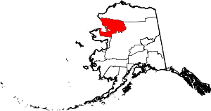 | |
| CDPs | ||
| Unincorporated communities | ||
| Ghost towns | ||