La Dominelais
| La Dominelais Doveneleg | |
|---|---|
|
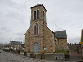
The church in La Dominelais | |
 La Dominelais | |
|
Location within Brittany region  La Dominelais | |
| Coordinates: 47°45′48″N 1°41′14″W / 47.7633°N 1.6872°WCoordinates: 47°45′48″N 1°41′14″W / 47.7633°N 1.6872°W | |
| Country | France |
| Region | Brittany |
| Department | Ille-et-Vilaine |
| Arrondissement | Redon |
| Canton | Grand-Fougeray |
| Intercommunality | Pays de Grand-Fougeray |
| Government | |
| • Mayor (2014–2020) | Jean-Éric Berton |
| Area1 | 32.45 km2 (12.53 sq mi) |
| Population (2008)2 | 1,220 |
| • Density | 38/km2 (97/sq mi) |
| Time zone | CET (UTC+1) |
| • Summer (DST) | CEST (UTC+2) |
| INSEE/Postal code | 35098 / 35390 |
| Elevation | 22–105 m (72–344 ft) |
|
1 French Land Register data, which excludes lakes, ponds, glaciers > 1 km² (0.386 sq mi or 247 acres) and river estuaries. 2 Population without double counting: residents of multiple communes (e.g., students and military personnel) only counted once. | |
La Dominelais (Breton: Doveneleg) is a commune in the Ille-et-Vilaine department of Brittany in north-western France.
Population
Inhabitants of La Dominelais are called in French dominelaisiens.
| Historical population | ||
|---|---|---|
| Year | Pop. | ±% |
| 1962 | 847 | — |
| 1968 | 887 | +4.7% |
| 1975 | 806 | −9.1% |
| 1982 | 796 | −1.2% |
| 1990 | 829 | +4.1% |
| 1999 | 906 | +9.3% |
| 2008 | 1,220 | +34.7% |
See also
References
External links
| Wikimedia Commons has media related to La Dominelais. |
This article is issued from Wikipedia - version of the 9/3/2015. The text is available under the Creative Commons Attribution/Share Alike but additional terms may apply for the media files.