Montgermont
| Montgermont Menezgervant | ||
|---|---|---|
|
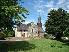
The church of Montgermont | ||
| ||
 Montgermont | ||
|
Location within Brittany region  Montgermont | ||
| Coordinates: 48°09′27″N 1°42′54″W / 48.1575°N 1.7150°WCoordinates: 48°09′27″N 1°42′54″W / 48.1575°N 1.7150°W | ||
| Country | France | |
| Region | Brittany | |
| Department | Ille-et-Vilaine | |
| Arrondissement | Rennes | |
| Canton | Betton | |
| Intercommunality | Rennes Métropole | |
| Government | ||
| • Mayor (2014–2020) | Brigitte Le Men | |
| Area1 | 4.67 km2 (1.80 sq mi) | |
| Population (2008)2 | 3,039 | |
| • Density | 650/km2 (1,700/sq mi) | |
| Time zone | CET (UTC+1) | |
| • Summer (DST) | CEST (UTC+2) | |
| INSEE/Postal code | 35189 / 35760 | |
| Elevation | 34–62 m (112–203 ft) | |
|
1 French Land Register data, which excludes lakes, ponds, glaciers > 1 km² (0.386 sq mi or 247 acres) and river estuaries. 2 Population without double counting: residents of multiple communes (e.g., students and military personnel) only counted once. | ||
.svg.png)
Montgermont (Breton: Menezgervant, Gallo: Monjèrmont) is a commune in the Ille-et-Vilaine department of Brittany in northwestern France.
Population
Inhabitants of Montgermont are called in French Montgermontais.
| Historical population | ||
|---|---|---|
| Year | Pop. | ±% |
| 1962 | 455 | — |
| 1968 | 606 | +33.2% |
| 1975 | 1,099 | +81.4% |
| 1982 | 1,976 | +79.8% |
| 1990 | 2,395 | +21.2% |
| 1999 | 2,758 | +15.2% |
| 2008 | 3,039 | +10.2% |
See also
References
External links
| Wikimedia Commons has media related to Montgermont. |
- Official website (French)
- French Ministry of Culture list for Montgermont (French)
This article is issued from Wikipedia - version of the 11/4/2015. The text is available under the Creative Commons Attribution/Share Alike but additional terms may apply for the media files.