Ercé-en-Lamée
| Ercé-en-Lamée Herzieg-Mez | |
|---|---|
|
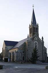
The church of Saint-Jean-Baptiste | |
 Ercé-en-Lamée | |
|
Location within Brittany region  Ercé-en-Lamée | |
| Coordinates: 47°49′51″N 1°33′28″W / 47.8308°N 1.5578°WCoordinates: 47°49′51″N 1°33′28″W / 47.8308°N 1.5578°W | |
| Country | France |
| Region | Brittany |
| Department | Ille-et-Vilaine |
| Arrondissement | Redon |
| Canton | Bain-de-Bretagne |
| Intercommunality | Moyenne Vilaine et du Semnon |
| Government | |
| • Mayor (2014–2020) | Patrick Derval |
| Area1 | 39.21 km2 (15.14 sq mi) |
| Population (2008)2 | 1,395 |
| • Density | 36/km2 (92/sq mi) |
| Time zone | CET (UTC+1) |
| • Summer (DST) | CEST (UTC+2) |
| INSEE/Postal code | 35106 / 35620 |
| Elevation | 23–107 m (75–351 ft) |
|
1 French Land Register data, which excludes lakes, ponds, glaciers > 1 km² (0.386 sq mi or 247 acres) and river estuaries. 2 Population without double counting: residents of multiple communes (e.g., students and military personnel) only counted once. | |
Ercé-en-Lamée (Breton: Herzieg-Mez) is a commune in the Ille-et-Vilaine department in Brittany in northwestern France.
Geography
The river Semnon forms all of the commune's northern border.
Population
Inhabitants of Ercé-en-Lamée are called Ercéens in French.
| Historical population | ||
|---|---|---|
| Year | Pop. | ±% |
| 1962 | 1,416 | — |
| 1968 | 1,542 | +8.9% |
| 1975 | 1,356 | −12.1% |
| 1982 | 1,253 | −7.6% |
| 1990 | 1,145 | −8.6% |
| 1999 | 1,156 | +1.0% |
| 2008 | 1,395 | +20.7% |
See also
References
External links
| Wikimedia Commons has media related to Ercé-en-Lamée. |
This article is issued from Wikipedia - version of the 2/18/2016. The text is available under the Creative Commons Attribution/Share Alike but additional terms may apply for the media files.