Ossé
| Ossé Oc'heg | |
|---|---|
|
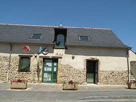
The town hall of Ossé | |
 Ossé | |
|
Location within Brittany region  Ossé | |
| Coordinates: 48°03′23″N 1°26′54″W / 48.0564°N 1.4483°WCoordinates: 48°03′23″N 1°26′54″W / 48.0564°N 1.4483°W | |
| Country | France |
| Region | Brittany |
| Department | Ille-et-Vilaine |
| Arrondissement | Fougères-Vitré |
| Canton | Châteaubourg |
| Intercommunality | Vitré |
| Government | |
| • Mayor (2014–2020) | Joseph Ménard |
| Area1 | 8.99 km2 (3.47 sq mi) |
| Population (2008)2 | 1,173 |
| • Density | 130/km2 (340/sq mi) |
| Time zone | CET (UTC+1) |
| • Summer (DST) | CEST (UTC+2) |
| INSEE/Postal code | 35209 / 35410 |
| Elevation | 44–78 m (144–256 ft) |
|
1 French Land Register data, which excludes lakes, ponds, glaciers > 1 km² (0.386 sq mi or 247 acres) and river estuaries. 2 Population without double counting: residents of multiple communes (e.g., students and military personnel) only counted once. | |
Ossé (Breton: Oc'heg) is a commune in the Ille-et-Vilaine department in Brittany in northwestern France.
Population
Inhabitants of Ossé are called Osséens in French.
| Historical population | ||
|---|---|---|
| Year | Pop. | ±% |
| 1962 | 430 | — |
| 1968 | 442 | +2.8% |
| 1975 | 420 | −5.0% |
| 1982 | 630 | +50.0% |
| 1990 | 705 | +11.9% |
| 1999 | 772 | +9.5% |
| 2009 | 1,173 | +51.9% |
See also
References
External links
| Wikimedia Commons has media related to Ossé. |
This article is issued from Wikipedia - version of the 11/5/2015. The text is available under the Creative Commons Attribution/Share Alike but additional terms may apply for the media files.