Saint-Méloir-des-Ondes
| Saint-Méloir-des-Ondes | ||
|---|---|---|
|
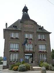
The town hall of Saint-Méloir-des-Ondes | ||
| ||
 Saint-Méloir-des-Ondes | ||
|
Location within Brittany region  Saint-Méloir-des-Ondes | ||
| Coordinates: 48°38′18″N 1°54′06″W / 48.6383°N 1.9017°WCoordinates: 48°38′18″N 1°54′06″W / 48.6383°N 1.9017°W | ||
| Country | France | |
| Region | Brittany | |
| Department | Ille-et-Vilaine | |
| Arrondissement | Saint-Malo | |
| Canton | Cancale | |
| Intercommunality | Saint-Malo | |
| Government | ||
| • Mayor (2014–2020) | René Bernard | |
| Area1 | 29.49 km2 (11.39 sq mi) | |
| Population (2009)2 | 3,649 | |
| • Density | 120/km2 (320/sq mi) | |
| Time zone | CET (UTC+1) | |
| • Summer (DST) | CEST (UTC+2) | |
| INSEE/Postal code | 35299 / 35350 | |
| Elevation |
2–58 m (6.6–190.3 ft) (avg. 51 m or 167 ft) | |
|
1 French Land Register data, which excludes lakes, ponds, glaciers > 1 km² (0.386 sq mi or 247 acres) and river estuaries. 2 Population without double counting: residents of multiple communes (e.g., students and military personnel) only counted once. | ||

Saint-Méloir-des-Ondes (Breton: Sant-Meleg) is a commune in the Ille-et-Vilaine department in Brittany in northwestern France. It is located near Saint-Malo.
The parish was named after St Melor a Breton and Cornish saint, by the monks of Mont Saint-Michel, who established a priory there in the early 11th century.
Population
Inhabitants of Saint-Méloir-des-Ondes are called méloriens in French.
| Historical population | ||
|---|---|---|
| Year | Pop. | ±% |
| 1962 | 2,413 | — |
| 1968 | 2,486 | +3.0% |
| 1975 | 2,320 | −6.7% |
| 1982 | 2,322 | +0.1% |
| 1990 | 2,588 | +11.5% |
| 1999 | 2,995 | +15.7% |
| 2009 | 3,649 | +21.8% |
See also
References
External links
| Wikimedia Commons has media related to Saint-Méloir-des-Ondes. |
- Cultural Heritage (French)
This article is issued from Wikipedia - version of the 5/27/2016. The text is available under the Creative Commons Attribution/Share Alike but additional terms may apply for the media files.