Labergement-Sainte-Marie
| Labergement-Sainte-Marie | |
|---|---|
 | |
 Labergement-Sainte-Marie | |
|
Location within Bourgogne-Franche-Comté region  Labergement-Sainte-Marie | |
| Coordinates: 46°46′32″N 6°16′51″E / 46.7756°N 6.2808°ECoordinates: 46°46′32″N 6°16′51″E / 46.7756°N 6.2808°E | |
| Country | France |
| Region | Bourgogne-Franche-Comté |
| Department | Doubs |
| Arrondissement | Pontarlier |
| Canton | Mouthe |
| Intercommunality | Mont d'Or et les Deux Lacs |
| Government | |
| • Mayor (2008–2014) | Claude Page |
| Area1 | 22.12 km2 (8.54 sq mi) |
| Population (2012)2 | 1,137 |
| • Density | 51/km2 (130/sq mi) |
| Time zone | CET (UTC+1) |
| • Summer (DST) | CEST (UTC+2) |
| INSEE/Postal code | 25320 / 25160 |
| Elevation | 846–1,054 m (2,776–3,458 ft) |
|
1 French Land Register data, which excludes lakes, ponds, glaciers > 1 km² (0.386 sq mi or 247 acres) and river estuaries. 2 Population without double counting: residents of multiple communes (e.g., students and military personnel) only counted once. | |
Labergement-Sainte-Marie is a commune in the Doubs department in the Bourgogne-Franche-Comté region in eastern France.
Geography
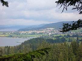
The commune is situated 18 km (11 mi) south of Pontarlier on between the lakes of Remoray and Saint-Point. It is dominated by the Bois de Ban and the forests of Fuvelle and Grande Côte.
History
The commune was formed from two former communes Labergement-Sainte-Marie and Granges-Sainte-Marie in 1972. Both took their names from the Cistercian abbey of Mont-Sainte-Marie.
Population
| Historical population | ||
|---|---|---|
| Year | Pop. | ±% |
| 1962 | 541 | — |
| 1968 | 541 | +0.0% |
| 1975 | 565 | +4.4% |
| 1982 | 702 | +24.2% |
| 1990 | 864 | +23.1% |
| 1999 | 920 | +6.5% |
| 2008 | 1,034 | +12.4% |
| 2012 | 1,137 | +10.0% |
Tourism
The rich natural resources of the commune attract many visitors to the lakes and forests. There are numerous hotels, hostels, and furnished apartments available for the visitor, as well as a campground.
See also
References
External links
| Wikimedia Commons has media related to Labergement-Sainte-Marie. |