Larnod
| Larnod | |
|---|---|
 Larnod | |
|
Location within Bourgogne-Franche-Comté region  Larnod | |
| Coordinates: 47°11′11″N 5°58′22″E / 47.1864°N 5.9728°ECoordinates: 47°11′11″N 5°58′22″E / 47.1864°N 5.9728°E | |
| Country | France |
| Region | Bourgogne-Franche-Comté |
| Department | Doubs |
| Arrondissement | Besançon |
| Canton | Boussières |
| Intercommunality | Grand Besançon |
| Government | |
| • Mayor (2008–2014) | Gisèle Ardiet |
| Area1 | 4.05 km2 (1.56 sq mi) |
| Population (2012)2 | 695 |
| • Density | 170/km2 (440/sq mi) |
| Time zone | CET (UTC+1) |
| • Summer (DST) | CEST (UTC+2) |
| INSEE/Postal code | 25328 / 25720 |
| Elevation |
296–470 m (971–1,542 ft) (avg. 380 m or 1,250 ft) |
|
1 French Land Register data, which excludes lakes, ponds, glaciers > 1 km² (0.386 sq mi or 247 acres) and river estuaries. 2 Population without double counting: residents of multiple communes (e.g., students and military personnel) only counted once. | |
Larnod is a commune in the Doubs department in the Bourgogne-Franche-Comté region in eastern France.
Geography
Larnod is situated on a hill over the valley of the Doubs River. It lies on departmental highway 308 7 km (4.3 mi) northeast of Boussières.
Population
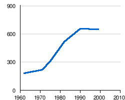
| Historical population | ||
|---|---|---|
| Year | Pop. | ±% |
| 1962 | 179 | — |
| 1968 | 216 | +20.7% |
| 1975 | 306 | +41.7% |
| 1982 | 514 | +68.0% |
| 1990 | 649 | +26.3% |
| 1999 | 647 | −0.3% |
| 2008 | 583 | −9.9% |
| 2012 | 695 | +19.2% |
The inhabitants of the commune are called Larnodiens.
See also
References
External links
| Wikimedia Commons has media related to Larnod. |
This article is issued from Wikipedia - version of the 10/29/2016. The text is available under the Creative Commons Attribution/Share Alike but additional terms may apply for the media files.