Les Gras
| Les Gras | |
|---|---|
|
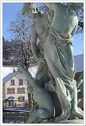
Fountain | |
 Les Gras | |
|
Location within Bourgogne-Franche-Comté region  Les Gras | |
| Coordinates: 46°59′42″N 6°32′42″E / 46.995°N 6.545°ECoordinates: 46°59′42″N 6°32′42″E / 46.995°N 6.545°E | |
| Country | France |
| Region | Bourgogne-Franche-Comté |
| Department | Doubs |
| Arrondissement | Pontarlier |
| Canton | Morteau |
| Intercommunality | Val de Morteau |
| Government | |
| • Mayor (2008–2014) | Jean-Paul Bulliard |
| Area1 | 14.99 km2 (5.79 sq mi) |
| Population (2012)2 | 784 |
| • Density | 52/km2 (140/sq mi) |
| Time zone | CET (UTC+1) |
| • Summer (DST) | CEST (UTC+2) |
| INSEE/Postal code | 25296 / 25790 |
| Elevation | 782–1,290 m (2,566–4,232 ft) |
|
1 French Land Register data, which excludes lakes, ponds, glaciers > 1 km² (0.386 sq mi or 247 acres) and river estuaries. 2 Population without double counting: residents of multiple communes (e.g., students and military personnel) only counted once. | |
Les Gras is a commune in the Doubs department in the Bourgogne-Franche-Comté region in eastern France.
Population
| Historical population | ||
|---|---|---|
| Year | Pop. | ±% |
| 1962 | 715 | — |
| 1968 | 727 | +1.7% |
| 1975 | 649 | −10.7% |
| 1982 | 585 | −9.9% |
| 1990 | 601 | +2.7% |
| 1999 | 654 | +8.8% |
| 2008 | 740 | +13.1% |
| 2012 | 784 | +5.9% |
See also
References
| Wikimedia Commons has media related to Les Gras. |
This article is issued from Wikipedia - version of the 10/29/2016. The text is available under the Creative Commons Attribution/Share Alike but additional terms may apply for the media files.