Montancy
| Montancy | |
|---|---|
|
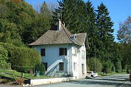
Border crossing | |
 Montancy | |
|
Location within Bourgogne-Franche-Comté region  Montancy | |
| Coordinates: 47°20′50″N 7°02′52″E / 47.3472°N 7.0478°ECoordinates: 47°20′50″N 7°02′52″E / 47.3472°N 7.0478°E | |
| Country | France |
| Region | Bourgogne-Franche-Comté |
| Department | Doubs |
| Arrondissement | Montbéliard |
| Canton | Saint-Hippolyte |
| Intercommunality | Saint-Hippolyte |
| Government | |
| • Mayor (2008–2014) | Suzanne Wermeille |
| Area1 | 8.86 km2 (3.42 sq mi) |
| Population (2012)2 | 158 |
| • Density | 18/km2 (46/sq mi) |
| Time zone | CET (UTC+1) |
| • Summer (DST) | CEST (UTC+2) |
| INSEE/Postal code | 25386 / 25190 |
| Elevation | 410–920 m (1,350–3,020 ft) |
|
1 French Land Register data, which excludes lakes, ponds, glaciers > 1 km² (0.386 sq mi or 247 acres) and river estuaries. 2 Population without double counting: residents of multiple communes (e.g., students and military personnel) only counted once. | |
Montancy (unofficial also Montancy-Brémoncourt) is a commune in the Doubs department in the Bourgogne-Franche-Comté region in eastern France.
Geography
The commune lies 23 km (14 mi) east of Saint-Hippolyte at the east end of the department near the Swiss border. The village of Brémoncourt lies in the valle of the Doubs River at 430 m, and Montancy on the plateau at 900 m.
Population
| Historical population | ||
|---|---|---|
| Year | Pop. | ±% |
| 1962 | 136 | — |
| 1968 | 146 | +7.4% |
| 1975 | 124 | −15.1% |
| 1982 | 122 | −1.6% |
| 1990 | 137 | +12.3% |
| 1999 | 152 | +10.9% |
| 2008 | 154 | +1.3% |
| 2012 | 158 | +2.6% |
See also
References
External links
External links
| Wikimedia Commons has media related to Montancy. |
- Official Web site (French)
This article is issued from Wikipedia - version of the 10/29/2016. The text is available under the Creative Commons Attribution/Share Alike but additional terms may apply for the media files.