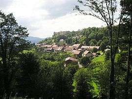
Belvoir, Doubs
| Belvoir | |
|---|---|
 | |
 Belvoir | |
|
Location within Bourgogne-Franche-Comté region  Belvoir | |
| Coordinates: 47°19′06″N 6°36′15″E / 47.3183°N 6.6042°ECoordinates: 47°19′06″N 6°36′15″E / 47.3183°N 6.6042°E | |
| Country | France |
| Region | Bourgogne-Franche-Comté |
| Department | Doubs |
| Arrondissement | Montbéliard |
| Canton | Clerval |
| Intercommunality | Vallon de Sancey |
| Government | |
| • Mayor (2008–2014) | Christian Brand |
| Area1 | 9.31 km2 (3.59 sq mi) |
| Population (2012)2 | 97 |
| • Density | 10/km2 (27/sq mi) |
| Time zone | CET (UTC+1) |
| • Summer (DST) | CEST (UTC+2) |
| INSEE/Postal code | 25053 / 25430 |
| Elevation | 506–671 m (1,660–2,201 ft) |
|
1 French Land Register data, which excludes lakes, ponds, glaciers > 1 km² (0.386 sq mi or 247 acres) and river estuaries. 2 Population without double counting: residents of multiple communes (e.g., students and military personnel) only counted once. | |
Belvoir is a commune in the Doubs department in the Bourgogne-Franche-Comté region in eastern France.
Geography
Belvoir lies 18 km (11 mi) southeast of Clerval on a prominent hill.
History
Belvoir is noted for its castle, built by Jean de Chalon. It has been rebuilt, and the date of 1224 inscribed above the arch of the north tower is the oldest inscription in Arabic numerals in the region.
The lords of Belvoir were noted both in war and in peace: Hervis and Huon were Crusaders, and Vincent, the friend of Louis IX of France, wrote the first encyclopedia.
The Rohan family were the last noble owners of the castle.
Population
| Historical population | ||
|---|---|---|
| Year | Pop. | ±% |
| 1962 | 120 | — |
| 1968 | 130 | +8.3% |
| 1975 | 115 | −11.5% |
| 1982 | 100 | −13.0% |
| 1990 | 98 | −2.0% |
| 1999 | 102 | +4.1% |
| 2008 | 99 | −2.9% |
| 2012 | 97 | −2.0% |
See also
References
| Wikimedia Commons has media related to Belvoir, Doubs. |
This article is issued from Wikipedia - version of the 10/29/2016. The text is available under the Creative Commons Attribution/Share Alike but additional terms may apply for the media files.