Lac Ste. Anne County
| Lac Ste. Anne County | ||
|---|---|---|
| Municipal district | ||
| ||
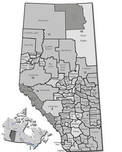 Location of Lac Ste. Anne County in Alberta | ||
| Coordinates: 53°53′42″N 114°53′27″W / 53.89500°N 114.89083°WCoordinates: 53°53′42″N 114°53′27″W / 53.89500°N 114.89083°W | ||
| Country |
| |
| Province |
| |
| Region | Central Alberta | |
| Census division | No. 13 | |
| Established | 1944 | |
| Incorporated | 1965 | |
| Government[1] | ||
| • Reeve | William Hegy | |
| • Governing body |
Lac Ste. Anne County Council
| |
| • Manager | Mike Primeau | |
| • Office location | Sangudo | |
| Area (2011)[2] | ||
| • Total | 2,845.61 km2 (1,098.70 sq mi) | |
| Population (2011)[2] | ||
| • Total | 10,260 | |
| • Density | 3.6/km2 (9.3/sq mi) | |
| • Dwellings | 4,567 | |
| Time zone | MST (UTC-7) | |
| Website | Official website | |
Lac Ste. Anne County is a municipal district in central Alberta, Canada.
It is located in Census Division 13, north west of Edmonton. Highway 43 stretches across this county. Its municipal office is located in the Hamlet of Sangudo.
The county was named after Lac Ste. Anne, which in turn was named for Saint Anne.
Demographics
In the 2011 Census, Lac Ste. Anne County had a population of 10,260 living in 4,092 of its 4,959 total dwellings, a 3.8% change from its 2006 adjusted population of 9,880. With a land area of 2,845.61 km2 (1,098.70 sq mi), it had a population density of 3.6/km2 (9.3/sq mi) in 2011.[2]
The population of Lac Ste. Anne County according to its 2008 municipal census is 10,220.[3]
In 2006, Lac Ste. Anne County had a population of 9,516 living in 4,567 dwellings, a 6.3% increase from 2001. The municipal district has a land area of 2,842.46 km2 (1,097.48 sq mi) and a population density of 3.3/km2 (8.5/sq mi).[4]
In 2001, Lac Ste. Anne County had a population of 8,948 in 4,103 dwellings, a 2.4% increase from 1996. On a surface of 2,845.08 km² it had a density of 3.1 inhabitants/km².[5]
Attractions

The municipality of Lac Ste. Anne maintains the Lessard Lake Campground, the Lessard Lake Outdoor Ed Centre, the Riverside Campground, and the Paddle River Dam Campground.
Many summer villages are established, especially on lake shores (such as Lac Ste. Anne, Lac La Nonne, Nakamun Lake, and Lake Isle).
Protected and recreational areas in the county include Lily Lake Provincial Natural Area, Pembina River Provincial Natural Area, Majeau Lake Provincial Natural Area (with two campgrounds), Paddle River Dam Picnic Site, Park Court Provincial Natural Area, Lily Lake Provincial Natural Area and Prefontaine and Brock Lake Provincial Natural Area.
Communities and localities
The following urban municipalities are surrounded by Lac Ste. Anne County:[6]
|
The following hamlets are located within Lac Ste. Anne County:[6]
|
The following localities are located within Lac Ste. Anne County:[7]
|
|
|
See also
References
- ↑ "Municipal Officials Search". Alberta Municipal Affairs. November 18, 2016. Retrieved November 21, 2016.
- 1 2 3 "Population and dwelling counts, for Canada, provinces and territories, and census subdivisions (municipalities), 2011 and 2006 censuses (Alberta)". Statistics Canada. 2012-02-08. Retrieved 2012-02-08.
- ↑ Alberta Municipal Affairs (2009-09-15). "Alberta 2009 Official Population List" (PDF). Retrieved 2010-09-12.
- ↑ Statistics Canada. "Canada 2006 Census: Lac Ste. Anne County - Community Profile". Retrieved 2007-06-11.
- ↑ Lac Ste. Anne County community profile - Statistics Canada. 2002. 2001 Community Profiles. Released June 27, 2002. Last modified: 2005-11-30. Statistics Canada Catalogue no. 93F0053XIE
- 1 2 "Specialized and Rural Municipalities and Their Communities" (PDF). Alberta Municipal Affairs. 2012-03-01. Retrieved 2012-08-11.
- ↑ "Standard Geographical Classification (SGC) 2006, Economic Regions: 4813001 - Lac Ste. Anne County, geographical codes and localities, 2006". Statistics Canada. 2010-03-05. Retrieved 2012-08-11.
External links
 |
Woodlands County | County of Barrhead No. 11 | Westlock County | |
| Woodlands County | |
Sturgeon County | ||
| ||||
| | ||||
| Yellowhead County | Parkland County | Parkland County |