Willmore Wilderness Park
| Willmore Wilderness Park | |
|---|---|
|
IUCN category Ib (wilderness area) | |
|
Mount DeVeber in Willmore Wilderness Park | |
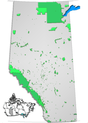 Location of Willmore Wilderness Park in Alberta | |
| Location | Alberta, Canada |
| Nearest city | Grande Cache, Hinton |
| Coordinates | 53°42′05″N 119°03′21″W / 53.70139°N 119.05583°WCoordinates: 53°42′05″N 119°03′21″W / 53.70139°N 119.05583°W |
| Area | 4,568 km² |
| Governing body | Alberta Tourism, Parks and Recreation |

| Improvement District No. 25 | |
|---|---|
| Improvement district | |
 Location of Willmore Wilderness Park in Alberta | |
| Coordinates: 53°42′5″N 119°3′21″W / 53.70139°N 119.05583°W | |
| Country |
|
| Province |
|
| Region | Alberta's Rockies |
| Census division | No. 14 |
| Established | January 2, 1994[1] |
| Government[2] | |
| • Governing body | Alberta Municipal Affairs (AMA) |
| • Minister of AMA | Deron Bilous |
| Area[3] | |
| • Land | 4,604.97 km2 (1,777.99 sq mi) |
| Population (2011)[3] | |
| • Total | 0 |
| Website | Alberta Environment and Sustainable Resource Development website |
Willmore Wilderness Park, located in Alberta, Canada, is a 4,600 square kilometre (1840 sq. mi.) wilderness area adjacent to the world-famous Jasper National Park. It is lesser known and less visited than Jasper National Park. There are no public roads, bridges or buildings. There are, however, several ranger cabins in the park that are available as a courtesy to visitors.
Other parks surround this wilderness reserve: Kakwa Wildlands Park to the north, Kakwa Provincial Park and Protected Area to the west, Rock Lake Provincial Park to the south-west, Sulphur Gates Provincial Park to the west. Kakwa Wildlands Park, Kakwa Provincial Park and Willmore Wilderness Park comprise the first interprovincial shared between Alberta and British Columbia.[4][5]
Access to the park is via Highway 40, through the town of Grande Cache, and the four staging areas: Sulphur Gates, Cowlick Creek, Berland River and Rock Lake.[6] Motorised vehicles are not allowed in the park, transportation is done by foot, horse, mountain bike or ski.
Another staging area is found south-east of the park, in the town of Hinton.
Conservation
Current conservation-based research within Willmore includes:
The Willmore Biodiversity Monitoring Project
The Alberta Experimental Wolverine Monitoring Project
The park protects a large population of mountain goats and bighorn sheep (20% of the total population in Alberta). Other mammals commonly found here include grizzly bears, mountain caribou, elk, deer, cougars and wolves.[7] Coyotes, wolverines, lynx and black bears are also present in the sub-alpine region, while marmots, rock pika, ptarmigan and Rocky Mountain goats can be found in the higher alpine areas.
The sub-alpine environment contains white spruce, lodgepole pine, balsam fir and aspen poplar.
Several native burial sites are located at Big Grave Flats, as well as some early coal mining, forestry and trapper cabins.
Activities
Recreational activities in the park include camping, hiking, horseback riding, mountain biking, cross-country skiing and some hunting. Fishing for bull trout is only allowed in a catch and release fashion (reports of 20 lb bull trout have been caught on the upper part of the Jackpine River). Canoeing and whitewater rafting can be done on the Smoky River.
All motorized vehicles are prohibited within the park.
Open pit fires allowed.
Potential dangers while travelling through the park are changing weather (which can make rising waters dangerous to ford; there are not many bridges so don't get caught behind rising water), lost and water-logged trails and the abundant bear population.
Several trails cross the park (Indian Trail, Pope Thoreau Trail), and horseback riding can be done along rivers and passes (Sulphur River, West Sulphur River, Rocky Pass, Jackknife Pass, Casket Pass, Forget-Me-Not Pass, Fetherstonhaugh Pass and Morkill Pass).
Rock Lake staging area allows easy access to north of Jasper park through Willow Creek trail. The 14 km trail joins the north boundary trail at about 49 km (from snake Indian river staging).
Administration
The park is administered by Alberta Municipal Affairs (as Improvement District No. 9) and is managed by Alberta Community Development as a wilderness park.
See also
- List of protected areas of Alberta
- List of Canadian provincial parks
- List of National Parks of Canada
- Cypress Hills Interprovincial Park (Alberta-Saskatchewan)
References
- ↑ "Location and History Profile". Alberta Municipal Affairs. Retrieved May 11, 2015.
- ↑ "Alberta Municipal Affairs". Alberta Municipal Affairs. Retrieved May 25, 2015.
- 1 2 "Population and dwelling counts, for Canada, provinces and territories, and census subdivisions (municipalities), 2011 and 2006 censuses (Alberta)". Statistics Canada. January 30, 2013. Retrieved April 25, 2015.
- ↑ Kakwa-Willmore Interprovincial park
- ↑ BC Parks infopage on Kakwa Provincial Park
- ↑ Town of Grande Cache - Willmore Wilderness Park
- ↑ Alberta Parks - Willmore Wilderness Park
External links
| Ranges |
| ||||||||||||||
|---|---|---|---|---|---|---|---|---|---|---|---|---|---|---|---|
| Mountains |
| ||||||||||||||
| Passes | |||||||||||||||
| Glaciers | |||||||||||||||
| Rivers | see List of rivers of the Canadian Rockies and Category:Rivers of the Canadian Rockies | ||||||||||||||
| Peoples | |||||||||||||||
| Parks and protected areas |
| ||||||||||||||
| Ski resorts | |||||||||||||||
| Communities | |||||||||||||||
| Ecoregions | |||||||||||||||
| |||||||||||||||