Flagstaff County
| Flagstaff County | ||
|---|---|---|
| Municipal district | ||
|
St. Peter's Roman Catholic Church | ||
| ||
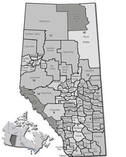 Location of Flagstaff County in Alberta | ||
| Coordinates: 52°46′21″N 111°41′49″W / 52.77250°N 111.69694°WCoordinates: 52°46′21″N 111°41′49″W / 52.77250°N 111.69694°W | ||
| Country |
| |
| Province |
| |
| Region | Central Alberta | |
| Census division | No. 7 | |
| Established | 1944 | |
| Incorporated | 1968 | |
| Government[1] | ||
| • Reeve | Gerald Kuefler | |
| • Governing body | Flagstaff County Council | |
| • Office location | Sedgewick | |
| Area (2011)[2] | ||
| • Total | 4,065.56 km2 (1,569.72 sq mi) | |
| Population (2011)[2] | ||
| • Total | 3,244 | |
| • Density | 0.8/km2 (2/sq mi) | |
| • Dwellings | 1,295 | |
| Time zone | MST (UTC-7) | |
| Website |
flagstaff | |

Flagstaff County is a municipal district in east central Alberta, Canada.
It is located in Census Division 7. The county was incorporated in the current boundaries in 1944 as Municipal District of Killam No. 390, name changed a year later to Municipal District of Flagstaff No. 62. It was established as a county in 1968. Its municipal office is located in the Town of Sedgewick.
Demographics
In the 2011 Census, Flagstaff County had a population of 3,244 living in 1,190 of its 1,331 total dwellings, a -7.5% change from its 2006 population of 3,506. With a land area of 4,065.56 km2 (1,569.72 sq mi), it had a population density of 0.8/km2 (2.1/sq mi) in 2011.[2]
In 2006, Flagstaff County had a population of 3,506 living in 1,295 dwellings, a -5.0% increase from 2001. The countyhas a land area of 4,066.92 km2 (1,570.25 sq mi) and a population density of 0.9/km2 (2.3/sq mi).[3]
In 2001, the municipal district had a population of 3,697 in 1,346 dwellings, a 7.9% decrease from 1996. On a surface of 4,065.16 km² it has a density of 0.9 inhabitants/km².[4]
Communities and localities
|
The following urban municipalities are surrounded by Flagstaff County:[5]
|
The following hamlets are located within Flagstaff County:[5] The following localities are located within Flagstaff County:[8]
|
Transportation
The area is served by Killam-Sedgewick/Flagstaff Regional Airport.
See also
References
- ↑ "Municipal Officials Search". Alberta Municipal Affairs. November 18, 2016. Retrieved November 21, 2016.
- 1 2 3 "Population and dwelling counts, for Canada, provinces and territories, and census subdivisions (municipalities), 2011 and 2006 censuses (Alberta)". Statistics Canada. February 8, 2012. Retrieved February 8, 2012.
- ↑ "Canada 2006 Census: Flagstaff County - Community Profile". Statistics Canada. Retrieved June 11, 2007.
- ↑ Flagstaff County community profile - Statistics Canada. 2002. 2001 Community Profiles. Released June 27, 2002. Last modified: November 11, 2005. Statistics Canada Catalogue no. 93F0053XIE.
- 1 2 "Specialized and Rural Municipalities and Their Communities" (PDF). Alberta Municipal Affairs. March 1, 2012. Retrieved February 11, 2012.
- ↑ "O.C. 259/2015". Government of Alberta. November 17, 2015. Retrieved November 19, 2015.
- ↑ "O.C. 260/2015". Government of Alberta. November 17, 2015. Retrieved November 19, 2015.
- ↑ "Standard Geographical Classification (SGC) 2006, Economic Regions: 4807031 - Flagstaff County, geographical codes and localities, 2006". Statistics Canada. March 5, 2010. Retrieved February 11, 2012.
External links

| Subdivisions | |||||||||||
|---|---|---|---|---|---|---|---|---|---|---|---|
| Communities | |||||||||||
| Cities and urban service areas | |||||||||||
| Rural municipalities |
| ||||||||||
| Specialized municipalities | |||||||||||
| |||||||||||