Parkland County
| Parkland County | ||
|---|---|---|
| Municipal district | ||
| ||
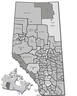 Location of Parkland County in Alberta | ||
| Coordinates: 53°31′48″N 114°00′23″W / 53.53000°N 114.00639°WCoordinates: 53°31′48″N 114°00′23″W / 53.53000°N 114.00639°W | ||
| Country | Canada | |
| Province | Alberta | |
| Region | Edmonton Capital Region | |
| Census division | No. 11 | |
| Established | 1969 | |
| Incorporated | 1969 | |
| Government[1] | ||
| • Mayor | Rodney Shaigec | |
| • Governing body |
Parkland County Council
| |
| • CAO | Mike Heck | |
| • Office location | north of Stony Plain | |
| Area (2011)[2] | ||
| • Total | 2,387.68 km2 (921.89 sq mi) | |
| Population (2011)[2] | ||
| • Total | 30,568 | |
| • Density | 12.8/km2 (33/sq mi) | |
| • Dwellings | 11,064 | |
| Time zone | MST (UTC−7) | |
| • Summer (DST) | MDT (UTC−6) | |
| Website | Official website | |
Parkland County is a municipal district in central Alberta, Canada. Located west of Edmonton in Census Division No. 11, its municipal office, Parkland County Centre, is located 0.25 km (0.16 mi) north of the Town of Stony Plain on Highway 779.[3]
Demographics
In the 2011 Census, Parkland County had a population of 30,568 living in 10,931 of its 12,150 total dwellings, a 4.6% change from its 2006 adjusted population of 29,220. With a land area of 2,387.68 km2 (921.89 sq mi), it had a population density of 12.8/km2 (33.2/sq mi) in 2011.[2]
The population of Parkland County according to its 2009 municipal census is 30,089.[4]
In 2006, Parkland County had a population of 29,265 living in 11,064 dwellings, a 7.5% increase from 2001. The county has a land area of 2,392.61 km2 (923.79 sq mi) and a population density of 12.2/km2 (32/sq mi).[5]
According to the Canada 2001 Census:[6]
| Population: | 27,252 (2001) |
| Change: | (1996–2001): 8.0% |
| Dwellings: | 10,444 |
| Area: | 2,400.5 km2 (926.8 sq mi) |
| Density: | 11.4/km2 (30/sq mi) |
Economy
Parkland County's economic development hub is the Acheson Industrial Area.[7] Its 4,000 hectares (9,900 acres) of land[7] is home to over 200 businesses.[8]
Attractions
- Wagner Natural Area
- Clifford E. Lee Nature Sanctuary
- Devonian Botanic Garden
- Golf courses: Trestle Creek Golf Resort www.trestlecreek.ca, Cougar Creek Golf Resort, Deer Meadows Golf Course, Devon Valley Golf Course, Edmonton Springs Golf, esort, Grouse Nest Golf Course, Indian Lakes Golf Course, Les Furbur designed Ironhead Golf & Country Club on the Paul First Nation www.ironheadgolfcourse.ca, The Links Spruce Grove, Pineridge Golf Course, The Ranch Golf & Country Club, Stony Plain Golf Course, Whitewood Links Golf & RV Park
- Lakes: Jackfish Lake, Hasse Lake
- Regional Parks and Campgrounds: Chickakoo Lake Park, KoKoMoKo, Ascot Beach Park, Rich's Point Park, Muir Lake Park
- Wabamun Provincial Park
- Pembina River Provincial Park
Communities and localities
The following urban municipalities are surrounded by Parkland County:[9][10]
The following localities are located within Parkland County:[11]
- Localities
- Acheson
- Alpine Acres
- Amisk Acres
- Annaliesa Estates
- Anne Dale Acres
- Arrowhead Estates
- Ascot Beach
- Ashwood Meadows
- Aspen Estates
- Aspen Hills
- Avondale Acres
- Avondale Estates
- Banksiana Ranch
- Beach Corner
- Beach Corner Heights
- Beau Rand Estates
- Beaver Brook Park
- Beaverbrook
- Bell Acres
- Bergman Estates
- Birch Estates
- Birch Hill Park (designated place)
- Birch Hills
- Birch Street Estates
- Bonnie Acres
- Bowen Lake Estates
- Bridgewater Properties
- Brightbank
- Brightbank Estates
- Broken Wheel Ranches
- Brookside Estates
- Burtonsville
- Cameron Heights
- Cameron Lake Estates
- Canterbury Estates
- Carvel Corner
- Cedar Heights
- Central Heights
- Chateau Heights
- Chelsea Estates
- Cherlyn Heights
- Cheryl Heights
- Chickadoo Estates
- Chickakoo Estates
- Clear Lake Estates
- Clearwater Estates (designated place)
- Cole Anne Heights
- Cottage Lake Heights
- Country Lane Estates
- Crystal Meadows (designated place)
- Dartmoor Meadow
- Dawn Valley (designated place)
- Deer Lake Estates
- Deer Park
- Deer Park No. 1 Subdivision
- Deer Park No. 2 Subdivision
- Deer Park No. 3 Subdivision
- Delta Estates
- Devon Ridge Estates
- Devonshire Grove
- Devonshire Meadows (designated place)
- Double You Ranch
- Douglas Meadows
- Duffield Downs
- East Eighty Estates
- Eden Park Estates
- Edgemont Ridge
- Edgewood Acres
- Edinburgh Park
- Erin Estates (designated place)
- Eureka Beach
- Exelsior Park
- Falcon Hills
- Fernwood Estates
- Fleming Park (designated place)
- Forest Heights
- Freeman
- Garden Grove Estates (designated place)
- Gardner's Cove
- Genesse Park
- Glenwood Estates
- Glory Hills Estates
- Golden Acres
- Golden Spike
- Graminia
- Grand River Valley
- Grandmuir Estates (designated place)
- Green Acre Estates (designated place)
- Greenfield Acres
- Grove Acres
- Hacienda Estates
- Happy Acres
- Harder Acres
- Harris Acres
- Heatherlea
- Helenslea Estates
- Hennic Acres
- Highland Acres
- Highvale
- Hillside Estates
- Hilltop Acres
- Hillview Estates
- Holborn
- Horen
- Horizon West
- Hubbles Lake (designated place) or Hubble Lake Subdivision
- Huntington Heights
- Hycrest Place
- J. C.'s Ranch
- Jay Haven
- Jesperview Heights
- Johnny's Estates
- Johnny's Lake Estates
- Kathmarcan Estates
- Kilini Ridge
- Kolba Estates
- Kolga Estates
- Lake Country Estates
- Lake Crest
- Lake Isle Estates
- Lakeside Park
- Lamorr Landing Estates
- Landmark Estates
- Langford Park
- Linconshire Downs
- Linden Acres
- Magnolia
- Magnolia Bridge
- Mallard Park
- Manly Corner
- Manuan Lake
- Marine Drive Estates
- Marra Kesh Estates
- Maude West
- Mayatan Lake Estates
- Mayfair Heights
- Meadow Crest
- Meadow Grove Estates
- Meadow Ridge
- Meadow Run
- Meadowview Park
- Meridian Estates
- Meso West (designated place) or Messo West
- Mewassin
- Michael Park
- Michel Park
- Millham Gardens
- Moon Lake
- Neutral Valley
- Norris Acres
- North Side Acres
- Northleigh
- Northridge Meadows
- Oakwood Estates
- Old Entwistle
- Osborne Acres (designated place)
- Panorama Heights (designated place)
- Paramac Cove
- Paramac Point
- Park Ridge Heights
- Parkland Heights
- Parkland Village
- Parkland Village Trailer Ct. North
- Parkland Village Trailer Ct. South
- Parklane Acres
- Parkview Estates
- Parmac Cove
- Parmac Point
- Partridge Heights
- Partridge Place
- Patricia Hills
- Peterburn Estates (designated place) or Peter Burn Estate
- Pine Valley Acres Subdivision
- Pinewood Subdivision
- Poplar Grove
- Prestige Heights
- Princess Estates
- Richie's Point
- Ridgewood Estates
- Riverview Acres
- Rizzie's Point
- Rolling Heights
- Rolling Hills
- Rolling Meadows (designated place)
- Rolling View Estates
- Rosewood Beach
- Roslaire Estates
- Royal Park
- Sandy Heights
- Sandy Ridge
- Scenic View Estates
- Shady Acres
- Shannon Meadows
- Sherwin
- Silver Bell Estates
- Silver Bell Heights
- Silver Diamond Estates
- Silver Sands Estates
- Singer Acres
- Singing Hill Estates
- Skyline Gardens
- Smithfield
- Sorensens Park
- South Parkdale
- South Seba Beach
- South Woodland Acres
- Spanish Oaks
- Spring Hills
- Spruce Bluff
- Spruce Ridge
- Spruce Valley Estates
- Sprucehill Park
- Star Lake
- Star Lake Estates
- Stony Brook Gardens
- Stonybrook Gardens
- Summer View Heights
- Sundance Power Plant (designated place) or Sundance
- Sundance Meadows
- Sundown Estates
- Sunnyside Park
- Sunset View Acres (designated place)
- Surrey Lane Acreages
- Swiss Valley
- Terralta Estates
- Tower Acres
- Trafalgar Heights
- Tranquility Hills
- Twin Ravines
- Valaspen Place
- Viewpoint Estates
- Warnock Acres
- Weekend Estates
- Wendel Heights
- Wendel Place
- Wendel Place Park
- West Country Estates
- West Eighty Estates
- West Gentry Estates
- West Hill Acres
- West Lake Estates
- West Parkdale
- West Thirty-Five Estates
- Westbrooke Crescents (designated place) or Westbrook Crescent
- Westering Heights
- Westland Park
- Westward Acres
- Whispering Pines
- Whitewood Sands
- Wild Rose Park
- Willow Park
- Willow Ridge
- Willow Ridge Estates
- Winfield Heights
- Woodbend Crescent (designated place) or Woodbend Crescents
- Woodbend Place
- Woodland Acres
- Woodland Park (designated place)
- Woodridge
- Woodridge Estates
- Yellowhead Estates
- Other places
- Westlake Estates (designated place)
See also
References
- ↑ "Municipal Officials Search". Alberta Municipal Affairs. November 18, 2016. Retrieved November 21, 2016.
- 1 2 3 "Population and dwelling counts, for Canada, provinces and territories, and census subdivisions (municipalities), 2011 and 2006 censuses (Alberta)". Statistics Canada. 2012-02-08. Retrieved 2012-02-08.
- ↑ Parkland County. "Location". Retrieved 2007-02-15.
- ↑ Alberta Municipal Affairs (2009-09-15). "Alberta 2009 Official Population List" (PDF). Retrieved 2010-09-12.
- ↑ Statistics Canada. "Canada 2006 Census: Parkland County - Community Profile". Retrieved 2007-06-11.
- ↑ Parkland County community profile - Statistics Canada. 2002. 2001 Community Profiles. Released June 27, 2002. Last modified: 2005-11-30. Statistics Canada Catalogue no. 93F0053XIE.
- 1 2 "Acheson Industrial Area". Parkland County. Retrieved 2011-10-15.
- ↑ "History of Acheson". Acheson Business Association. Retrieved 2011-10-15.
- ↑ "Spruce Grove, City (Census Subdivision), Alberta". Statistics Canada. 2012-06-20. Retrieved 2012-08-13.
- 1 2 "Specialized and Rural Municipalities and Their Communities" (PDF). Alberta Municipal Affairs. 2012-03-01. Retrieved 2012-08-12.
- ↑ "Standard Geographical Classification (SGC) 2006, Economic Regions: 4811034 - Parkland County, geographical codes and localities, 2006". Statistics Canada. 2010-03-05. Retrieved 2012-08-12.
External links
 |
Lac Ste. Anne County | Lac Ste. Anne County | Sturgeon County | |
| Yellowhead County | |
City of Edmonton | ||
| ||||
| | ||||
| Brazeau County | Leduc County | Leduc County |