County of Grande Prairie No. 1
| County of Grande Prairie No. 1 | ||
|---|---|---|
| Municipal district | ||
|
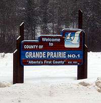
Boundary sign | ||
| ||
| Nickname(s): Alberta's First County | ||
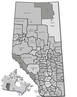 Location of the County of Grande Prairie No. 1 in Alberta | ||
| Coordinates: 55°16′0″N 118°47′0″W / 55.26667°N 118.78333°WCoordinates: 55°16′0″N 118°47′0″W / 55.26667°N 118.78333°W | ||
| Country |
| |
| Province |
| |
| Region | Northern Alberta | |
| Census division | No. 19 | |
| Established | 1943 | |
| Incorporated | 1951 | |
| Government[1] | ||
| • Reeve | Leanne Beaupre | |
| • Governing body |
County of Grande Prairie No. 1 Council
| |
| • Administrator | Bill Rogan | |
| • Office location | Clairmont | |
| Area (2011)[2] | ||
| • Total | 5,862.74 km2 (2,263.62 sq mi) | |
| Population (2011)[2] | ||
| • Total | 20,347 | |
| • Density | 3.5/km2 (9/sq mi) | |
| • Dwellings | 6,460 | |
| Time zone | MST (UTC-7) | |
| Website |
countygp | |
The County of Grande Prairie No. 1 is a municipal district in northwestern Alberta, Canada in Census Division No. 19.
It is bounded on the south by the Wapiti River, on the east by the Smoky River and on the west by the province of British Columbia.
Demographics
The County of Grande Prairie No. 1 conducted its own municipal census in 2012, which resulted in an estimated population of 21,157,[3] a 17.6% increase over its 2006 municipal census population of 17,989.[4]
In the 2011 Census, the County of Grande Prairie No. 1 had a population of 20,347 living in 7,195 of its 7,620 total dwellings, a 13.5% change from its 2006 adjusted population of 17,929. With a land area of 5,862.74 km2 (2,263.62 sq mi), it had a population density of 3.5/km2 (9.0/sq mi) in 2011.[2]
In 2006, the County of Grande Prairie No. 1 had a population of 17,970 living in 6,460 dwellings, a 14.9% increase from 2001. The county has a land area of 5,883.92 km2 (2,271.79 sq mi) and a population density of 3.1/km2 (8.0/sq mi).[5]
According to the Canada 2001 Census, the County of Grande Prairie No. 1 had:
- a population of 15,638 living in 5,597 dwellings, a 15.5% increase from 1996;
- a land area of 5,570.02 km²; and
- a population density of 2.8 (persons per km²).[6]
Communities and localities
|
The following urban municipalities are surrounded by the County of Grande Prairie No. 1:[7][8]
The following hamlets are located within the County of Grande Prairie No. 1:[8]
The following Indian reserves are located within the County of Grande Prairie No. 1: |
The following localities are located within the County of Grande Prairie No. 1:[9]
|
|
|
See also
References
- ↑ "Municipal Officials Search". Alberta Municipal Affairs. November 18, 2016. Retrieved November 21, 2016.
- 1 2 3 "Population and dwelling counts, for Canada, provinces and territories, and census subdivisions (municipalities), 2011 and 2006 censuses (Alberta)". Statistics Canada. 2012-02-08. Retrieved 2012-02-08.
- ↑ "County Releases Population Estimates" (PDF). County of Grande Prairie No. 1. November 5, 2012. Retrieved April 10, 2013.
- ↑ Alberta Municipal Affairs (2009-09-15). "Alberta 2009 Official Population List" (PDF). Retrieved 2010-09-12.
- ↑ Statistics Canada. "Canada 2006 Census: County of Grande Prairie No. 1 - Community Profile". Retrieved 2007-06-11.
- ↑ County of Grande Prairie Community Profile - Statistics Canada. 2002. 2001 Community Profiles. Released June 27, 2002. Last modified: 2005-11-30. Statistics Canada Catalogue no. 93F0053XIE
- ↑ "Grande Prairie, City (Census Subdivision), Alberta". Statistics Canada. 2012-06-20. Retrieved 2012-08-13.
- 1 2 "Specialized and Rural Municipalities and Their Communities" (PDF). Alberta Municipal Affairs. 2012-03-01. Retrieved 2012-08-11.
- ↑ "Standard Geographical Classification (SGC) 2006, Economic Regions: 4819006 - Grande Prairie County No. 1, geographical codes and localities, 2006". Statistics Canada. 2010-03-05. Retrieved 2012-08-11.
External links

| Subdivisions | |||||||||||
|---|---|---|---|---|---|---|---|---|---|---|---|
| Communities | |||||||||||
| Cities and urban service areas | |||||||||||
| Rural municipalities |
| ||||||||||
| Specialized municipalities | |||||||||||
| |||||||||||