Leslie, Missouri
| Leslie, Missouri | |
|---|---|
| Village | |
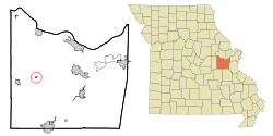 Location of Leslie, Missouri | |
| Coordinates: 38°25′4″N 91°13′53″W / 38.41778°N 91.23139°WCoordinates: 38°25′4″N 91°13′53″W / 38.41778°N 91.23139°W | |
| Country | United States |
| State | Missouri |
| County | Franklin |
| Area[1] | |
| • Total | 0.17 sq mi (0.44 km2) |
| • Land | 0.17 sq mi (0.44 km2) |
| • Water | 0 sq mi (0 km2) |
| Elevation | 827 ft (252 m) |
| Population (2010)[2] | |
| • Total | 171 |
| • Estimate (2012[3]) | 170 |
| • Density | 1,005.9/sq mi (388.4/km2) |
| Time zone | Central (CST) (UTC-6) |
| • Summer (DST) | CDT (UTC-5) |
| ZIP code | 63056 |
| Area code(s) | 573 |
| FIPS code | 29-41690[4] |
| GNIS feature ID | 0720921[5] |
Leslie is a village in Franklin County, Missouri, United States. The population was 171 at the 2010 census.
Geography
Leslie is located at 38°25′4″N 91°13′53″W / 38.41778°N 91.23139°W (38.417673, -91.231378).[6]
According to the United States Census Bureau, the village has a total area of 0.17 square miles (0.44 km2), all of it land.[1]
Demographics
| Historical population | |||
|---|---|---|---|
| Census | Pop. | %± | |
| 1920 | 162 | — | |
| 1930 | 103 | −36.4% | |
| 1940 | 130 | 26.2% | |
| 1950 | 114 | −12.3% | |
| 1960 | 104 | −8.8% | |
| 1970 | 81 | −22.1% | |
| 1980 | 108 | 33.3% | |
| 1990 | 134 | 24.1% | |
| 2000 | 87 | −35.1% | |
| 2010 | 171 | 96.6% | |
| Est. 2015 | 169 | [7] | −1.2% |
2010 census
As of the census[2] of 2010, there were 171 people, 50 households, and 36 families residing in the village. The population density was 1,005.9 inhabitants per square mile (388.4/km2). There were 60 housing units at an average density of 352.9 per square mile (136.3/km2). The racial makeup of the village was 96.5% White, 0.6% Native American, and 2.9% from two or more races. Hispanic or Latino of any race were 2.3% of the population.
There were 50 households of which 48.0% had children under the age of 18 living with them, 48.0% were married couples living together, 16.0% had a female householder with no husband present, 8.0% had a male householder with no wife present, and 28.0% were non-families. 18.0% of all households were made up of individuals and 2% had someone living alone who was 65 years of age or older. The average household size was 3.42 and the average family size was 4.00.
The median age in the village was 25.8 years. 37.4% of residents were under the age of 18; 11.1% were between the ages of 18 and 24; 28.7% were from 25 to 44; 18.7% were from 45 to 64; and 4.1% were 65 years of age or older. The gender makeup of the village was 48.0% male and 52.0% female.
2000 census
As of the census[4] of 2000, there were 87 people, 35 households, and 19 families residing in the village. The population density was 535.5 people per square mile (209.9/km²). There were 49 housing units at an average density of 301.6 per square mile (118.2/km²). The racial makeup of the village was 100.00% White.
There were 35 households out of which 31.4% had children under the age of 18 living with them, 34.3% were married couples living together, 8.6% had a female householder with no husband present, and 42.9% were non-families. 37.1% of all households were made up of individuals and 22.9% had someone living alone who was 65 years of age or older. The average household size was 2.49 and the average family size was 3.15.
In the village the population was spread out with 29.9% under the age of 18, 11.5% from 18 to 24, 27.6% from 25 to 44, 20.7% from 45 to 64, and 10.3% who were 65 years of age or older. The median age was 36 years. For every 100 females there were 117.5 males. For every 100 females age 18 and over, there were 103.3 males.
The median income for a household in the village was $29,250, and the median income for a family was $36,250. Males had a median income of $25,500 versus $17,917 for females. The per capita income for the village was $13,140. There were 15.8% of families and 12.4% of the population living below the poverty line, including no under eighteens and 22.2% of those over 64.
Notable residents
- Frank Saucier, Major League Baseball player
References
- 1 2 "US Gazetteer files 2010". United States Census Bureau. Archived from the original on January 24, 2012. Retrieved 2012-07-08.
- 1 2 "American FactFinder". United States Census Bureau. Retrieved 2012-07-08.
- ↑ "Population Estimates". United States Census Bureau. Archived from the original on June 17, 2013. Retrieved 2013-05-30.
- 1 2 "American FactFinder". United States Census Bureau. Archived from the original on September 11, 2013. Retrieved 2008-01-31.
- ↑ "US Board on Geographic Names". United States Geological Survey. 2007-10-25. Retrieved 2008-01-31.
- ↑ "US Gazetteer files: 2010, 2000, and 1990". United States Census Bureau. 2011-02-12. Retrieved 2011-04-23.
- ↑ "Annual Estimates of the Resident Population for Incorporated Places: April 1, 2010 to July 1, 2015". Retrieved July 2, 2016.
- ↑ "Census of Population and Housing". Census.gov. Archived from the original on May 11, 2015. Retrieved June 4, 2015.
Municipalities and communities of Franklin County, Missouri, United States | ||
|---|---|---|
| Cities | 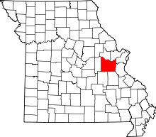 | |
| Villages | ||
| Townships | ||
| CDPs | ||
| Other unincorporated communities |
| |
| Ghost towns | ||
| Footnotes | ‡This populated place also has portions in an adjacent county or counties | |