Saint Clair, Missouri
| Saint Clair | |
|---|---|
| City | |
| Saint Clair, Missouri | |
.jpg) | |
 Saint Clair Location within the state of Missouri | |
| Coordinates: 38°20′59″N 90°58′58″W / 38.34972°N 90.98278°WCoordinates: 38°20′59″N 90°58′58″W / 38.34972°N 90.98278°W | |
| Country | United States |
| State | Missouri |
| County | Franklin |
| Area[1] | |
| • Total | 3.71 sq mi (9.61 km2) |
| • Land | 3.70 sq mi (9.58 km2) |
| • Water | 0.01 sq mi (0.03 km2) |
| Population (2010)[2] | |
| • Total | 4,724 |
| • Estimate (2012[3]) | 4,702 |
| • Density | 1,276.8/sq mi (493.0/km2) |
| Time zone | Central (CST) (UTC-6) |
| • Summer (DST) | CST (UTC-5) |
| ZIP codes | 63077 |
Saint Clair is a city in Franklin County, Missouri, United States. The population was 4,472 at the 2010 census.[4]
Geography
Saint Clair is located at 38°20′59″N 90°58′58″W / 38.34972°N 90.98278°W (38.349654, -90.982812).[5]
According to the United States Census Bureau, the city has a total area of 3.71 square miles (9.61 km2), of which, 3.70 square miles (9.58 km2) is land and 0.01 square miles (0.03 km2) is water.[1]
History
An early variant name was "Travelers Repose".[6] Saint Clair was platted in 1859 when the railroad was extended to that point.[7] The present name is after a railroad official with the surname St. Clair.[7]
Demographics
| Historical population | |||
|---|---|---|---|
| Census | Pop. | %± | |
| 1880 | 217 | — | |
| 1890 | 208 | −4.1% | |
| 1900 | 189 | −9.1% | |
| 1910 | 397 | 110.1% | |
| 1920 | 442 | 11.3% | |
| 1930 | 1,135 | 156.8% | |
| 1940 | 1,410 | 24.2% | |
| 1950 | 1,779 | 26.2% | |
| 1960 | 2,711 | 52.4% | |
| 1970 | 2,978 | 9.8% | |
| 1980 | 3,485 | 17.0% | |
| 1990 | 3,917 | 12.4% | |
| 2000 | 4,390 | 12.1% | |
| 2010 | 4,724 | 7.6% | |
| Est. 2015 | 4,705 | [8] | −0.4% |
2010 census
As of the census[2] of 2010, there were 4,724 people, 1,908 households, and 1,136 families residing in the city. The population density was 1,276.8 inhabitants per square mile (493.0/km2). There were 2,142 housing units at an average density of 578.9 per square mile (223.5/km2). The racial makeup of the city was 96.9% White, 1.0% African American, 0.3% Native American, 0.1% Asian, 0.3% from other races, and 1.4% from two or more races. Hispanic or Latino of any race were 1.2% of the population.
There were 1,908 households of which 34.2% had children under the age of 18 living with them, 37.5% were married couples living together, 16.1% had a female householder with no husband present, 5.9% had a male householder with no wife present, and 40.5% were non-families. 33.5% of all households were made up of individuals and 13.8% had someone living alone who was 65 years of age or older. The average household size was 2.43 and the average family size was 3.11.
The median age in the city was 33.1 years. 26.6% of residents were under the age of 18; 10.6% were between the ages of 18 and 24; 27.1% were from 25 to 44; 23% were from 45 to 64; and 12.8% were 65 years of age or older. The gender makeup of the city was 47.1% male and 52.9% female.
Since 2005 the unemployment rate in St. Clair, Missouri has ranged from 4.4% in April 2007 to 13.3% in January 2009. The current unemployment rate for St. Clair is 6.1% in December 2014.
Statistics found on city-data.com showed that 69.7% of the population completed high school, 6.5% achieved a bachelor's degree, and only 2.5% achieved a graduate degree.
2000 census
As of the census[10] of 2000, there were 4,390 people, 1,765 households, and 1,143 families residing in the city. The population density was 1,404.3 people per square mile (541.5/km²). There were 1,900 housing units at an average density of 607.8 per square mile (234.4/km²). The racial makeup of the city was 97.45% White, 0.75% African American, 0.46% Native American, 0.21% Asian, 0.09% from other races, and 1.05% from two or more races. Hispanic or Latino of any race were 0.71% of the population.
There were 1,765 households out of which 35.1% had children under the age of 18 living with them, 45.2% were married couples living together, 14.2% had a female householder with no husband present, and 35.2% were non-families. 30.4% of all households were made up of individuals and 14.0% had someone living alone who was 65 years of age or older. The average household size was 2.44 and the average family size was 3.05.
In the city the population was spread out with 27.9% under the age of 18, 10.8% from 18 to 24, 29.6% from 25 to 44, 18.0% from 45 to 64, and 13.7% who were 65 years of age or older. The median age was 32 years. For every 100 females there were 88.5 males. For every 100 females age 18 and over, there were 82.5 males.
The median income for a household in the city was $35,716, and the median income for a family was $41,939. Males had a median income of $35,509 versus $23,986 for females. The per capita income for the city was $18,101. About 8.6% of families and 10.6% of the population were below the poverty line, including 10.2% of those under age 18 and 10.1% of those age 65 or over.
Notable people
- Phoebe Hearst, mother of William Randolph Hearst, was born in Saint Clair.
National Register of Historic Places
- International Shoe Company Building
- Panhorst Feed Store
References
- 1 2 "US Gazetteer files 2010". United States Census Bureau. Retrieved 2012-07-08.
- 1 2 "American FactFinder". United States Census Bureau. Retrieved 2012-07-08.
- ↑ "Population Estimates". United States Census Bureau. Retrieved 2013-05-30.
- ↑ http://www.city-data.com/city/St.-Clair-Missouri.html
- ↑ "US Gazetteer files: 2010, 2000, and 1990". United States Census Bureau. 2011-02-12. Retrieved 2011-04-23.
- ↑ U.S. Geological Survey Geographic Names Information System: Saint Clair, Missouri
- 1 2 "Franklin County Place Names, 1928–1945 (archived)". The State Historical Society of Missouri. Retrieved 1 October 2016.
- ↑ "Annual Estimates of the Resident Population for Incorporated Places: April 1, 2010 to July 1, 2015". Retrieved July 2, 2016.
- ↑ "Census of Population and Housing". Census.gov. Retrieved June 4, 2015.
- ↑ "American FactFinder". United States Census Bureau. Retrieved 2008-01-31.
External links
- Historic maps of Saint Clair in the Sanborn Maps of Missouri Collection at the University of Missouri
Municipalities and communities of Franklin County, Missouri, United States | ||
|---|---|---|
| Cities | 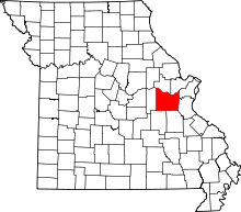 | |
| Villages | ||
| Townships | ||
| CDPs | ||
| Other unincorporated communities |
| |
| Ghost towns | ||
| Footnotes | ‡This populated place also has portions in an adjacent county or counties | |