Lightsview, South Australia
| Lightsview Adelaide, South Australia | |||||||||||||
|---|---|---|---|---|---|---|---|---|---|---|---|---|---|
 The Adelaide skyline at night from Lightsview | |||||||||||||
 Lightsview | |||||||||||||
| Coordinates | 34°51′45″S 138°37′40″E / 34.86250°S 138.62778°ECoordinates: 34°51′45″S 138°37′40″E / 34.86250°S 138.62778°E | ||||||||||||
| Established | 2016 | ||||||||||||
| Postcode(s) | 5085 | ||||||||||||
| LGA(s) | City of Port Adelaide Enfield | ||||||||||||
| State electorate(s) | Torrens | ||||||||||||
| Federal Division(s) | Adelaide | ||||||||||||
| |||||||||||||
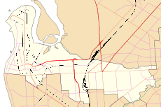
Lightsview is a suburb of Adelaide. It was created in April 2016 from parts of Northgate, Greenacres and Northfield.[1] It is in the inner northeast, bounded by Hampstead Road, Redward Avenue, Fosters Road and Folland Avenue.[2]
The bulk of the suburb of Lightsview began as a housing development (also named Lightsview) in the southern part of what was then the suburb of Northgate in 2006. The project was extended in October 2013 with the addition of the land from the former Ross Smith Secondary School.[3]
The suburb includes a row of houses along the north side of Redward Avenue that had previously been in Greenacres and are older than the main development. It also includes land fronting Hampstead Road that had been in Northfield including the former high school site and the Hampstead Rehabilitation Centre (a campus of the Royal Adelaide Hospital).
References
- ↑
- Stephen Mullighan (7 April 2016). "Geographical Names Act 1991 - Notice to Alter the Boundaries of Places and Assign a Name and Boundary to a Place" (PDF). Government Gazette. Government of South Australia. p. 1119 (PDF page 7). Retrieved 30 April 2016.
- New Suburb of Lightsview (PDF) (Map). Government of South Australia. Retrieved 30 April 2016.
- ↑ Councillor Mark Bassham (7 April 2016). "Lightsview Renaming". Retrieved 30 April 2016.
- ↑ "Lightsview". Renewal SA. Retrieved 2 May 2016.
External links
- www
.lightsview Housing development partnership between CIC Australia and RenewalSA (Government of South Australia).com .au