List of United Kingdom locations: Ia-Im
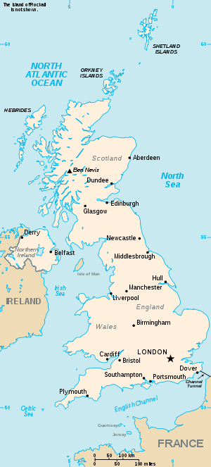
The United Kingdom

This is part of the list of United Kingdom locations: a gazetteer of place names in the United Kingdom showing each place's locality and geographical coordinates.

Ia

Location Locality Coordinates
(links to map & photo sources)
OS grid
reference
Ianstown Moray 57°41′N 2°57′W / 57.68°N 02.95°W / 57.68; -02.95 NJ4366

Ib

Location Locality Coordinates
(links to map & photo sources)
OS grid
reference
Ibberton Dorset 50°52′N 2°19′W / 50.86°N 02.31°W / 50.86; -02.31 ST7807
Ible Derbyshire 53°07′N 1°38′W / 53.11°N 01.64°W / 53.11; -01.64 SK2457
Ibrox City of Glasgow 55°50′N 4°19′W / 55.84°N 04.31°W / 55.84; -04.31 NS5564
Ibsley Hampshire 50°53′N 1°47′W / 50.88°N 01.78°W / 50.88; -01.78 SU1509
Ibstock Leicestershire 52°41′N 1°24′W / 52.68°N 01.40°W / 52.68; -01.40 SK4010
Ibstone Buckinghamshire 51°38′N 0°55′W / 51.63°N 00.91°W / 51.63; -00.91 SU7593
Ibthorpe Hampshire 51°16′N 1°28′W / 51.27°N 01.47°W / 51.27; -01.47 SU3753
Ibworth Hampshire 51°17′N 1°11′W / 51.28°N 01.19°W / 51.28; -01.19 SU5654

Ic

Location Locality Coordinates
(links to map & photo sources)
OS grid
reference
Icelton North Somerset 51°23′N 2°54′W / 51.38°N 02.90°W / 51.38; -02.90 ST3765
Ichrachan Argyll and Bute 56°25′N 5°13′W / 56.42°N 05.22°W / 56.42; -05.22 NN0130
Ickburgh Norfolk 52°31′N 0°40′E / 52.51°N 00.66°E / 52.51; 00.66 TL8194
Ickenham Hillingdon 51°33′N 0°27′W / 51.55°N 00.45°W / 51.55; -00.45 TQ0785
Ickenthwaite Cumbria 54°17′N 3°02′W / 54.29°N 03.04°W / 54.29; -03.04 SD3289
Ickford Oxfordshire 51°45′N 1°04′W / 51.75°N 01.07°W / 51.75; -01.07 SP6407
Ickham Kent 51°16′N 1°11′E / 51.27°N 01.18°E / 51.27; 01.18 TR2258
Ickleford Hertfordshire 51°58′N 0°17′W / 51.96°N 00.28°W / 51.96; -00.28 TL1831
Icklesham East Sussex 50°55′N 0°39′E / 50.91°N 00.65°E / 50.91; 00.65 TQ8716
Ickleton Cambridgeshire 52°04′N 0°10′E / 52.06°N 00.17°E / 52.06; 00.17 TL4943
Icklingham Suffolk 52°19′N 0°35′E / 52.31°N 00.59°E / 52.31; 00.59 TL7772
Ickornshaw North Yorkshire 53°52′N 2°04′W / 53.87°N 02.06°W / 53.87; -02.06 SD9642
Ickwell Bedfordshire 52°05′N 0°19′W / 52.09°N 00.32°W / 52.09; -00.32 TL1545
Ickwell Green Bedfordshire 52°05′N 0°19′W / 52.09°N 00.32°W / 52.09; -00.32 TL1545
Icomb Gloucestershire 51°53′N 1°41′W / 51.89°N 01.69°W / 51.89; -01.69 SP2122
Icy Park Devon 50°18′N 3°50′W / 50.30°N 03.84°W / 50.30; -03.84 SX6947

Id

Location Locality Coordinates
(links to map & photo sources)
OS grid
reference
Idbury Oxfordshire 51°52′N 1°40′W / 51.86°N 01.66°W / 51.86; -01.66 SP2319
Iddesleigh Devon 50°51′N 4°02′W / 50.85°N 04.04°W / 50.85; -04.04 SS5608
Ide Devon 50°41′N 3°34′W / 50.69°N 03.57°W / 50.69; -03.57 SX8990
Ideford Devon 50°35′N 3°34′W / 50.58°N 03.56°W / 50.58; -03.56 SX8977
Ide Hill Kent 51°14′N 0°07′E / 51.23°N 00.11°E / 51.23; 00.11 TQ4851
Iden East Sussex 50°58′N 0°43′E / 50.97°N 00.71°E / 50.97; 00.71 TQ9123
Iden Green Kent 51°06′N 0°29′E / 51.10°N 00.48°E / 51.10; 00.48 TQ7437
Iden Green Kent 51°03′N 0°34′E / 51.05°N 00.56°E / 51.05; 00.56 TQ8031
Idle Bradford 53°49′N 1°44′W / 53.82°N 01.74°W / 53.82; -01.74 SE1737
Idle Nottinghamshire 53°18′N 0°56′W / 53.30°N 00.93°W / 53.30; -00.93 SK708797
Idle Moor Bradford 53°49′N 1°45′W / 53.82°N 01.75°W / 53.82; -01.75 SE1637
Idless Cornwall 50°17′N 5°04′W / 50.28°N 05.06°W / 50.28; -05.06 SW8247
Idlicote Warwickshire 52°05′N 1°35′W / 52.09°N 01.59°W / 52.09; -01.59 SP2844
Idmiston Wiltshire 51°08′N 1°43′W / 51.13°N 01.72°W / 51.13; -01.72 SU1937
Idoch Water Aberdeenshire 57°32′N 2°29′W / 57.53°N 02.48°W / 57.53; -02.48 NJ710499
Idole Carmarthenshire 51°49′N 4°17′W / 51.81°N 04.29°W / 51.81; -04.29 SN4215
Idridgehay Derbyshire 53°02′N 1°35′W / 53.03°N 01.58°W / 53.03; -01.58 SK2849
Idridgehay Green Derbyshire 53°02′N 1°35′W / 53.03°N 01.58°W / 53.03; -01.58 SK2849
Idrigill Highland 57°35′N 6°23′W / 57.58°N 06.38°W / 57.58; -06.38 NG3863
Idstone Oxfordshire 51°33′N 1°38′W / 51.55°N 01.64°W / 51.55; -01.64 SU2584

Ie

Location Locality Coordinates
(links to map & photo sources)
OS grid
reference
Iet-y-bwlch Carmarthenshire 51°55′N 4°40′W / 51.92°N 04.67°W / 51.92; -04.67 SN1628

If

Location Locality Coordinates
(links to map & photo sources)
OS grid
reference
Iffley Oxfordshire 51°43′N 1°14′W / 51.72°N 01.24°W / 51.72; -01.24 SP5203
Ifield West Sussex 51°07′N 0°13′W / 51.11°N 00.21°W / 51.11; -00.21 TQ2537
Ifield Green West Sussex 51°07′N 0°13′W / 51.12°N 00.21°W / 51.12; -00.21 TQ2538
Ifieldwood West Sussex 51°07′N 0°14′W / 51.12°N 00.24°W / 51.12; -00.24 TQ2338
Ifold West Sussex 51°04′N 0°32′W / 51.06°N 00.54°W / 51.06; -00.54 TQ0231
Iford East Sussex 50°50′N 0°01′W / 50.84°N 00.01°W / 50.84; -00.01 TQ4007
Iford Bournemouth 50°44′N 1°49′W / 50.73°N 01.81°W / 50.73; -01.81 SZ1393
Ifton Heath Shropshire 52°55′N 2°59′W / 52.92°N 02.99°W / 52.92; -02.99 SJ3337

Ig

Location Locality Coordinates
(links to map & photo sources)
OS grid
reference
Ightfield Shropshire 52°56′N 2°37′W / 52.93°N 02.61°W / 52.93; -02.61 SJ5938
Ightfield Heath Shropshire 52°55′N 2°37′W / 52.92°N 02.61°W / 52.92; -02.61 SJ5937
Ightham Kent 51°17′N 0°16′E / 51.28°N 00.27°E / 51.28; 00.27 TQ5956
Igtham Common Kent 51°16′N 0°16′E / 51.27°N 00.26°E / 51.27; 00.26 TQ5855

Ik

Location Locality Coordinates
(links to map & photo sources)
OS grid
reference
Iken Suffolk 52°08′N 1°31′E / 52.14°N 01.52°E / 52.14; 01.52 TM4155

Il

Location Locality Coordinates
(links to map & photo sources)
OS grid
reference
Ilam Staffordshire 53°02′N 1°48′W / 53.04°N 01.80°W / 53.04; -01.80 SK1350
Ilchester Somerset 50°59′N 2°41′W / 50.99°N 02.68°W / 50.99; -02.68 ST5222
Ilchester Mead Somerset 50°59′N 2°41′W / 50.99°N 02.69°W / 50.99; -02.69 ST5122
Ilderton Northumberland 55°29′N 1°59′W / 55.48°N 01.98°W / 55.48; -01.98 NU0121
Ileden Kent 51°13′N 1°08′E / 51.22°N 01.14°E / 51.22; 01.14 TR2052
Ilford Somerset 50°56′N 2°55′W / 50.94°N 02.91°W / 50.94; -02.91 ST3617
Ilford Redbridge 51°33′N 0°04′E / 51.55°N 00.07°E / 51.55; 00.07 TQ4486
Ilfracombe Devon 51°12′N 4°08′W / 51.20°N 04.13°W / 51.20; -04.13 SS5147
Ilkeston Derbyshire 52°58′N 1°19′W / 52.97°N 01.31°W / 52.97; -01.31 SK4642
Ilketshall St Andrew Suffolk 52°25′N 1°29′E / 52.42°N 01.49°E / 52.42; 01.49 TM3887
Ilketshall St Lawrence Suffolk 52°23′N 1°29′E / 52.39°N 01.49°E / 52.39; 01.49 TM3883
Ilketshall St Margaret Suffolk 52°25′N 1°27′E / 52.41°N 01.45°E / 52.41; 01.45 TM3585
Ilkley Bradford 53°55′N 1°50′W / 53.91°N 01.83°W / 53.91; -01.83 SE1147
Illand Cornwall 50°34′N 4°26′W / 50.57°N 04.43°W / 50.57; -04.43 SX2878
Illeray Western Isles 57°32′N 7°23′W / 57.54°N 07.38°W / 57.54; -07.38 NF7863
Illey Worcestershire 52°25′N 2°02′W / 52.42°N 02.03°W / 52.42; -02.03 SO9881
Illidge Green Cheshire 53°10′N 2°19′W / 53.16°N 02.31°W / 53.16; -02.31 SJ7963
Illington Norfolk 52°28′N 0°51′E / 52.46°N 00.85°E / 52.46; 00.85 TL9489
Illingworth Calderdale 53°44′N 1°53′W / 53.74°N 01.89°W / 53.74; -01.89 SE0728
Illogan Cornwall 50°15′N 5°16′W / 50.25°N 05.27°W / 50.25; -05.27 SW6744
Illogan Highway Cornwall 50°13′N 5°16′W / 50.22°N 05.26°W / 50.22; -05.26 SW6741
Illshaw Heath Warwickshire 52°22′N 1°49′W / 52.36°N 01.81°W / 52.36; -01.81 SP1374
Illston on the Hill Leicestershire 52°35′N 0°58′W / 52.58°N 00.96°W / 52.58; -00.96 SP7099
Ilmer Buckinghamshire 51°44′N 0°54′W / 51.73°N 00.90°W / 51.73; -00.90 SP7605
Ilmington Warwickshire 52°05′N 1°41′W / 52.08°N 01.69°W / 52.08; -01.69 SP2143
Ilminster Somerset 50°55′N 2°55′W / 50.92°N 02.91°W / 50.92; -02.91 ST3614
Ilsington Devon 50°34′N 3°43′W / 50.57°N 03.72°W / 50.57; -03.72 SX7876
Ilston Swansea 51°35′N 4°05′W / 51.59°N 04.09°W / 51.59; -04.09 SS5590
Ilton Somerset 50°56′N 2°55′W / 50.94°N 02.92°W / 50.94; -02.92 ST3517
Ilton North Yorkshire 54°11′N 1°43′W / 54.19°N 01.72°W / 54.19; -01.72 SE1878

Im

Location Locality Coordinates
(links to map & photo sources)
OS grid
reference
Imachar North Ayrshire 55°36′N 5°23′W / 55.60°N 05.39°W / 55.60; -05.39 NR8640
Imber Wiltshire 51°14′N 2°03′W / 51.23°N 02.05°W / 51.23; -02.05 ST9648
Imeraval Argyll and Bute 55°37′N 6°13′W / 55.62°N 06.21°W / 55.62; -06.21 NR3545
Immingham North East Lincolnshire 53°36′N 0°13′W / 53.60°N 00.21°W / 53.60; -00.21 TA1814
Impington Cambridgeshire 52°14′N 0°06′E / 52.24°N 00.10°E / 52.24; 00.10 TL4463
This article is issued from Wikipedia - version of the 11/16/2015. The text is available under the Creative Commons Attribution/Share Alike but additional terms may apply for the media files.