List of United Kingdom locations: Boa-Bot

The United Kingdom

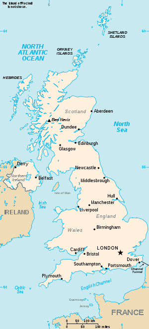
This is part of the list of United Kingdom locations: a gazetteer of place names in the United Kingdom showing each place's locality and geographical coordinates.

Bo

Boa

Location Locality Coordinates
(links to map & photo sources)
OS grid
reference
Boarhills Fife 56°19′N 2°43′W / 56.31°N 02.71°W / 56.31; -02.71 NO5614
Boarhunt Hampshire 50°52′N 1°08′W / 50.86°N 01.14°W / 50.86; -01.14 SU6008
Boarsgreave Lancashire 53°40′N 2°14′W / 53.67°N 02.24°W / 53.67; -02.24 SD8420
Boarshead East Sussex 51°04′N 0°11′E / 51.06°N 00.18°E / 51.06; 00.18 TQ5332
Boar's Head Wigan 53°34′N 2°39′W / 53.56°N 02.65°W / 53.56; -02.65 SD5708
Boars Hill Oxfordshire 51°43′N 1°18′W / 51.71°N 01.30°W / 51.71; -01.30 SP4802
Boarstall Buckinghamshire 51°49′N 1°06′W / 51.82°N 01.10°W / 51.82; -01.10 SP6214
Boasley Cross Devon 50°43′N 4°07′W / 50.71°N 04.12°W / 50.71; -04.12 SX5093
Boat of Garten Highland 57°14′N 3°45′W / 57.24°N 03.75°W / 57.24; -03.75 NH9418

Bob

Location Locality Coordinates
(links to map & photo sources)
OS grid
reference
Bobbing Kent 51°21′N 0°41′E / 51.35°N 00.69°E / 51.35; 00.69 TQ8865
Bobbington Shropshire 52°30′N 2°17′W / 52.50°N 02.29°W / 52.50; -02.29 SO8090
Bobbingworth Essex 51°43′N 0°13′E / 51.72°N 00.21°E / 51.72; 00.21 TL5305
Bobby Hill, Suffolk Suffolk 52°19′N 0°56′E / 52.32°N 00.93°E / 52.32; 00.93 TM0074

Boc

Location Locality Coordinates
(links to map & photo sources)
OS grid
reference
Bocaddon Cornwall 50°23′N 4°34′W / 50.39°N 04.57°W / 50.39; -04.57 SX1758
Bockhanger Kent 51°10′N 0°52′E / 51.16°N 00.87°E / 51.16; 00.87 TR0144
Bocking, Essex Essex 51°52′N 0°32′E / 51.87°N 00.54°E / 51.87; 00.54 TL7523
Bocking Churchstreet Essex 51°53′N 0°33′E / 51.89°N 00.55°E / 51.89; 00.55 TL7625
Bocking's Elm Essex 51°48′N 1°07′E / 51.80°N 01.11°E / 51.80; 01.11 TM1516
Bockleton Worcestershire 52°14′N 2°36′W / 52.24°N 02.60°W / 52.24; -02.60 SO5961
Bockmer End Buckinghamshire 51°34′N 0°50′W / 51.56°N 00.83°W / 51.56; -00.83 SU8186
Bocombe Devon 50°58′N 4°18′W / 50.96°N 04.30°W / 50.96; -04.30 SS3821

Bod

Location Locality Coordinates
(links to map & photo sources)
OS grid
reference
Boddam Shetland Islands 59°55′N 1°18′W / 59.91°N 01.30°W / 59.91; -01.30 HU3915
Boddam Aberdeenshire 57°28′N 1°47′W / 57.46°N 01.78°W / 57.46; -01.78 NK1342
Bodden Somerset 51°11′N 2°32′W / 51.19°N 02.53°W / 51.19; -02.53 ST6344
Boddin Angus 56°40′N 2°28′W / 56.66°N 02.47°W / 56.66; -02.47 NO7153
Boddington Gloucestershire 51°55′N 2°10′W / 51.92°N 02.16°W / 51.92; -02.16 SO8925
Bodedern Isle of Anglesey 53°17′N 4°30′W / 53.29°N 04.50°W / 53.29; -04.50 SH3380
Bodellick Cornwall 50°31′N 4°53′W / 50.52°N 04.89°W / 50.52; -04.89 SW9573
Bodelva Cornwall 50°21′N 4°44′W / 50.35°N 04.74°W / 50.35; -04.74 SX0554
Bodelwyddan Denbighshire 53°16′N 3°30′W / 53.26°N 03.50°W / 53.26; -03.50 SJ0075
Bodenham Wiltshire 51°02′N 1°46′W / 51.03°N 01.77°W / 51.03; -01.77 SU1626
Bodenham Herefordshire 52°09′N 2°41′W / 52.15°N 02.68°W / 52.15; -02.68 SO5351
Bodenham Bank Herefordshire 51°59′N 2°31′W / 51.98°N 02.52°W / 51.98; -02.52 SO6432
Bodenham Moor Herefordshire 52°08′N 2°40′W / 52.14°N 02.67°W / 52.14; -02.67 SO5450
Bodewryd Isle of Anglesey 53°23′N 4°25′W / 53.38°N 04.42°W / 53.38; -04.42 SH3990
Bodfari Denbighshire 53°13′N 3°22′W / 53.21°N 03.36°W / 53.21; -03.36 SJ0970
Bodffordd Isle of Anglesey 53°15′N 4°22′W / 53.25°N 04.37°W / 53.25; -04.37 SH4276
Bodham Norfolk 52°55′N 1°09′E / 52.91°N 01.15°E / 52.91; 01.15 TG1240
Bodiam East Sussex 50°59′N 0°32′E / 50.99°N 00.53°E / 50.99; 00.53 TQ7825
Bodicote Oxfordshire 52°01′N 1°20′W / 52.02°N 01.33°W / 52.02; -01.33 SP4637
Bodieve Cornwall 50°31′N 4°50′W / 50.52°N 04.83°W / 50.52; -04.83 SW9973
Bodiggo Cornwall 50°23′N 4°45′W / 50.38°N 04.75°W / 50.38; -04.75 SX0458
Bodilly Cornwall 50°08′N 5°16′W / 50.14°N 05.27°W / 50.14; -05.27 SW6632
Bodinnick Cornwall 50°20′N 4°37′W / 50.33°N 04.62°W / 50.33; -04.62 SX1352
Bodle Street Green East Sussex 50°54′N 0°20′E / 50.90°N 00.34°E / 50.90; 00.34 TQ6514
Bodley Devon 51°11′N 3°55′W / 51.18°N 03.91°W / 51.18; -03.91 SS6645
Bodmin Cornwall 50°28′N 4°44′W / 50.47°N 04.73°W / 50.47; -04.73 SX0667
Bodmin Moor Cornwall 50°34′N 4°32′W / 50.57°N 04.53°W / 50.57; -04.53 SX206780
Bodmiscombe Devon 50°52′N 3°17′W / 50.87°N 03.28°W / 50.87; -03.28 ST1009
Bodney Norfolk 52°32′N 0°41′E / 52.54°N 00.69°E / 52.54; 00.69 TL8398
Bodsham Kent 51°10′N 1°00′E / 51.16°N 01.00°E / 51.16; 01.00 TR1045
Boduan Gwynedd 52°54′N 4°29′W / 52.90°N 04.49°W / 52.90; -04.49 SH3237
Boduel Cornwall 50°26′N 4°30′W / 50.43°N 04.50°W / 50.43; -04.50 SX2263
Bodwen Cornwall 50°24′N 4°46′W / 50.40°N 04.77°W / 50.40; -04.77 SX0360
Bodymoor Heath Warwickshire 52°34′N 1°42′W / 52.56°N 01.70°W / 52.56; -01.70 SP2096

Bof

Location Locality Coordinates
(links to map & photo sources)
OS grid
reference
Bofarnel Cornwall 50°26′N 4°40′W / 50.43°N 04.67°W / 50.43; -04.67 SX1063

Bog

Location Locality Coordinates
(links to map & photo sources)
OS grid
reference
Bogach Western Isles 56°59′N 7°25′W / 56.99°N 07.41°W / 56.99; -07.41 NF7102
Bogallan Highland 57°31′N 4°17′W / 57.52°N 04.28°W / 57.52; -04.28 NH6350
Bogend South Ayrshire 55°33′N 4°33′W / 55.55°N 04.55°W / 55.55; -04.55 NS3932
Bogend Nottinghamshire 53°00′N 1°16′W / 53.00°N 01.27°W / 53.00; -01.27 SK4946
Boghall Midlothian 55°52′N 3°13′W / 55.87°N 03.21°W / 55.87; -03.21 NT2465
Boghall West Lothian 55°53′N 3°37′W / 55.89°N 03.61°W / 55.89; -03.61 NS9968
Bogie Aberdeenshire 57°24′N 2°48′W / 57.40°N 02.80°W / 57.40; -02.80 NJ518350
Bogmoor Moray 57°38′N 3°05′W / 57.64°N 03.09°W / 57.64; -03.09 NJ3562
Bogniebrae Aberdeenshire 57°29′N 2°41′W / 57.49°N 02.68°W / 57.49; -02.68 NJ5945
Bognor Regis West Sussex 50°47′N 0°41′W / 50.78°N 00.68°W / 50.78; -00.68 SZ9399
Bograxie Aberdeenshire 57°16′N 2°29′W / 57.26°N 02.49°W / 57.26; -02.49 NJ7019
Bogs Bank Scottish Borders 55°44′N 3°21′W / 55.73°N 03.35°W / 55.73; -03.35 NT1550
Bogside North Lanarkshire 55°46′N 3°52′W / 55.76°N 03.86°W / 55.76; -03.86 NS8354
Bogthorn Bradford 53°50′N 1°56′W / 53.84°N 01.94°W / 53.84; -01.94 SE0439
Bogton Aberdeenshire 57°32′N 2°33′W / 57.54°N 02.55°W / 57.54; -02.55 NJ6751

Boh

Location Locality Coordinates
(links to map & photo sources)
OS grid
reference
Bohemia East Sussex 50°52′N 0°33′E / 50.86°N 00.55°E / 50.86; 00.55 TQ8010
Bohemia Wiltshire 50°58′N 1°43′W / 50.97°N 01.71°W / 50.97; -01.71 SU2019
Bohenie Highland 56°53′N 4°48′W / 56.89°N 04.80°W / 56.89; -04.80 NN2982
Bohetherick Cornwall 50°29′N 4°14′W / 50.48°N 04.24°W / 50.48; -04.24 SX4167
Bohortha Cornwall 50°08′N 4°59′W / 50.14°N 04.99°W / 50.14; -04.99 SW8632
Bohuntine Highland 56°54′N 4°49′W / 56.90°N 04.82°W / 56.90; -04.82 NN2883
Bohuntinville Highland 56°53′N 4°49′W / 56.89°N 04.82°W / 56.89; -04.82 NN2882

Boj

Location Locality Coordinates
(links to map & photo sources)
OS grid
reference
Bojewyan Cornwall 50°08′N 5°39′W / 50.14°N 05.65°W / 50.14; -05.65 SW3934

Bok

Location Locality Coordinates
(links to map & photo sources)
OS grid
reference
Bokiddick Cornwall 50°25′N 4°44′W / 50.42°N 04.74°W / 50.42; -04.74 SX0562

Bol

Location Locality Coordinates
(links to map & photo sources)
OS grid
reference
Bolahaul Carmarthenshire 51°50′N 4°17′W / 51.83°N 04.29°W / 51.83; -04.29 SN4218
Bolam Northumberland 55°08′N 1°52′W / 55.13°N 01.86°W / 55.13; -01.86 NZ0982
Bolam Durham 54°35′N 1°42′W / 54.59°N 01.70°W / 54.59; -01.70 NZ1922
Bolam West Houses Northumberland 55°08′N 1°54′W / 55.13°N 01.90°W / 55.13; -01.90 NZ0682
Bolas Heath Shropshire 52°47′N 2°29′W / 52.78°N 02.49°W / 52.78; -02.49 SJ6721
Bolberry Devon 50°14′N 3°50′W / 50.23°N 03.83°W / 50.23; -03.83 SX6939
Bold Heath St Helens 53°23′N 2°42′W / 53.39°N 02.70°W / 53.39; -02.70 SJ5389
Boldmere Birmingham 52°32′N 1°50′W / 52.54°N 01.83°W / 52.54; -01.83 SP1194
Boldon Colliery South Tyneside 54°56′N 1°28′W / 54.94°N 01.47°W / 54.94; -01.47 NZ3461
Boldre Hampshire 50°47′N 1°32′W / 50.78°N 01.54°W / 50.78; -01.54 SZ3298
Boldron Durham 54°31′N 1°57′W / 54.52°N 01.95°W / 54.52; -01.95 NZ0314
Bole Nottinghamshire 53°22′N 0°49′W / 53.37°N 00.81°W / 53.37; -00.81 SK7987
Bolehall Staffordshire 52°37′N 1°41′W / 52.62°N 01.69°W / 52.62; -01.69 SK2103
Bolehill Derbyshire 53°05′N 1°34′W / 53.09°N 01.56°W / 53.09; -01.56 SK2955
Bolehill Sheffield 53°20′N 1°28′W / 53.33°N 01.47°W / 53.33; -01.47 SK3582
Bolenowe Cornwall 50°11′N 5°16′W / 50.18°N 05.26°W / 50.18; -05.26 SW6737
Boleside Scottish Borders 55°35′N 2°49′W / 55.58°N 02.81°W / 55.58; -02.81 NT4933
Boley Park Staffordshire 52°40′N 1°48′W / 52.67°N 01.80°W / 52.67; -01.80 SK1309
Bolham Devon 50°55′N 3°29′W / 50.91°N 03.49°W / 50.91; -03.49 SS9514
Bolham Nottinghamshire 53°20′N 0°57′W / 53.33°N 00.95°W / 53.33; -00.95 SK7082
Bolham Water Devon 50°54′N 3°11′W / 50.90°N 03.19°W / 50.90; -03.19 ST1612
Bolholt Bury 53°35′N 2°20′W / 53.59°N 02.33°W / 53.59; -02.33 SD7811
Bolingey Cornwall 50°20′N 5°08′W / 50.33°N 05.14°W / 50.33; -05.14 SW7653
Bolitho Cornwall 50°09′N 5°16′W / 50.15°N 05.27°W / 50.15; -05.27 SW6634
Bollihope Durham 54°42′N 2°00′W / 54.70°N 02.00°W / 54.70; -02.00 NZ0034
Bollin Cheshire 53°20′N 2°21′W / 53.34°N 02.35°W / 53.34; -02.35 SJ764831
Bollington Cheshire 53°17′N 2°06′W / 53.29°N 02.10°W / 53.29; -02.10 SJ9377
Bollington Cross Cheshire 53°17′N 2°07′W / 53.29°N 02.12°W / 53.29; -02.12 SJ9277
Bolney West Sussex 50°59′N 0°12′W / 50.99°N 00.20°W / 50.99; -00.20 TQ2623
Bolnhurst Bedfordshire 52°13′N 0°25′W / 52.21°N 00.42°W / 52.21; -00.42 TL0859
Bolnore West Sussex 50°59′N 0°07′W / 50.99°N 00.12°W / 50.99; -00.12 TQ3223
Bolsover Derbyshire 53°13′N 1°17′W / 53.22°N 01.29°W / 53.22; -01.29 SK4770
Bolsterstone Sheffield 53°28′N 1°35′W / 53.46°N 01.59°W / 53.46; -01.59 SK2796
Bolstone Herefordshire 51°59′N 2°39′W / 51.98°N 02.65°W / 51.98; -02.65 SO5532
Boltby North Yorkshire 54°16′N 1°14′W / 54.26°N 01.24°W / 54.26; -01.24 SE4986
Bolter End Buckinghamshire 51°37′N 0°52′W / 51.62°N 00.86°W / 51.62; -00.86 SU7992
Bolt Head Devon 50°12′N 3°47′W / 50.20°N 03.78°W / 50.20; -03.78 SX725358
Bolton Northumberland 55°25′N 1°50′W / 55.41°N 01.84°W / 55.41; -01.84 NU1013
Bolton Cumbria 54°36′N 2°34′W / 54.60°N 02.57°W / 54.60; -02.57 NY6323
Bolton Bradford 53°49′N 1°45′W / 53.81°N 01.75°W / 53.81; -01.75 SE1635
Bolton East Riding of Yorkshire 53°57′N 0°49′W / 53.95°N 00.82°W / 53.95; -00.82 SE7752
Bolton 53°34′N 2°26′W / 53.56°N 02.43°W / 53.56; -02.43 SD7108
Bolton East Lothian 55°55′N 2°48′W / 55.92°N 02.80°W / 55.92; -02.80 NT5070
Bolton Abbey North Yorkshire 53°58′N 1°53′W / 53.97°N 01.89°W / 53.97; -01.89 SE0753
Bolton Bridge North Yorkshire 53°58′N 1°55′W / 53.97°N 01.91°W / 53.97; -01.91 SE0653
Bolton-by-Bowland Lancashire 53°56′N 2°20′W / 53.93°N 02.33°W / 53.93; -02.33 SD7849
Boltonfellend Cumbria 55°00′N 2°50′W / 55.00°N 02.83°W / 55.00; -02.83 NY4768
Boltongate Cumbria 54°44′N 3°13′W / 54.74°N 03.21°W / 54.74; -03.21 NY2240
Bolton Green Lancashire 53°38′N 2°41′W / 53.64°N 02.68°W / 53.64; -02.68 SD5517
Bolton Houses Lancashire 53°47′N 2°51′W / 53.79°N 02.85°W / 53.79; -02.85 SD4433
Bolton-le-Sands Lancashire 54°06′N 2°47′W / 54.10°N 02.79°W / 54.10; -02.79 SD4868
Bolton Low Houses Cumbria 54°47′N 3°11′W / 54.78°N 03.19°W / 54.78; -03.19 NY2344
Bolton New Houses Cumbria 54°47′N 3°11′W / 54.78°N 03.18°W / 54.78; -03.18 NY2444
Bolton-on-Swale North Yorkshire 54°23′N 1°37′W / 54.38°N 01.61°W / 54.38; -01.61 SE2599
Bolton Percy North Yorkshire 53°52′N 1°11′W / 53.86°N 01.19°W / 53.86; -01.19 SE5341
Bolton Town End Lancashire 54°05′N 2°47′W / 54.09°N 02.79°W / 54.09; -02.79 SD4867
Bolton upon Dearne Rotherham 53°31′N 1°19′W / 53.51°N 01.32°W / 53.51; -01.32 SE4502
Bolton Wood Lane Cumbria 54°47′N 3°10′W / 54.78°N 03.16°W / 54.78; -03.16 NY2544
Bolton Woods Bradford 53°49′N 1°46′W / 53.81°N 01.77°W / 53.81; -01.77 SE1535
Boltshope Park Durham 54°49′N 2°05′W / 54.81°N 02.09°W / 54.81; -02.09 NY9447
Bolt Tail Devon 50°14′N 3°52′W / 50.23°N 03.86°W / 50.23; -03.86 SX674392
Bolventor Cornwall 50°33′N 4°34′W / 50.55°N 04.57°W / 50.55; -04.57 SX1876

Bom

Location Locality Coordinates
(links to map & photo sources)
OS grid
reference
Bomarsund Northumberland 55°09′N 1°34′W / 55.15°N 01.57°W / 55.15; -01.57 NZ2784
Bomby Cumbria 54°32′N 2°44′W / 54.54°N 02.74°W / 54.54; -02.74 NY5217
Bomere Heath Shropshire 52°46′N 2°47′W / 52.76°N 02.78°W / 52.76; -02.78 SJ4719

Bon

Location Locality Coordinates
(links to map & photo sources)
OS grid
reference
Bonaly City of Edinburgh 55°53′N 3°16′W / 55.89°N 03.26°W / 55.89; -03.26 NT2168
Bonar Bridge Highland 57°53′N 4°20′W / 57.88°N 04.34°W / 57.88; -04.34 NH6191
Bonawe Argyll and Bute 56°26′N 5°14′W / 56.44°N 05.24°W / 56.44; -05.24 NN0033
Bonby North Lincolnshire 53°37′N 0°29′W / 53.62°N 00.48°W / 53.62; -00.48 TA0015
Boncath Pembrokeshire 52°01′N 4°37′W / 52.01°N 04.62°W / 52.01; -04.62 SN2038
Bonchester Bridge Scottish Borders 55°23′N 2°40′W / 55.39°N 02.66°W / 55.39; -02.66 NT5811
Bonchurch Isle of Wight 50°35′N 1°11′W / 50.59°N 01.19°W / 50.59; -01.19 SZ5777
Bondend Gloucestershire 51°50′N 2°12′W / 51.83°N 02.20°W / 51.83; -02.20 SO8615
Bond End Staffordshire 52°45′N 1°47′W / 52.75°N 01.79°W / 52.75; -01.79 SK1418
Bondleigh Devon 50°49′N 3°55′W / 50.81°N 03.91°W / 50.81; -03.91 SS6504
Bondman Hays Leicestershire 52°39′N 1°16′W / 52.65°N 01.27°W / 52.65; -01.27 SK4907
Bonds Lancashire 53°53′N 2°46′W / 53.89°N 02.77°W / 53.89; -02.77 SD4944
Bonehill Devon 50°34′N 3°48′W / 50.57°N 03.80°W / 50.57; -03.80 SX7277
Bonehill Staffordshire 52°37′N 1°43′W / 52.61°N 01.72°W / 52.61; -01.72 SK1902
Bo'ness Falkirk 56°01′N 3°37′W / 56.01°N 03.62°W / 56.01; -03.62 NS9981
Bonhill West Dunbartonshire 55°58′N 4°34′W / 55.97°N 04.56°W / 55.97; -04.56 NS4079
Bonkle North Lanarkshire 55°47′N 3°52′W / 55.78°N 03.86°W / 55.78; -03.86 NS8356
Bonnavoulin Highland 56°36′N 5°58′W / 56.60°N 05.97°W / 56.60; -05.97 NM5653
Bonning Gate Cumbria 54°20′N 2°48′W / 54.34°N 02.80°W / 54.34; -02.80 SD4895
Bonnington Kent 51°04′N 0°55′E / 51.07°N 00.92°E / 51.07; 00.92 TR0535
Bonnington Scottish Borders 55°38′N 3°11′W / 55.63°N 03.19°W / 55.63; -03.19 NT2538
Bonnington City of Edinburgh 55°54′N 3°25′W / 55.90°N 03.42°W / 55.90; -03.42 NT1169
Bonnington Smiddy Angus 56°32′N 2°42′W / 56.54°N 02.70°W / 56.54; -02.70 NO5739
Bonnybank Fife 56°13′N 3°02′W / 56.21°N 03.04°W / 56.21; -03.04 NO3503
Bonnybridge Falkirk 55°59′N 3°53′W / 55.99°N 03.89°W / 55.99; -03.89 NS8280
Bonnykelly Aberdeenshire 57°34′N 2°15′W / 57.56°N 02.25°W / 57.56; -02.25 NJ8553
Bonnyrigg and Lasswade Midlothian 55°52′N 3°07′W / 55.87°N 03.12°W / 55.87; -03.12 NT3065
Bonnyton East Ayrshire 55°37′N 4°31′W / 55.61°N 04.52°W / 55.61; -04.52 NS4138
Bonnyton Angus 56°41′N 2°33′W / 56.68°N 02.55°W / 56.68; -02.55 NO6655
Bonnyton Aberdeenshire 57°22′N 2°33′W / 57.36°N 02.55°W / 57.36; -02.55 NJ6730
Bonnyton Angus 56°31′N 3°05′W / 56.52°N 03.09°W / 56.52; -03.09 NO3338
Bonsall Derbyshire 53°07′N 1°35′W / 53.11°N 01.59°W / 53.11; -01.59 SK2758
Bonson Somerset 51°09′N 3°07′W / 51.15°N 03.11°W / 51.15; -03.11 ST2240
Bontddu Gwynedd 52°44′N 3°59′W / 52.74°N 03.98°W / 52.74; -03.98 SH6618
Bont Dolgadfan Powys 52°35′N 3°39′W / 52.58°N 03.65°W / 52.58; -03.65 SH8800
Bont Fawr Carmarthenshire 51°54′N 3°52′W / 51.90°N 03.87°W / 51.90; -03.87 SN7125
Bont-goch (Elerch) Ceredigion 52°27′N 3°56′W / 52.45°N 03.94°W / 52.45; -03.94 SN6886
Bonthorpe Lincolnshire 53°13′N 0°13′E / 53.22°N 00.21°E / 53.22; 00.21 TF4872
Bont-newydd Conwy 53°13′N 3°29′W / 53.21°N 03.48°W / 53.21; -03.48 SJ0170
Bontnewydd Gwynedd 53°06′N 4°16′W / 53.10°N 04.27°W / 53.10; -04.27 SH4859
Bontuchel Denbighshire 53°06′N 3°22′W / 53.10°N 03.37°W / 53.10; -03.37 SJ0857
Bonvilston The Vale Of Glamorgan 51°27′N 3°21′W / 51.45°N 03.35°W / 51.45; -03.35 ST0674
Bon-y-maen Swansea 51°38′N 3°54′W / 51.63°N 03.90°W / 51.63; -03.90 SS6895

Boo

Location Locality Coordinates
(links to map & photo sources)
OS grid
reference
Boode Devon 51°07′N 4°08′W / 51.12°N 04.14°W / 51.12; -04.14 SS5038
Booker Buckinghamshire 51°37′N 0°48′W / 51.61°N 00.80°W / 51.61; -00.80 SU8391
Bookham Dorset 50°50′N 2°25′W / 50.83°N 02.42°W / 50.83; -02.42 ST7004
Booleybank Shropshire 52°49′N 2°38′W / 52.82°N 02.63°W / 52.82; -02.63 SJ5725
Boon, Scotland Scottish Borders 55°41′N 2°41′W / 55.69°N 02.68°W / 55.69; -02.68 NT5745
Boon Hill Staffordshire 53°02′N 2°17′W / 53.04°N 02.29°W / 53.04; -02.29 SJ8050
Boorley Green Hampshire 50°55′N 1°17′W / 50.92°N 01.28°W / 50.92; -01.28 SU5014
Boosbeck Redcar and Cleveland 54°32′N 0°59′W / 54.54°N 00.98°W / 54.54; -00.98 NZ6617
Boose's Green Essex 51°56′N 0°40′E / 51.93°N 00.67°E / 51.93; 00.67 TL8430
Boot Cumbria 54°23′N 3°17′W / 54.39°N 03.28°W / 54.39; -03.28 NY1701
Booth Calderdale 53°44′N 1°56′W / 53.73°N 01.94°W / 53.73; -01.94 SE0427
Booth Staffordshire 52°50′N 1°56′W / 52.84°N 01.94°W / 52.84; -01.94 SK0427
Booth Bank Cheshire 53°22′N 2°25′W / 53.36°N 02.42°W / 53.36; -02.42 SJ7285
Booth Bridge Lancashire 53°55′N 2°08′W / 53.91°N 02.13°W / 53.91; -02.13 SD9147
Boothby Graffoe Lincolnshire 53°07′N 0°32′W / 53.11°N 00.53°W / 53.11; -00.53 SK9859
Boothby Pagnell Lincolnshire 52°51′N 0°34′W / 52.85°N 00.56°W / 52.85; -00.56 SK9730
Boothen City of Stoke-on-Trent 52°59′N 2°11′W / 52.99°N 02.19°W / 52.99; -02.19 SJ8744
Boothferry East Riding of Yorkshire 53°43′N 0°53′W / 53.72°N 00.89°W / 53.72; -00.89 SE7326
Boothgate Derbyshire 53°02′N 1°26′W / 53.03°N 01.44°W / 53.03; -01.44 SK3749
Booth Green Cheshire 53°19′N 2°07′W / 53.32°N 02.12°W / 53.32; -02.12 SJ9281
Booth of Toft Shetland Islands 60°28′N 1°13′W / 60.46°N 01.21°W / 60.46; -01.21 HU4376
Boothroyd Kirklees 53°41′N 1°39′W / 53.68°N 01.65°W / 53.68; -01.65 SE2321
Boothsdale Cheshire 53°11′N 2°42′W / 53.19°N 02.70°W / 53.19; -02.70 SJ5367
Boothstown Salford 53°29′N 2°25′W / 53.49°N 02.42°W / 53.49; -02.42 SD7200
Boothtown Calderdale 53°44′N 1°53′W / 53.73°N 01.88°W / 53.73; -01.88 SE0826
Boothville Northamptonshire 52°16′N 0°51′W / 52.26°N 00.85°W / 52.26; -00.85 SP7864
Booth Wood Calderdale 53°38′N 1°57′W / 53.64°N 01.95°W / 53.64; -01.95 SE0316
Bootle Cumbria 54°17′N 3°23′W / 54.28°N 03.38°W / 54.28; -03.38 SD1088
Bootle Sefton 53°26′N 3°01′W / 53.43°N 03.01°W / 53.43; -03.01 SJ3394
Booton Norfolk 52°45′N 1°07′E / 52.75°N 01.12°E / 52.75; 01.12 TG1122
Boots Green Cheshire 53°14′N 2°22′W / 53.24°N 02.37°W / 53.24; -02.37 SJ7572
Boot Street Suffolk 52°05′N 1°14′E / 52.08°N 01.23°E / 52.08; 01.23 TM2248
Booze North Yorkshire 54°25′N 1°59′W / 54.41°N 01.98°W / 54.41; -01.98 NZ0102

Boq

Location Locality Coordinates
(links to map & photo sources)
OS grid
reference
Boquhan Stirling 56°03′N 4°22′W / 56.05°N 04.36°W / 56.05; -04.36 NS5387
Boquhapple Stirling 56°10′N 4°10′W / 56.17°N 04.17°W / 56.17; -04.17 NN6500
Boquio Cornwall 50°09′N 5°16′W / 50.15°N 05.26°W / 50.15; -05.26 SW6733

Bor

Location Locality Coordinates
(links to map & photo sources)
OS grid
reference
Boraston Shropshire 52°19′N 2°34′W / 52.31°N 02.57°W / 52.31; -02.57 SO6169
Boraston Dale Shropshire 52°19′N 2°34′W / 52.32°N 02.57°W / 52.32; -02.57 SO6170
Borden Kent 51°19′N 0°41′E / 51.32°N 00.69°E / 51.32; 00.69 TQ8862
Borden West Sussex 51°00′N 0°50′W / 51.00°N 00.83°W / 51.00; -00.83 SU8224
Border Cumbria 54°52′N 3°19′W / 54.87°N 03.31°W / 54.87; -03.31 NY1654
Bordesley Birmingham 52°28′N 1°53′W / 52.47°N 01.88°W / 52.47; -01.88 SP0886
Bordesley Green Birmingham 52°28′N 1°51′W / 52.47°N 01.85°W / 52.47; -01.85 SP1086
Bordlands Scottish Borders 55°42′N 3°21′W / 55.70°N 03.35°W / 55.70; -03.35 NT1546
Bordley North Yorkshire 54°04′N 2°05′W / 54.07°N 02.09°W / 54.07; -02.09 SD9464
Bordon Hampshire 51°06′N 0°52′W / 51.10°N 00.87°W / 51.10; -00.87 SU7935
Boreham Essex 51°45′N 0°32′E / 51.75°N 00.53°E / 51.75; 00.53 TL7509
Boreham Wiltshire 51°11′N 2°10′W / 51.19°N 02.17°W / 51.19; -02.17 ST8844
Boreham Street East Sussex 50°52′N 0°21′E / 50.87°N 00.35°E / 50.87; 00.35 TQ6611
Borehamwood Hertfordshire 51°39′N 0°17′W / 51.65°N 00.28°W / 51.65; -00.28 TQ1997
Boreland Dumfries and Galloway 55°12′N 3°18′W / 55.20°N 03.30°W / 55.20; -03.30 NY1791
Boreland Fife 56°08′N 3°07′W / 56.13°N 03.12°W / 56.13; -03.12 NT3094
Boreley Worcestershire 52°17′N 2°16′W / 52.28°N 02.26°W / 52.28; -02.26 SO8265
Boreray Western Isles 57°43′N 7°17′W / 57.71°N 07.29°W / 57.71; -07.29 NF849812
Boreray Western Isles 57°52′N 8°29′W / 57.87°N 08.49°W / 57.87; -08.49 NA154052
Borestone Stirling 56°05′N 3°56′W / 56.08°N 03.94°W / 56.08; -03.94 NS7990
Borgh Western Isles 58°25′N 6°26′W / 58.41°N 06.43°W / 58.41; -06.43 NB4156
Borghastan Western Isles 58°16′N 6°47′W / 58.27°N 06.79°W / 58.27; -06.79 NB1942
Borgie Highland 58°29′N 4°17′W / 58.49°N 04.28°W / 58.49; -04.28 NC6759
Borgie Highland 58°31′N 4°16′W / 58.51°N 04.27°W / 58.51; -04.27 NC677606
Borgue Dumfries and Galloway 54°48′N 4°08′W / 54.80°N 04.13°W / 54.80; -04.13 NX6348
Borgue Highland 58°12′N 3°29′W / 58.20°N 03.48°W / 58.20; -03.48 ND1325
Borley Essex 52°02′N 0°41′E / 52.04°N 00.68°E / 52.04; 00.68 TL8442
Borley Green Essex 52°02′N 0°40′E / 52.04°N 00.66°E / 52.04; 00.66 TL8342
Borley Green Suffolk 52°12′N 0°55′E / 52.20°N 00.91°E / 52.20; 00.91 TL9960
Bornais Western Isles 57°14′N 7°25′W / 57.23°N 07.42°W / 57.23; -07.42 NF7329
Bornesketaig Highland 57°39′N 6°25′W / 57.65°N 06.41°W / 57.65; -06.41 NG3771
Borness Dumfries and Galloway 54°47′N 4°10′W / 54.78°N 04.16°W / 54.78; -04.16 NX6145
Borough Isles of Scilly 49°56′N 6°20′W / 49.94°N 06.33°W / 49.94; -06.33 SV8914
Boroughbridge North Yorkshire 54°05′N 1°24′W / 54.08°N 01.40°W / 54.08; -01.40 SE3966
Borough Green Kent 51°17′N 0°17′E / 51.28°N 00.29°E / 51.28; 00.29 TQ6057
Borough Marsh Berkshire 51°29′N 0°53′W / 51.48°N 00.89°W / 51.48; -00.89 SU7777
Borough Park Staffordshire 52°38′N 1°41′W / 52.64°N 01.69°W / 52.64; -01.69 SK2105
Borough Post Somerset 51°01′N 2°59′W / 51.01°N 02.98°W / 51.01; -02.98 ST3124
Borough The Dorset 50°53′N 2°25′W / 50.89°N 02.42°W / 50.89; -02.42 ST7011
Borras Wrexham 53°04′N 2°59′W / 53.06°N 02.98°W / 53.06; -02.98 SJ3452
Borreraig Highland 57°28′N 6°42′W / 57.47°N 06.70°W / 57.47; -06.70 NG1853
Borrodale Highland 57°26′N 6°44′W / 57.43°N 06.73°W / 57.43; -06.73 NG1648
Borrowash Derbyshire 52°54′N 1°22′W / 52.90°N 01.37°W / 52.90; -01.37 SK4234
Borrow Beck Cumbria 54°26′N 2°40′W / 54.43°N 02.66°W / 54.43; -02.66 NY571049
Borrowby North Yorkshire 54°31′N 0°49′W / 54.52°N 00.81°W / 54.52; -00.81 NZ7715
Borrowby North Yorkshire 54°17′N 1°21′W / 54.29°N 01.35°W / 54.29; -01.35 SE4289
Borrowston Highland 58°22′N 3°10′W / 58.37°N 03.16°W / 58.37; -03.16 ND3243
Borrowstoun Mains Falkirk 56°00′N 3°37′W / 56.00°N 03.62°W / 56.00; -03.62 NS9980
Borsham Western Isles 57°46′N 6°55′W / 57.76°N 06.91°W / 57.76; -06.91 NG0885
Borstal Kent 51°22′N 0°29′E / 51.36°N 00.48°E / 51.36; 00.48 TQ7366
Borth Ceredigion 52°29′N 4°04′W / 52.48°N 04.06°W / 52.48; -04.06 SN6089
Borthwick Midlothian 55°49′N 3°01′W / 55.82°N 03.02°W / 55.82; -03.02 NT3659
Borthwick Water Scottish Borders 55°23′N 2°58′W / 55.39°N 02.96°W / 55.39; -02.96 NT389113
Borth-y-Gest Gwynedd 52°55′N 4°08′W / 52.91°N 04.14°W / 52.91; -04.14 SH5637
Borve Highland 57°27′N 6°16′W / 57.45°N 06.26°W / 57.45; -06.26 NG4448
Borve Western Isles 57°43′N 7°11′W / 57.71°N 07.19°W / 57.71; -07.19 NF9181
Borve Western Isles 57°50′N 7°00′W / 57.83°N 07.00°W / 57.83; -07.00 NG0394
Borve Western Isles 56°58′N 7°30′W / 56.97°N 07.50°W / 56.97; -07.50 NF6601
Borve River Western Isles 58°24′N 6°24′W / 58.40°N 06.40°W / 58.40; -06.40 NB426542
Borwick Lancashire 54°09′N 2°44′W / 54.15°N 02.73°W / 54.15; -02.73 SD5273
Borwick Rails Cumbria 54°12′N 3°15′W / 54.20°N 03.25°W / 54.20; -03.25 SD1879

Bos

Location Locality Coordinates
(links to map & photo sources)
OS grid
reference
Bosbury Herefordshire 52°05′N 2°27′W / 52.08°N 02.45°W / 52.08; -02.45 SO6943
Boscadjack Cornwall 50°08′N 5°16′W / 50.13°N 05.27°W / 50.13; -05.27 SW6631
Boscastle Cornwall 50°40′N 4°42′W / 50.67°N 04.70°W / 50.67; -04.70 SX0990
Boscean Cornwall 50°07′N 5°41′W / 50.12°N 05.69°W / 50.12; -05.69 SW3632
Boscombe Bournemouth 50°43′N 1°50′W / 50.71°N 01.84°W / 50.71; -01.84 SZ1191
Boscombe Wiltshire 51°08′N 1°43′W / 51.14°N 01.71°W / 51.14; -01.71 SU2038
Boscomoor Staffordshire 52°43′N 2°07′W / 52.71°N 02.11°W / 52.71; -02.11 SJ9213
Boscoppa Cornwall 50°20′N 4°46′W / 50.34°N 04.77°W / 50.34; -04.77 SX0353
Boscreege Cornwall 50°07′N 5°22′W / 50.12°N 05.37°W / 50.12; -05.37 SW5930
Bosham West Sussex 50°50′N 0°52′W / 50.83°N 00.86°W / 50.83; -00.86 SU8004
Bosham Hoe West Sussex 50°48′N 0°51′W / 50.80°N 00.85°W / 50.80; -00.85 SU8101
Bosherston Pembrokeshire 51°36′N 4°56′W / 51.60°N 04.94°W / 51.60; -04.94 SR9694
Boskednan Cornwall 50°09′N 5°35′W / 50.15°N 05.58°W / 50.15; -05.58 SW4434
Boskenna Cornwall 50°03′N 5°36′W / 50.05°N 05.60°W / 50.05; -05.60 SW4223
Bosleake Cornwall 50°13′N 5°16′W / 50.21°N 05.26°W / 50.21; -05.26 SW6740
Bosley Staffordshire 53°11′N 2°08′W / 53.18°N 02.13°W / 53.18; -02.13 SJ9165
Boslowick Cornwall 50°08′N 5°05′W / 50.13°N 05.09°W / 50.13; -05.09 SW7931
Boslymon Cornwall 50°25′N 4°42′W / 50.41°N 04.70°W / 50.41; -04.70 SX0861
Bosoughan Cornwall 50°24′N 4°59′W / 50.40°N 04.99°W / 50.40; -04.99 SW8760
Bosporthennis Cornwall 50°10′N 5°36′W / 50.16°N 05.60°W / 50.16; -05.60 SW4336
Bossall North Yorkshire 54°02′N 0°55′W / 54.03°N 00.91°W / 54.03; -00.91 SE7160
Bossiney Cornwall 50°39′N 4°44′W / 50.65°N 04.74°W / 50.65; -04.74 SX0688
Bossingham Kent 51°11′N 1°04′E / 51.19°N 01.07°E / 51.19; 01.07 TR1548
Bossington Somerset 51°13′N 3°35′W / 51.21°N 03.59°W / 51.21; -03.59 SS8947
Bossington Hampshire 51°04′N 1°32′W / 51.07°N 01.53°W / 51.07; -01.53 SU3331
Bossington Kent 51°15′N 1°11′E / 51.25°N 01.19°E / 51.25; 01.19 TR2355
Bostock Green Cheshire 53°13′N 2°29′W / 53.21°N 02.49°W / 53.21; -02.49 SJ6769
Boston Lincolnshire 52°58′N 0°01′W / 52.97°N 00.02°W / 52.97; -00.02 TF3344
Boston Long Hedges Lincolnshire 53°00′N 0°01′E / 53.00°N 00.01°E / 53.00; 00.01 TF3547
Boston Spa Leeds 53°53′N 1°22′W / 53.89°N 01.36°W / 53.89; -01.36 SE4245
Boston West Lincolnshire 52°59′N 0°04′W / 52.98°N 00.07°W / 52.98; -00.07 TF2945
Boswednack Cornwall 50°10′N 5°35′W / 50.17°N 05.58°W / 50.17; -05.58 SW4437
Boswin Cornwall 50°10′N 5°14′W / 50.16°N 05.23°W / 50.16; -05.23 SW6934
Boswinger Cornwall 50°14′N 4°49′W / 50.23°N 04.82°W / 50.23; -04.82 SW9941
Boswyn Cornwall 50°10′N 5°16′W / 50.17°N 05.27°W / 50.17; -05.27 SW6636

Bot

Location Locality Coordinates
(links to map & photo sources)
OS grid
reference
Botallack Cornwall 50°07′N 5°41′W / 50.12°N 05.69°W / 50.12; -05.69 SW3632
Botany Bay Enfield 51°40′N 0°08′W / 51.67°N 00.13°W / 51.67; -00.13 TQ2999
Botany Bay Monmouthshire 51°43′N 2°43′W / 51.71°N 02.71°W / 51.71; -02.71 SO5102
Botcherby Cumbria 54°53′N 2°55′W / 54.88°N 02.92°W / 54.88; -02.92 NY4155
Botcheston Leicestershire 52°38′N 1°17′W / 52.63°N 01.29°W / 52.63; -01.29 SK4804
Botesdale Suffolk 52°20′N 0°59′E / 52.33°N 00.99°E / 52.33; 00.99 TM0475
Bothal Northumberland 55°10′N 1°38′W / 55.16°N 01.64°W / 55.16; -01.64 NZ2386
Bothampstead Berkshire 51°29′N 1°17′W / 51.48°N 01.28°W / 51.48; -01.28 SU5076
Bothamsall Nottinghamshire 53°15′N 0°59′W / 53.25°N 00.99°W / 53.25; -00.99 SK6773
Bothel Cumbria 54°44′N 3°16′W / 54.73°N 03.27°W / 54.73; -03.27 NY1838
Bothen Shetland Islands 60°47′N 0°50′W / 60.78°N 00.84°W / 60.78; -00.84 HP6312
Bothenhampton Dorset 50°43′N 2°46′W / 50.71°N 02.76°W / 50.71; -02.76 SY4691
Bothwell South Lanarkshire 55°47′N 4°04′W / 55.79°N 04.07°W / 55.79; -04.07 NS7058
Botley Hampshire 50°55′N 1°16′W / 50.91°N 01.27°W / 50.91; -01.27 SU5113
Botley Oxfordshire 51°44′N 1°18′W / 51.74°N 01.30°W / 51.74; -01.30 SP4805
Botley Buckinghamshire 51°42′N 0°35′W / 51.70°N 00.58°W / 51.70; -00.58 SP9802
Botloe's Green Gloucestershire 51°57′N 2°24′W / 51.95°N 02.40°W / 51.95; -02.40 SO7228
Botolph Claydon Buckinghamshire 51°55′N 0°56′W / 51.91°N 00.94°W / 51.91; -00.94 SP7324
Botolphs West Sussex 50°52′N 0°19′W / 50.86°N 00.31°W / 50.86; -00.31 TQ1909
Bottacks Highland 57°36′N 4°32′W / 57.60°N 04.54°W / 57.60; -04.54 NH4860
Botternell Cornwall 50°32′N 4°26′W / 50.54°N 04.44°W / 50.54; -04.44 SX2774
Bottesford Leicestershire 52°56′N 0°49′W / 52.93°N 00.81°W / 52.93; -00.81 SK8038
Bottesford North Lincolnshire 53°33′N 0°39′W / 53.55°N 00.65°W / 53.55; -00.65 SE8907
Bottisham Cambridgeshire 52°13′N 0°15′E / 52.21°N 00.25°E / 52.21; 00.25 TL5460
Bottlesford Wiltshire 51°20′N 1°50′W / 51.33°N 01.84°W / 51.33; -01.84 SU1159
Bottom Boat Wakefield 53°43′N 1°28′W / 53.71°N 01.47°W / 53.71; -01.47 SE3524
Bottomcraig Fife 56°24′N 3°02′W / 56.40°N 03.03°W / 56.40; -03.03 NO3624
Bottom House Staffordshire 53°04′N 1°56′W / 53.06°N 01.94°W / 53.06; -01.94 SK0452
Bottomley Calderdale 53°40′N 1°55′W / 53.66°N 01.91°W / 53.66; -01.91 SE0619
Bottom of Hutton Lancashire 53°44′N 2°47′W / 53.73°N 02.78°W / 53.73; -02.78 SD4827
Bottom o' th' Moor Bolton 53°35′N 2°31′W / 53.58°N 02.51°W / 53.58; -02.51 SD6610
Bottom Pond Kent 51°17′N 0°42′E / 51.28°N 00.70°E / 51.28; 00.70 TQ8958
Botton North Yorkshire 54°26′N 0°56′W / 54.43°N 00.93°W / 54.43; -00.93 NZ6904
Bottoms, Cornwall Cornwall 50°03′N 5°40′W / 50.05°N 05.66°W / 50.05; -05.66 SW3824
Bottreaux Mill Devon 51°01′N 3°41′W / 51.02°N 03.68°W / 51.02; -03.68 SS8226
Bottrells Close Buckinghamshire 51°37′N 0°35′W / 51.62°N 00.58°W / 51.62; -00.58 SU9893
Botts Green Warwickshire 52°31′N 1°38′W / 52.52°N 01.64°W / 52.52; -01.64 SP2492
Botusfleming Cornwall 50°25′N 4°15′W / 50.42°N 04.25°W / 50.42; -04.25 SX4061
Botwnnog Gwynedd 52°50′N 4°35′W / 52.84°N 04.58°W / 52.84; -04.58 SH2631
This article is issued from Wikipedia - version of the 1/17/2016. The text is available under the Creative Commons Attribution/Share Alike but additional terms may apply for the media files.