List of states in India by past population
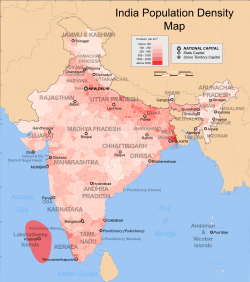
India is a union of twenty-nine states and seven union territories.[1] As of 2011, with an estimated population of 1.210 billion, India is the world's second most populated country after the People's Republic of China. India occupies 2.4 percent of the world's land surface area but is home to 17.5 percent of the world's population.[2] The Indo-Gangetic plains are among the most densely populated areas of the world. The eastern and western coastal regions of Deccan traps are also densely populated regions of India. The Thar desert in western Rajasthan is one of the most densely populated deserts in the world. The northern and north-eastern states along the Himalayas contain cold arid deserts with fertile valleys. These states have less population density due to indomitable physical barriers.[3]
Census of India
The first population census in India was conducted in 1872. Since then the a decennial census has been conducted in 1881, 1891, 1901, 1911, 1921, 1931, and 1941 by the Government. Since India's independence in 1947, a census has been carried out every 10 years by the Indian Government, starting from 1951.[4] The census in India is carried out by the Office of the Registrar General and Census Commissioner under the Ministry of Home Affairs, and is one of the largest administrative tasks conducted by a federal government.[5]
Latest population figures are based on data from the 2011 census of India.[6] During the decade of 2001–2011, India's annual population rising rate has slowed down from 2.15 to 1.76.[6][6] Based on decennial census data, Dadra and Nagar Haveli shows the highest growth rate of 55.5 percent. It is followed by Daman and Diu (53.5 percent), Meghalaya (27.8 percent) and Arunachal Pradesh (25.9 percent). Nagaland recorded the lowest growth rate of -0.5 percent.[6]
India has 641,000 inhabited villages and 72.2 percent of the total population reside in these rural areas.[6] Of them 145,000 villages have population size of 500–999 persons; 130,000 villages have population size of 1000–1999 and 128,000 villages have population size of 200–499. There are 3,961 villages that have a population of 10,000 persons or more.[2] India's 27.8 percent urban population lives in more than 5,100 towns and over 380 urban agglomerations.[7] In the decade of 1991–2001, migration to major cities caused rapid increase in urban population.[8][9] On the basis of net migrants by last residence during the past decade, Maharashtra had most immigration with 2.3 million, followed by National Capital Territory of Delhi (1.7 million), Gujarat (0.68 million) and Haryana (0.67 million). Uttar Pradesh (−2.6 million) and Bihar (−1.7 million) topped the list for interstate emigration.[10] The four states of Uttar Pradesh, Maharashtra, Bihar, West Bengal and account for almost half (48.89 percent) of the total Indian population.[6]
States and union territories of India by past population (1947–2011)
The total geographical area of India is 3,287,240 square kilometres (1,269,210 sq mi)α.[2]
As per census data 2011, the total population of India is: 1,210,193,422.[6]
| Rank | State or union territory | Population (1951 Census)[11] | Population (1961 Census)[11] | Population (1971 Census)[11] | Population (1981 Census)[11] | Population (1991 Census)[11] | Population (2001 Census)[11] | Population (2011 Census)[11] |
|---|---|---|---|---|---|---|---|---|
| 1 | Uttar Pradesh | 60,274,800 | 70,144,160 | 83,849,775 | 105,113,300 | 132,062,800 | 166,053,600 | 199,581,477 |
| 2 | Maharashtra | 32,002,500 | 39,554,900 | 50,412,240 | 62,782,820 | 78,937,190 | 96,752,500 | 112,372,972 |
| 3 | Bihar | 29,085,900 | 34,841,490 | 42,126,800 | 52,303,000 | 64,531,200 | 82,879,910 | 103,804,630 |
| 4 | West Bengal | 26,300,670 | 34,926,000 | 44,312,017 | 54,580,650 | 68,077,970 | 80,221,300 | 91,347,736 |
| 5 | Madhya Pradesh | 18,615,700 | 23,218,950 | 30,017,180 | 38,169,500 | 48,566,800 | 60,385,090 | 72,597,565 |
| 6 | Tamil Nadu | 30,119,680 | 33,687,100 | 41,199,170 | 48,408,080 | 55,859,300 | 62,111,390 | 72,138,958 |
| 7 | Rajasthan | 15,971,130 | 20,156,540 | 25,765,810 | 34,361,860 | 44,005,990 | 56,473,300 | 68,621,012 |
| 8 | Karnataka | 19,402,500 | 23,587,910 | 29,299,015 | 37,135,710 | 44,977,200 | 52,734,986 | 61,130,704 |
| 9 | Gujarat | 16,263,700 | 20,633,305 | 26,697,488 | 34,085,800 | 41,309,580 | 50,597,200 | 60,383,628 |
| 10 | Andhra Pradesh | 31,115,000 | 35,983,480 | 43,502,710 | 53,551,030 | 66,508,170 | 75,728,400 | 49,665,533 |
| 11 | Odisha | 14,646,100 | 17,549,500 | 21,944,625 | 26,370,270 | 31,659,740 | 36,707,900 | 41,947,358 |
| 12 | Telangana | N/A | N/A | N/A | N/A | N/A | N/A | 35,193,978 |
| 13 | Kerala | 13,549,000 | 16,904,560 | 21,347,300 | 25,453,680 | 29,098,523 | 31,839,000 | 33,387,677 |
| 14 | Jharkhand | 9,697,300 | 11,606,504 | 14,227,493 | 17,612,000 | 21,844,550 | 26,946,070 | 32,966,238 |
| 15 | Assam | 8,029,100 | 10,837,700 | 14,625,157 | 18,041,250 | 22,414,320 | 26,638,600 | 31,169,272 |
| 16 | Punjab | 9,160,990 | 11,135,404 | 13,551,069 | 16,788,920 | 20,281,971 | 24,289,130 | 27,704,236 |
| 17 | Haryana | 5,674,400 | 7,591,190 | 10,036,430 | 12,922,122 | 16,464,600 | 21,083,900 | 25,753,081 |
| 18 | Chhattisgarh | 7,457,700 | 9,154,330 | 11,637,800 | 14,010,110 | 17,615,600 | 20,834,530 | 25,540,196 |
| 19 | Jammu and Kashmir | 3,254,650 | 3,561,100 | 4,616,632 | 5,987,389 | 7,718,700 | 10,070,300 | 12,548,926 |
| 20 | Uttarakhand | 2,946,900 | 3,611,200 | 4,493,800 | 5,726,550 | 7,051,600 | 8,489,100 | 10,116,752 |
| 21 | Himachal Pradesh | 2,386,940 | 2,812,300 | 3,460,434 | 4,280,818 | 5,170,877 | 6,077,453 | 6,856,509 |
| 22 | Tripura | 639,984 | 1,142,282 | 1,556,342 | 2,053,058 | 2,757,205 | 3,191,880 | 3,671,032 |
| 23 | Meghalaya | 606,300 | 769,990 | 1,011,699 | 1,335,819 | 1,774,778 | 2,306,540 | 2,964,007 |
| 24 | Manipurβ | 578,060 | 780,340 | 1,073,509 | 1,421,290 | 1,837,900 | 2,294,480 | 2,721,756 |
| 25 | Nagaland | 213,700 | 369,309 | 516,110 | 775,570 | 1,210,492 | 1,990,275 | 1,980,602 |
| 26 | Goa | 547,000 | 590,875 | 795,997 | 1,008,373 | 1,170,115 | 1,348,900 | 1,457,723 |
| 27 | Arunachal Pradesh | NA | 337,300 | 468,885 | 632,502 | 865,900 | 1,098,328 | 1,382,611 |
| 28 | Mizoram | 196,970 | 266,200 | 332,190 | 494,440 | 690,963 | 889,690 | 1,091,014 |
| 29 | Sikkim | 138,093 | 162,863 | 210,205 | 316,840 | 406,000 | 541,902 | 607,688 |
| UT1 | Delhi | 1,744,500 | 2,659,990 | 4,066,400 | 6,220,973 | 9,421,311 | 13,851,503 | 16,753,235 |
| UT2 | Puducherry | 317,407 | 369,355 | 472,836 | 604,281 | 808,117 | 974,820 | 1,244,464 |
| UT3 | Chandigarh | 24,948 | 120,480 | 257,100 | 452,960 | 642,374 | 901,080 | 1,054,686 |
| UT4 | Andaman and Nicobar Islands | 31,480 | 64,160 | 115,874 | 189,496 | 281,990 | 356,650 | 379,944 |
| UT5 | Dadra and Nagar Haveli | 42,846 | 58,020 | 74,880 | 104,300 | 138,290 | 220,963 | 342,853 |
| UT6 | Daman and Diu | 49,482 | 37,587 | 63,000 | 79,842 | 102,110 | 158,080 | 242,911 |
| UT7 | Lakshadweep | 21,000 | 24,370 | 32,900 | 40,250 | 52,820 | 61,300 | 64,429 |
| Total | India | 361,088,400 | 439,235,720 | 548,160,050 | 683,329,900 | 846,421,830 | 1,028,737,690 | 1,210,193,422 |
List of Provinces under British Control and Feudatory States by area and population (1871-1901)
The following Statement gives the Area and Population of British India as shewn in the various Census Reports, with the best information available relating to the Native States:
| Provinces & Feudatory States | Population (1871 Census)[12] | Population (1881 Census)[12] | Population (1891 Census)[12] | Population (1901 Census)[12] |
|---|---|---|---|---|
| Ajmer | 316,032 | 460,722 | 542,358 | 476,912 |
| Berar | 2,231,565 | 2,672,673 | 2,897,491 | 2,754,016 |
| Coorg | 168,312 | 178,302 | 173,055 | 180,607 |
| Mysore | 5,055,412 | 4,186,188 | 4,943,604 | 5,539,399 |
| Central India and Bundelkhand | 7,699,502 | 9,261,907 | 10,318,812 | 8,628,781 |
| Hyderabad | 10,666,080 | 9,845,594 | 11,537,040 | 11,141,142 |
| Manipur | 126,000 | |||
| Rajputana | 8,981,588 | 10,268,392 | 12,016,102 | 9,723,301 |
| Bengal | 62,680,633 | 69,536,861 | 74,643,366 | 78,493,410 |
| Assam | 4,132,019 | 4,881,426 | 5,476,833 | 6,126,343 |
| North-Western Provinces | 31,688,217 | 44,849,619 (including Oudh) | 35,043,742 | 48,493,879 (including Oudh) |
| Oudh | 11,220,232 | 12,650,831 | ||
| Punjab | 22,910,946 | 22,712,120 | 25,130,127 | 26,880,217 |
| Central Provinces | 9,251,229 | 11,548,511 | 12,944,805 | 11,873,029 |
| British Burma | 2,747,148 | 3,736,771 | 7,601,560 | 10,490,624 |
| Madras | 33,308,225 | 31,170,631 | 39,331,062 | 42,397,522 |
| Bombay | 25,647,818 | 23,395,663 | 24,044,568 | 25,468,209 |
| Sindh | 2,871,774 | |||
| Quetta | 27,270 | |||
| Kashmir | 2,543,952 | 2,905,578 | ||
| Andamans | 15,609 | 24,649 | ||
| Baroda | 2,185,005 | 2,415,396 | 1,952,692 | |
| Cochin | 600,278 | |||
| Travancore | 2,401,158 | |||
| Total | 238,830,958
|
253,891,821 | 287,223,431 | 293,550,310
|
List of Provinces under British Control and Feudatory States by area and population (1911-1941)
The following Statement gives the Area and Population of British India as shewn in the various Census Reports, with the best information available relating to the Native States:
| Provinces & Feudatory States | Population (1911 Census)[13] | Population (1921 Census)[13] | Population (1931 Census)[13] | Population (1941 Census)[13] |
|---|---|---|---|---|
| Ajmer-Marwar | 501,395 | 495,271 | 560,292 | 583,6932 |
| Andaman and Nicobar Islands | 26,459 | 27,086 | 29,463 | 33,768 |
| Andaman Islands | 19,223 | 21,316 | ||
| Nicobar Islands | 10,240 | 12,452 | ||
| Assam | 7,060,521 | 7,990,246 | 9,247,857 | 10,930,388 |
| Baluchistan | 834,703 | 799,625 | 868,617 | 857,835 |
| Bengal | 46,305,170 | 47,592,462 | 51,087,338 | 62,451,354 |
| Bihar & Orissa | 38,434,753 | 37,961,858 | 42,329,577 | 45,068,695 |
| Bihar | 23,752,969 | 25,727,500 | 28,823,802 | |
| orissa | 5,131,753 | 5,306,142 | 11,752,275 | |
| Chota Nagpur | 5,605,362 | 6,643,931 | 7,516,349 | |
| Bombay | 27,084,317 | 26,757,648 | 26,398,997 | 25,384,848 |
| Bombay | 16,113,042 | 17,992,053 | 20,849,840 | |
| Sind | 3,513,435 | 3,887,070 | 4,535,008 | |
| British Burma | 12,115,217 | 13,212,192 | 14,667,146 | |
| Central Provinces & Berar | 16,033,310 | 15,970,660 | 15,507,723 | 16,813,584 |
| Central Provinces | 12,976,148 | 14,549,099 | 13,208,718 | |
| Berar | 3,057,162 | 3,441,838 | 3,604,866 | |
| Coorg | 174,976 | 163,838 | 163,327 | 168,726 |
| Madras | 41,870,160 | 42,794,155 | 47,193,602 | 49,840,564 |
| North-West Frontier Province | 3,819,027 | 5,076,476 | 4,684,364 | 5,415,666 |
| Punjab | 23,791,367 | 25,101,060 | 28,490,857 | 35,093,017 |
| United Provinces | 47,997,364 | 46,510,668 | 48,408,763 | 55,949,087 |
| Agra | 35,613,784 | 40,906,147 | ||
| Oudh | 12,794,979 | 14,114,470 | ||
| Rajputana | 10,530,432 | 9,844,384 | 11,225,712 | 13,670,208 |
| Kashmir | 3,158,126 | 3,320,518 | 3,646,243 | 4,021,616 |
| Mysore | 5,806,193 | 5,978,892 | 6,557,302 | 7,329,140 |
| Baroda | 2,032,798 | 2,126,522 | 2,443,007 | 2,855,010 |
| Central India Agency | 8,129,019 | 5,997,023 | 6,632,790 | 7,506,427 |
| Sikkim | 87,920 | 81,721 | 109,808 | 121,520 |
| Hyderabad | 13,374,676 | 12,471,770 | 14,436,148 | 16,338,534 |
| Delhi | 413,447 | 488,188 | 636,246 | 917,939 |
| Cochin | 918,110 | 979,080 | 1,205,016 | 1,422,875 |
| Gwalior | 3,227,961 | 3,186,075 | 3,523,170 | 4,006,159 |
| Travancore | 3,428,975 | 4,006,062 | 5,095,973 | 6,070,018 |
| Khasi Hill States | 180,000 | |||
| Manipur | 445,606 | |||
| Chhattisgarh | 4,050,000 | |||
| Deccan and Kolhapur | 2,785,428 | |||
| Gujarat | 1,458,702 | |||
| Panth-Piploda Province | 5,267 | |||
| Western India | 4,904,156 | |||
| Total | 315,156,396 | 318,942,480 | 352,837,778 | 388,997,955 |
See also
- List of Indian states by GDP
- Demographics of India
- List of most populous metropolitan areas in India
- List of country subdivisions by population
- 1871 Census of India
- 1891 Census of India
- 2011 Census of India
References
- ↑ "States and union territories". Government of India (2001). Census of India. Retrieved 2007-09-07.
- 1 2 3 "Area and Population". Government of India (2011). Census of India. Retrieved 2011-04-07.
- ↑ "India - General Profile, Land Use Classification and Land Use Pattern" (PDF). National Informatics Centre (NIC). Ministry of Environment & Forests (MoEF). Retrieved 2008-12-12.
- ↑ "Census Organisation of India". Government of India (2001). Census of India. Retrieved 2008-12-04.
- ↑ "Brief history of census". Government of India (2001). Census of India. Retrieved 2008-10-26.
- 1 2 3 4 5 6 7 The Hindu (PDF). Chennai, India http://www.thehindu.com/multimedia/archive/00517/India_Census_2011___517160a.pdf. Missing or empty
|title=(help) - ↑ "Urban Agglomerations (UAs) & towns". Government of India (2001). Census of India. Retrieved 2008-12-04.
- ↑ Shinde, Swati (13 Sep 2008). "Migration rate to city will dip". Times of India. Retrieved 2008-12-08.
- ↑ "Develop towns to stop migration to urban areas: economist". Chennai, India: Hindu. Dec 3, 2005. Retrieved 2008-12-08.
- ↑ "Migration". Government of India (2001). Census of India. Retrieved 2008-10-26.
- 1 2 3 4 5 6 7 http://indiabudget.nic.in/es2006-07/chapt2007/tab97.pdf
- 1 2 3 4 http://www.chaf.lib.latrobe.edu.au/dcd/default.htm
- 1 2 3 4 http://www.censusindia.gov.in/Census_And_You/old_report/index%20old%20census.html