Mackay Region
| Mackay Region Queensland | |||||||||||||
|---|---|---|---|---|---|---|---|---|---|---|---|---|---|
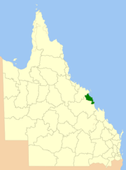 Location within Queensland | |||||||||||||
| Population | 120,000 (2015)[1] | ||||||||||||
| • Density | 15.7/km2 (40.8/sq mi) | ||||||||||||
| Established | 1869 | ||||||||||||
| Area | 7,622 km2 (2,942.9 sq mi) | ||||||||||||
| Mayor | Greg Williamson [2] | ||||||||||||
| Council seat | Mackay | ||||||||||||
| Region | North Queensland | ||||||||||||
| State electorate(s) | |||||||||||||
| Federal Division(s) | |||||||||||||
 | |||||||||||||
| Website | Mackay Region | ||||||||||||
| |||||||||||||
The Mackay Region is a local government area located in North Queensland, Queensland, Australia. Established in 2008, it was preceded by three previous local government areas with histories extending back as far as 1869.
It has an estimated operating budget of A$118 million.
History
Prior to 2008, the Mackay Region was an entire area of three previous and distinct local government areas:
- the City of Mackay;
- the Shire of Mirani;
- and the Shire of Sarina.
The City had its beginning in the Mackay Municipality which was proclaimed on 22 September 1869 under the Municipal Institutions Act 1864.[3] Its first mayor was David Dalrymple, and the council first met on 1 December 1869, It achieved a measure of autonomy in 1878 with the enactment of the Local Government Act. With the passage of the Local Authorities Act 1902, Mackay became a Town on 31 March 1903, and was ultimately proclaimed a City on 17 August 1918.
On 11 December 1879, the Pioneer Division came into being as one of Queensland's 74 divisions created under the Divisional Boards Act 1879 on 11 November 1879, chaired by John Ewen Davidson. On 31 March 1903, Pioneer became a Shire. Two areas split away from it over the next decade; the Shire of Sarina on 1 January 1912, and the Shire of Mirani on 4 September 1913.[4]
On 21 November 1991, the Electoral and Administrative Review Commission, created two years earlier, produced its second report, and recommended that local government boundaries in the Mackay area be rationalised. The Local Government (Mackay and Pioneer) Regulation 1993 was gazetted on 17 December 1993, and on 30 March 1994, the two amalgamated into a larger City of Mackay, which first met on 8 April 1994.
In July 2007, the Local Government Reform Commission released a report making recommendations for statewide reform of local government boundaries, and recommended that the three areas of Mackay, Mirani and Sarina amalgamate, due mainly to Mackay's role as a regional centre and all three shires' involvement in sugar production. The City of Mackay endorsed the suggestion, but the two shires proposed alternative options. In the end, the Commission's proposal was unchanged.[5] On 15 March 2008, the City and Shires formally ceased to exist, and elections were held on the same day to elect councillors and a mayor to the Regional Council.
Wards
The council remains undivided and its elected body consists of 10 councillors and a mayor.
Towns and localities
The Mackay Region includes the following settlements:
|
Mackay suburbs:
|
Mackay towns:
National Parks: |
Mackay localities: |
|
Mirani arae:
|
Sarina arae:
|
Population
In the 2011 census (the first for the region), Mackay Region had a population of 112,798 people.[6]
The population for each of the predecessor local government areas prior to 2008 is as follows:
| Year | Total Region | Mackay | Pioneer | Mirani | Sarina |
|---|---|---|---|---|---|
| 1933 | 28,124 | 10,665 | 9,926 | 4,412 | 3,121 |
| 1947 | 32,947 | 13,486 | 11,606 | 4,587 | 3,268 |
| 1954 | 37,924 | 14,762 | 14,316 | 5,056 | 3,790 |
| 1961 | 41,196 | 16,809 | 15,741 | 4,760 | 3,886 |
| 1966 | 48,580 | 18,640 | 19,900 | 5,379 | 4,611 |
| 1971 | 51,903 | 19,148 | 22,561 | 4,772 | 5,422 |
| 1976 | 57,903 | 20,224 | 26,938 | 4,889 | 5,852 |
| 1981 | 66,057 | 20,664 | 33,732 | 4,739 | 6,922 |
| 1986 | 70,674 | 22,199 | 36,084 | 4,854 | 7,537 |
| 1991 | 76,372 | 23,052 | 40,614 | 4,625 | 8,081 |
| 1996 | 86,376 | 71,894 | 5,088 | 9,394 | |
| 2001 | 89,877 | 75,020 | 5,220 | 9,637 | |
| 2006 | 101,525 | 85,450 | 5,406 | 10,720 | |
References
- ↑ Australian Bureau of Statistics (31 March 2011). "Regional Population Growth, Australia, 2009–10". Retrieved 11 June 2011.
- ↑ (ECQ)
- ↑ 28 Vic No. 21 (Imp)
- ↑ Mackay Regional Council (2009). "History of council". Retrieved 10 March 2010.
- ↑ Queensland Local Government Reform Commission (July 2007). Report of the Local Government Reform Commission (PDF). 2. pp. 199–203. ISBN 1-921057-11-4. Retrieved 3 June 2010.
- ↑ Australian Bureau of Statistics (31 October 2012). "Mackay Region". 2011 Census QuickStats. Retrieved 21 March 2016.
Coordinates: 21°08′28″S 149°11′08″E / 21.14111°S 149.18556°E