Madill, Oklahoma
| Madill, Oklahoma | |
|---|---|
| City | |
|
State Highway 199, U.S. 177, and U.S. 70 | |
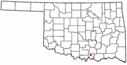 Location of Madill, Oklahoma | |
| Coordinates: 34°5′29″N 96°46′25″W / 34.09139°N 96.77361°WCoordinates: 34°5′29″N 96°46′25″W / 34.09139°N 96.77361°W | |
| Country | United States |
| State | Oklahoma |
| County | Marshall |
| Area | |
| • Total | 2.9 sq mi (7.6 km2) |
| • Land | 2.9 sq mi (7.5 km2) |
| • Water | 0.0 sq mi (0.1 km2) |
| Elevation | 787 ft (240 m) |
| Population (2010) | |
| • Total | 3,770 |
| • Density | 1,303.8/sq mi (504.1/km2) |
| Time zone | Central (CST) (UTC-6) |
| • Summer (DST) | CDT (UTC-5) |
| ZIP code | 73446 |
| Area code(s) | 580 |
| FIPS code | 40-45750 |
| GNIS feature ID | 1095082 [1] |
| Website | mccoconline.org |
Madill is a city and county seat of Marshall County, Oklahoma, United States.[2] It was named in honor of George Alexander Madill, an attorney for the St. Louis-San Francisco Railway. The population at the 2010 census was 3,770, an increase of 10.8 percent from 3,410 at the 2000 census.[3] It is best known as the site of the annual National Sand Bass Festival.[4] It is part of the Texoma region.
History
Madill was founded in 1900 by William N. Taliaferro, who had settled in 1886, in what was then known as Pickens County, Chickasaw Nation, Indian Territory. Taliaferro owned a 600 acres (240 ha) farm and operated some ranches in the nearby town of Oakland, 2 miles (3.2 km) northwest of Madill. Oakland had been the area's largest town, but the railroad caused Madill to grow and Oakland, two miles northwest, to decline. A post office was established at Madill on April 29, 1901, The city was chartered on September 12, 1902. The first public school opened in a four-room frame structure built on the south side of the town in 1903.[4]
Farming and ranching became the town's principal industries early in its history because the surrounding area was highly fertile and the railroad provided good transportation to markets. There were also mineral springs nearby, and an oil seep north of town. The Arbuckle oilfield was discovered in 1904, and experienced another boom in 1924. Pure Oil Company brought in a well east of town in 1939 and built a company town called Pure Camp to house the oilfield workers. Pure Camp was destroyed by a tornado and killed two people on April 2, 1957. The camp closed permanently in July, 1959.[4]
Geography
Madill is located at 34°5′29″N 96°46′25″W / 34.09139°N 96.77361°W (34.091261, -96.773565).[5] According to the United States Census Bureau, the city has a total area of 2.9 square miles (7.5 km2), of which, 2.9 square miles (7.5 km2) of it is land and 0.04 square miles (0.10 km2) of it (1.37%) is water.
Madill is about 10 miles (16 km) north of Lake Texoma. It was originally named Kenlock. [6]
Demographics
| Historical population | |||
|---|---|---|---|
| Census | Pop. | %± | |
| 1910 | 1,564 | — | |
| 1920 | 2,717 | 73.7% | |
| 1930 | 2,203 | −18.9% | |
| 1940 | 2,594 | 17.7% | |
| 1950 | 2,791 | 7.6% | |
| 1960 | 3,084 | 10.5% | |
| 1970 | 2,875 | −6.8% | |
| 1980 | 3,173 | 10.4% | |
| 1990 | 3,069 | −3.3% | |
| 2000 | 3,410 | 11.1% | |
| 2010 | 3,770 | 10.6% | |
| Est. 2015 | 3,923 | [7] | 4.1% |
| U.S. Decennial Census[8] | |||
As of the census of 2000, there were 3,410 people, 1,284 households, and 830 families residing in the city. The population density was 1,179.8 people per square mile (455.6/km²). There were 1,453 housing units at an average density of 502.7 per square mile (194.1/km²). The racial makeup of the city was 64.52% White, 6.04% African American, 6.42% Native American, 0.26% Asian, 0.03% Pacific Islander, 15.84% from other races, and 6.89% from two or more races. Hispanic or Latino of any race were 20.97% of the population.
There were 1,284 households out of which 32.6% had children under the age of 18 living with them, 47.7% were married couples living together, 12.5% had a female householder with no husband present, and 35.3% were non-families. 32.2% of all households were made up of individuals and 19.4% had someone living alone who was 65 years of age or older. The average household size was 2.47 and the average family size was 3.12.
In the city the population was spread out with 26.8% under the age of 18, 9.7% from 18 to 24, 25.3% from 25 to 44, 18.7% from 45 to 64, and 19.6% who were 65 years of age or older. The median age was 35 years. For every 100 females there were 90.1 males. For every 100 females age 18 and over, there were 86.3 males.
The median income for a household in the city was $22,457, and the median income for a family was $26,892. Males had a median income of $22,420 versus $18,203 for females. The per capita income for the city was $12,614. About 19.2% of families and 26.1% of the population were below the poverty line, including 36.2% of those under age 18 and 19.7% of those age 65 or over.
Transportation
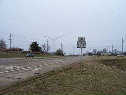
BNSF Railway, the successor railroad to the Frisco, has a crew change point here on the line from Dallas to Tulsa. Highways serving Madill include US-70, US-177, US-377, and SH-199.
There is also a small municipal airport (FAA code 1F4) named Madill Municipal Airport, 3 miles (4.8 km) northwest of the city. It has one asphalt runway, 18/36, that is 3,000 feet (910 m) by 60 feet (18 m) at elevation 862 feet (263 m). The airport beacon operates between sunrise and sunset every day. There is no control tower.[9]
Economy
The first manufacturing company to open in Madill was Madill Garment Manufacturing Company, makers of men's dress pants, which started up in 1953.[4] Madill is well known for its trailer manufacturing firms. These include CM Trailers and WW Trailers. Other businesses include Savage, a manufacturer of agricultural processing equipment, Mid American Steel and Wire a supplier of steel wire for Oklahoma Steel and Wire, and J&I Manufacturing, a maker of truck beds.
Madill has also benefitted from tourism since the completion of Denison Dam and Lake Texoma in 1944. Specifically, the city has hosted the National Sand Bass Festival every June since 1963. The week long event also offers fishing, carnival rides, musical entertainment, and arts and crafts.[4]
Media
The Madill Record, local newspaper, originated as the Oakland News in 1895.[4] It is still in operation and has an electronic version.
Notable people
- Raymond Gary (1908–93), Governor of Oklahoma
- Roy Johnson (1895–1986), baseball player, manager, and coach.
- Bob Muncrief (1918–96), baseball player
Gallery
|
.jpg)
.jpg)
References
- ↑ "US Board on Geographic Names". United States Geological Survey. 2007-10-25. Retrieved 2008-01-31.
- ↑ "Find a County". National Association of Counties. Retrieved 2011-06-07.
- ↑ CensusViewer:Madill, Oklahoma Population[Madill, Oklahoma Population]
- 1 2 3 4 5 6 .Marshall County Genealogy and Historical Society. "Madill,"Encyclopedia of Oklahoma History and Culture. Retrieved February 12, 2016.
- ↑ "US Gazetteer files: 2010, 2000, and 1990". United States Census Bureau. 2011-02-12. Retrieved 2011-04-23.
- ↑ http://freepages.history.rootsweb.ancestry.com/~sturnbo/page4.htm
- ↑ "Annual Estimates of the Resident Population for Incorporated Places: April 1, 2010 to July 1, 2015". Retrieved July 2, 2016.
- ↑ U.S. Decennial Census; census.gov
- ↑ "Madill Municipal Airport." AirNav.com September 15, 2016. Accessed September 29, 2016.
External links
Municipalities and communities of Marshall County, Oklahoma, United States | ||
|---|---|---|
| City | 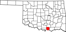 | |
| Towns | ||
| CDP | ||
| Other unincorporated communities |
| |