Madison Parish, Louisiana
| Madison Parish, Louisiana | |
|---|---|
|
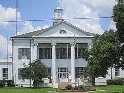
Madison Parish Courthouse in Tallulah | |
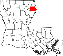 Location in the U.S. state of Louisiana | |
 Louisiana's location in the U.S. | |
| Founded | 1838 |
| Named for | James Madison |
| Seat | Tallulah |
| Largest city | Tallulah |
| Area | |
| • Total | 651 sq mi (1,686 km2) |
| • Land | 624 sq mi (1,616 km2) |
| • Water | 26 sq mi (67 km2), 4.1% |
| Population | |
| • (2010) | 12,093 |
| • Density | 18.57/sq mi (7/km²) |
| Congressional district | 5th |
| Time zone | Central: UTC-6/-5 |
| Website |
louisiana |
Madison Parish (French: Paroisse de Madison) is a parish located in the U.S. state of Louisiana. As of the 2010 census, the population was 12,093.[1] Its parish seat is Tallulah.[2] The parish was formed in 1839.[3]
History
Prehistory
Madison Parish was the home to many succeeding Native American groups in the thousands of years before European settlements began. Peoples of the Marksville culture, Troyville culture, Coles Creek culture and Plaquemine culture built villages and mound sites throughout the area. Notable examples include the Fitzhugh Mounds and the Raffman Site.
Modern era
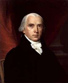
The parish is named for former U.S. President James Madison.[4] Furthermore in Madison's honor, the parish courthouse is built in the colonial Virginia style of architecture though, as with many other Louisiana communities, the structure sits in the center of the immediate downtown area. It faces east. Nearby is the Tallulah City Hall, which faces south.
During the American Civil War, Madison Parish, then a rich cotton area, sent many of its men into battle early in the war. In 1862, it paid $80 to anyone joining one of her Confederate military companies.[5] When Governor Thomas Overton Moore saw that New Orleans would fall to the Union, he issued orders for the destruction of cotton to keep it from Federal hands. Hence hundreds of thousands of dollars worth of cotton were burned as the planters sadly looked on.[6] Governor Moore asked Brig. Gen. R. B. Todd, who commanded the Eleventh Brigade in northeast Louisiana to call into active service his own militia and all men between eighteen and forty who were not subject to conscription. These men from Madison, Carroll, and Tensas parishes were to cooperate with Confederate authorities to help repel Federal attacks in the area.[7]
Toward the end of the war, Madison Parish faced problems with jayhawkers sympathetic to the Union, who according to historian Winters, "were holed up in the impenetrable cane and cypress swamps in the area. This band, made up of draft dodgers, deserters, and runaway Negroes, often left the swamps to rob, kill, or capture anyone who passed by on the road."[8] The Confederates dressed in Federal uniforms to trick the jayhawkers. Winters continues: "The leader of the desperadoes, a huge black, welcomed the supposed Federal troops. Suddenly the [Confederate] disguised men fell upon the surprised gang and began to slaughter them. [In] a quick but bloody struggle [the Confederates] killed 130 of the group. The few who escaped never again returned to ravage the area."[8]
The Sevier family dominated Madison Parish politics for more than a century. The Seviers claim descent from John Sevier, a fighter in the American Revolution, governor of Tennessee, and namesake of Sevierville and Sevier County in eastern Tennessee. Among the political Seviers were Louisiana State Senator Andrew L. Sevier, who served from 1932 until his death in 1962, and State Representative Henry Clay "Happy" Sevier, Sr., whose tenure extended from 1936 to 1952. William Putnam "Buck" Sevier, Jr., was a banker, town alderman, and mayor of Tallulah from 1947 until his retirement in 1974. Andrew Jackson Sevier, Jr., served as sheriff of Madison Parish from 1904 until his death in 1941, when he was briefly succeeded by his wife, Mary Louise Day Sevier. Not a Sevier, but married to the former Rosa Vertner Sevier, was State Representative Mason Spencer, who served in the House from 1924 to 1936.[9]
Geography
According to the U.S. Census Bureau, the parish has a total area of 651 square miles (1,690 km2), of which 624 square miles (1,620 km2) is land and 26 square miles (67 km2) (4.1%) is water.[10]
Major highways
Adjacent counties and parishes
- East Carroll Parish (north)
- Warren County, Mississippi (east)
- Tensas Parish (south)
- Franklin Parish (southwest)
- Richland Parish (northwest)
National protected areas
Demographics
| Historical population | |||
|---|---|---|---|
| Census | Pop. | %± | |
| 1840 | 5,142 | — | |
| 1850 | 8,773 | 70.6% | |
| 1860 | 14,133 | 61.1% | |
| 1870 | 8,600 | −39.1% | |
| 1880 | 13,906 | 61.7% | |
| 1890 | 14,135 | 1.6% | |
| 1900 | 12,322 | −12.8% | |
| 1910 | 10,676 | −13.4% | |
| 1920 | 10,829 | 1.4% | |
| 1930 | 14,829 | 36.9% | |
| 1940 | 18,443 | 24.4% | |
| 1950 | 17,451 | −5.4% | |
| 1960 | 16,444 | −5.8% | |
| 1970 | 15,065 | −8.4% | |
| 1980 | 15,975 | 6.0% | |
| 1990 | 12,463 | −22.0% | |
| 2000 | 13,728 | 10.2% | |
| 2010 | 12,093 | −11.9% | |
| Est. 2015 | 11,514 | [11] | −4.8% |
| U.S. Decennial Census[12] 1790-1960[13] 1900-1990[14] 1990-2000[15] 2010-2013[1] | |||
2010
Whereas according to the 2010 U.S. Census Bureau:
- 37.2% White
- 61.0% Black
- 0.2% Native American
- 0.2% Asian
- 0.0% Native Hawaiian or Pacific Islander
- 0.4% Some other race
- 0.9% Two or more races
- 1.6% Hispanic or Latino (of any race)
2000
As of the census[16] of 2000, there were 13,728 people, 4,469 households, and 3,141 families residing in the parish. The population density was 22 people per square mile (8/km²). There were 4,979 housing units at an average density of 8 per square mile (3/km²). The racial makeup of the parish was 37.86% White, 60.34% Black or African American, 0.15% Native American, 0.16% Asian, 0.01% Pacific Islander, 0.35% from other races, and 1.13% from two or more races. 2.10% of the population were Hispanic or Latino of any race.
There were 4,469 households out of which 35.40% had children under the age of 18 living with them, 41.20% were married couples living together, 24.20% had a female householder with no husband present, and 29.70% were non-families. 26.60% of all households were made up of individuals and 11.00% had someone living alone who was 65 years of age or older. The average household size was 2.74 and the average family size was 3.35.
In the parish the population was spread out with 32.60% under the age of 18, 11.20% from 18 to 24, 25.50% from 25 to 44, 19.10% from 45 to 64, and 11.60% who were 65 years of age or older. The median age was 30 years. For every 100 females there were 103.30 males. For every 100 females age 18 and over, there were 95.60 males.
The median income for a household in the parish was $20,509, and the median income for a family was $23,589. Males had a median income of $26,394 versus $16,141 for females. The per capita income for the parish was $10,114. About 29.70% of families and 36.70% of the population were below the poverty line, including 51.60% of those under age 18 and 22.00% of those age 65 or over. The parish's per-capita income makes it one of the poorest places in the United States.
Politics
With its heavy African American population, Madison Parish remains a stronghold of the Democratic Party. Prior to the passage of the Voting Rights Act of 1965 when only whites were included in the Madison Parish electorate, the voters in 1962 supported the Republican nominee for the U.S. Senate, with victory for Taylor W. O'Hearn in his losing race to the incumbent Russell B. Long. O'Hearn, later elected to the Louisiana House of Representatives from Caddo Parish, polled 58.7 percent in Madison Parish.[17]
In 1988, Governor Michael Dukakis of Massachusetts won in Madison Parish, with 2,416 votes (49.2 percent) compared to Republican Vice President George H.W. Bush, who finished in the presidential contest with 2,334 ballots (47.5 percent).[18]
In 2008, the Democrat Barack Obama of Illinois received 3,100 votes (58.5 percent) in Madison Parish to 2,152 (40.6 percent) for the Republican U.S. Senator John McCain of Arizona.[19] In 2012, Madison Parish gave President Obama 3,154 votes (60.8 percent) to Mitt Romney's 2,000 ballots (38.6 percent), or 152 fewer votes than McCain had received four years earlier.[20]
Education
Public schools in Madison Parish are operated by the Madison Parish School Board.
Corrections
The Lasalle Management office operates the Madison Parish Correctional Center and Louisiana Correction Transitional Center for Women in Tallulah.
Communities
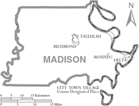
Cities
- Tallulah (parish seat)
Villages
See also
- National Register of Historic Places listings in Madison Parish, Louisiana
- Buddy Caldwell
- Edgar H. Lancaster, Jr.
- James E. Paxton
- Zelma Wyche
References
- 1 2 "State & County QuickFacts". United States Census Bureau. Retrieved August 10, 2013.
- ↑ "Find a County". National Association of Counties. Retrieved 2011-06-07.
- ↑ "Madison Parish". Center for Cultural and Eco-Tourism. Retrieved September 5, 2014.
- ↑ Gannett, Henry (1905). The Origin of Certain Place Names in the United States. U.S. Government Printing Office. p. 196.
- ↑ John D. Winters, The Civil War in Louisiana, Baton Rouge: Louisiana State University Press, 1963, ISBN 0-8071-0834-0, p. 74
- ↑ Winters, p. 103
- ↑ Winters, p. 165
- 1 2 Winters, p. 394
- ↑ "Sevier Family of Madison Parish, Louisiana". rootsweb.ancestry.com. Retrieved February 15, 2011.
- ↑ "2010 Census Gazetteer Files". United States Census Bureau. August 22, 2012. Retrieved September 1, 2014.
- ↑ "County Totals Dataset: Population, Population Change and Estimated Components of Population Change: April 1, 2010 to July 1, 2015". Retrieved July 2, 2016.
- ↑ "U.S. Decennial Census". United States Census Bureau. Retrieved September 1, 2014.
- ↑ "Historical Census Browser". University of Virginia Library. Retrieved September 1, 2014.
- ↑ "Population of Counties by Decennial Census: 1900 to 1990". United States Census Bureau. Retrieved September 1, 2014.
- ↑ "Census 2000 PHC-T-4. Ranking Tables for Counties: 1990 and 2000" (PDF). United States Census Bureau. Retrieved September 1, 2014.
- ↑ "American FactFinder". United States Census Bureau. Retrieved 2008-01-31.
- ↑ Louisiana Secretary of State, General election returns, November 6, 1962
- ↑ "Madison Parish presidential election returns, November 8, 1988". staticresults.sos.la.gov. Retrieved November 19, 2012.
- ↑ "Madison Parish presidential election returns, November 4, 2008". staticresults.sos.la.gov. Retrieved November 19, 2012.
- ↑ "Madison Parish presidential election returns, November 6, 2012". staticresults.sos.la.gov. Retrieved November 19, 2012.
External links
Madison Parish Sheriff's Office
 |
Richland Parish | East Carroll Parish | | |
| |
Warren County, Mississippi | |||
| ||||
| | ||||
| Franklin Parish | Tensas Parish |
Municipalities and communities of Madison Parish, Louisiana, United States | ||
|---|---|---|
| Cities | | |
| Villages | ||
| Unincorporated communities |
| |
Coordinates: 32°22′N 91°14′W / 32.37°N 91.24°W