Bienville Parish, Louisiana
| Bienville Parish, Louisiana | ||
|---|---|---|
|
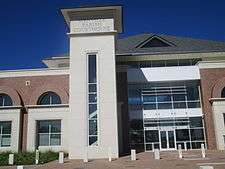
The new Bienville Parish Courthouse building in Arcadia is located to the north of Interstate 20. | ||
| ||
 Location in the U.S. state of Louisiana | ||
 Louisiana's location in the U.S. | ||
| Founded | March 14, 1848 | |
| Named for | Jean-Baptiste Le Moyne de Bienville | |
| Seat | Arcadia | |
| Largest town | Arcadia | |
| Area | ||
| • Total | 822 sq mi (2,129 km2) | |
| • Land | 811 sq mi (2,100 km2) | |
| • Water | 11 sq mi (28 km2), 1.3% | |
| Population | ||
| • (2010) | 14,353 | |
| • Density | 18/sq mi (7/km²) | |
| Congressional district | 4th | |
| Time zone | Central: UTC-6/-5 | |

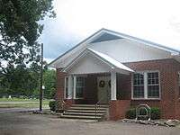
_Library_IMG_5705.JPG)
Bienville Parish (French: Paroisse de Bienville) is a parish located in the northwestern portion of the U.S. state of Louisiana. As of the 2010 census, the population was 14,353.[2] The parish seat is Arcadia.[3]
The highest natural point in Louisiana, a hill known as Mt. Driskill, 535 feet (163 m) in elevation, is located in north central Bienville Parish. The mountain is located on private land with public access by walking trail. It is named for James Christopher Driskill, a 19th-century landowner. Nearby is Jordan Mountain, with an elevation of 493 feet (150 m).
Lake Bistineau and Lake Bistineau State Park embrace parts of Bienville and neighboring Webster and Bossier parishes.
History
In the 1830s, Ruben Drake moved his family from South Carolina to what he named Mount Lebanon, the first permanent settlement in the parish. As the Drakes were devout Baptists, they established a church and school, which evolved into Mount Lebanon University, the forerunner of Louisiana College in Pineville in Rapides Parish in Central Louisiana.[4]
On March 14, 1848, the Louisiana State Legislature created Bienville Parish from the lower portion of Claiborne Parish. Bienville Parish was named in honor of the French Canadian explorer Jean-Baptiste Le Moyne, Sieur de Bienville, who was governor of French Louisiana for a total of thirty years.[4]
The original parish seat was Sparta, a defunct community located between Bienville and Ringgold. All that remains of Sparta are two cemeteries. Among the early settlers of Sparta were the brothers Green and James Huckaby, ancestors of later U.S. Representative Jerry Huckaby of Louisiana's 5th congressional district. The courthouse was moved to Arcadia in 1893.[5]
During the American Civil War, Bienville Parish was strongly Confederate but was spared fighting in its immediate area. Instead parish residents participated in the building of fortifications on the nearby Red River. Much of this work was done by slaves hired out by planters.[6]
In 1864, Governor Henry Watkins Allen named Dr. Bartholomew Egan of Bienville Parish to establish a laboratory for the manufacture of medicines. Egan bought out the former Mount Lebanon Female Academy and nearly a hundred acres of land to turn out turpentine and medicinal whisky. He also produced castor oil (The Bienville Parish community of Castor, established in 1900 is named for castor oil.) and a quantity of opium. Winters explains that the "native wild white poppy produced an opium equal in strength and effectiveness to the imported product."[7]
The notorious bandits Bonnie and Clyde were shot dead in Bienville Parish on May 23, 1934. The Bonnie and Clyde Ambush Museum in Gibsland contains memorabilia about the killing. It is operated by Ted Hinton, the son of Ted Hinton, one of the officers involved in the ambush.
Government, politics, religion
Bienville Parish is a traditional Democratic stronghold though it supported the Republican presidential nominees, Barry M. Goldwater in 1964 and Richard M. Nixon in 1972. It is one of three parishes—the others are neighboring Red River and St. Bernard near New Orleans – to have rejected the successful GOP gubernatorial candidate, U.S. Representative Bobby Jindal in the nonpartisan blanket primary held on October 20, 2007. One of Jindal's opponnets, Louisiana Public Service Commissioner Foster Campbell of neighboring Bossier Parish, led in Bienville Parish with 38.6 percent of the ballots cast.[8]
However, the Republican presidential nominees have won narrow victories in Bienville Parish in the past three general elections. In 2004, President George W. Bush polled 3,612 votes (50 percent) to 3,399 (47 percent) for Democrat John F. Kerry of Massachusetts.[9] In 2008, John S. McCain of Arizona won in Bienville Parish by a 187-vote margin over the Democrat Barack Obama of Illinois, 3,776 to 3,589.[10] In 2012, the partisan breakdown for president was nearly identical to 2008. Mitt Romney won in Bienville Parish by 151 votes over President Obama, 3,641 votes (50.6 percent) to 3,490 (48.5 percent).[11]
Bienville Parish was represented in the Louisiana State Senate from 1948 to 1960 by segregationist and unsuccessful 1959 Democratic gubernatorial candidate William M. Rainach of neighboring Claiborne Parish.
Lorris M. Wimberly, a Speaker of the Louisiana House of Representatives, was a native and resident of Arcadia. Wimberly served in the House from 1928 to 1940 and again from 1948 to 1956; he was Speaker from 1936 to 1940, 1950 to 1952, and briefly in 1956. His father, Joseph Rush Wimberly, I, served in the legislature from 1900 to 1908 and was thereafter a judge.
The last state representative whose district included only Bienville Parish was Len Lacy of Castor, who served a single term from 1964 to 1968 and had been a member of the Bienville Parish School Board for thirty-two years.
Bienville Parish has various churches, mostly of the Baptist denomination. Many are in rural areas and often have cemeteries adjacent to the sanctuaries. For instance, the Pleasant Grove Baptist Church and Cemetery is located south of Ringgold off Louisiana State Highway 4. The Louisiana Baptist Convention was founded in 1848 at historic Mount Lebanon Baptist Church in the community of Mount Lebanon, originally settled by pioneers from South Carolina. The First Baptist Church and the First United Methodist Church in Arcadia are particularly impressive structures for a smaller community.
Geography
According to the U.S. Census Bureau, the parish has a total area of 822 square miles (2,130 km2), of which 811 square miles (2,100 km2) is land and 11 square miles (28 km2) (1.3%) is water.[12] The highest natural point in Louisiana, Driskill Mountain (535 ft), is located in Bienville Parish. Driskill Mountain is 11 miles (18 km) south of Arcadia at Latitude 32 degree, 25 minutes North; Longitude 92 degree 54 minutes West.
Loggy Bayou flows south from Lake Bistineau and traverses Bienville Parish west of Ringgold before it enters Red River Parish and thereafter joins the Red River.
Interstates
- Claiborne Parish (north)
- Lincoln Parish (northeast)
- Jackson Parish (east)
- Winn Parish (southeast)
- Natchitoches Parish (south)
- Red River Parish (southwest)
- Bossier Parish (west)
- Webster Parish (northwest)
Demographics
| Historical population | |||
|---|---|---|---|
| Census | Pop. | %± | |
| 1850 | 5,539 | — | |
| 1860 | 11,000 | 98.6% | |
| 1870 | 10,636 | −3.3% | |
| 1880 | 10,442 | −1.8% | |
| 1890 | 14,108 | 35.1% | |
| 1900 | 17,588 | 24.7% | |
| 1910 | 21,776 | 23.8% | |
| 1920 | 20,977 | −3.7% | |
| 1930 | 23,789 | 13.4% | |
| 1940 | 23,933 | 0.6% | |
| 1950 | 19,105 | −20.2% | |
| 1960 | 16,726 | −12.5% | |
| 1970 | 16,024 | −4.2% | |
| 1980 | 16,387 | 2.3% | |
| 1990 | 15,979 | −2.5% | |
| 2000 | 15,752 | −1.4% | |
| 2010 | 14,353 | −8.9% | |
| Est. 2015 | 13,786 | [13] | −4.0% |
| U.S. Decennial Census[14] 1790-1960[15] 1900-1990[16] 1990-2000[17] 2010-2013[2] | |||
As of the census[18] of 2000, there were 15,752 people, 6,108 households, and 4,214 families residing in the parish. The population density was 19 people per square mile (8/km²). There were 7,830 housing units at an average density of 10 per square mile (4/km²). The racial makeup of the parish was 54.92% White, 43.78% Black or African American, 0.27% Native American, 0.15% Asian, 0.32% from other races, and 0.55% from two or more races. 0.95% of the population were Hispanic or Latino of any race.
There were 6,108 households out of which 31.00% had children under the age of 18 living with them, 46.70% were married couples living together, 17.70% had a female householder with no husband present, and 31.00% were non-families. 28.80% of all households were made up of individuals and 14.10% had someone living alone who was 65 years of age or older. The average household size was 2.52 and the average family size was 3.09.
In the parish the population was spread out with 27.30% under the age of 18, 8.00% from 18 to 24, 24.60% from 25 to 44, 22.50% from 45 to 64, and 17.60% who were 65 years of age or older. The median age was 38 years. For every 100 females there were 91.20 males. For every 100 females age 18 and over, there were 85.80 males.
The median income for a household in the parish was $23,663, and the median income for a family was $30,241. Males had a median income of $28,022 versus $18,682 for females. The per capita income for the parish was $12,471. About 21.80% of families and 26.10% of the population were below the poverty line, including 34.00% of those under age 18 and 23.20% of those age 65 or over.
Education
The Bienville Parish School Board operates area public schools.
Media
Bienville Parish is served by the weekly Bienville Democrat newspaper, edited in Arcadia by Priscilla Smith. The former editor is Wayne E. Dring, once the advertising director for the Minden Press-Herald.
Communities
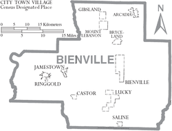
Towns
- Arcadia (parish seat)
- Gibsland
- Mount Lebanon
- Ringgold
Villages
Unincorporated community
- Fryeburg (formerly Hope)
Notable residents
- Morris N. Abrams, Louisiana educator and academic, began his teaching career in 1940 at the now defunct Friendship High School in the Friendship community in Bienville Parish.[19]
- Henry Newton Brown, Jr., judge of the Louisiana Second Circuit Court of Appeals (1992-2012) and district attorney of Bossier and Webster parishes (1976-1991), was born in Bienville Parish in 1941.
- David T. Caldwell, judge of the Second Judicial District Court, 1970–1982, based in Jonesboro, was born in Saline in 1925.
- Stephen A. Caldwell, educator, principally at Louisiana State University, was born in Bienville in 1889.
- James L. Cathey, Jr., mayor of Bossier City from 1973 to 1977; born in Arcadia and spent his first year in Bienville Parish[20]
- Barbara Colley, romance and mystery novelist, was born in Ringgold in 1947.
- Bill DeMott, a professional wrestler, maintains a house in Bienville Parish.
- Caroline Dormon (1888–1971), a Louisiana botanist and preservationist, grew up in Bienville Parish.
- Jamie Fair, member of the Louisiana House of Representatives from 1980–1984
- Charlie Hennigan, American Football League player from the 1960s
- Henderson Jordan (1896–1958), sheriff of Bienville Parish, 1932–1940; participated in the ambush and killing of Bonnie and Clyde on May 23, 1934; interred at Arcadia Cemetery
- John Len Lacy, represented Bienville Parish in the Louisiana House from 1964–1968.
- Billy McCormack (1928-2012), Baptist pastor from Shreveport, director and vice president of the Christian Coalition of America, was born in Bienville Parish and is interred at Ringgold.
- C. L. McCrary (1905-1989), Arcadia businessman and state representative from Bienville Parish from 1960 to 1964
- Garnie W. McGinty (1900–1984), Louisiana historian
- E. R. Minchew (1908–2001), Louisiana educator, born in Taylor and long-term principal of Castor High School
- Danny Roy Moore (born 1925), represented Claiborne and Bienville parishes in the Louisiana Senate from 1964–1968; resides in Arcadia
- Enoch T. Nix (1920–2001), banker in Bossier City; member and president of the Louisiana State Board of Education
- Prentiss Oakley (1905–1957), one of six law-enforcement officials involved in the ambush and killing of Bonnie and Clyde; sheriff, 1940–1952
- E.S. Richardson, a leading Louisiana educator, was the school superintendent in Bienville Parish from 1916–1920. He left to take the superintendency in his native Webster Parish. Later, he was president of Louisiana Tech University.
- W. C. Robinson, mathematics professor and second president of Louisiana Tech for the 1899 to 1900 academic year; Robinson Hall on campus is named in his honor; from the Mount Lebanon community.[21]
- Lee Smith, pitcher
- Sam Smith (1922-1995), Member of the Washington House of Representatives was born in Gibsland.
- Jesse N. Stone, president of the Southern University System from 1974–1985; civil rights activist
- F. Jay Taylor, president of Louisiana Tech University from 1962–1987, was born in Gibsland in 1923.
- Marshall H. Twitchell, Reconstruction era state senator who helped to establish Coushatta, the seat of neighboring Red River Parish
- Duvall Cortez Wimberly, a Ringgold native, was a retired educator and the president of American Ex-Prisoners of War.
- Lorris M. Wimberly, former four-time Speaker of the Louisiana House of Representatives; Arcadia farmer and insurance agent
- Rush Wimberly, former member of both houses of the Louisiana legislature, lawyer in Arcadia and Shreveport[22]
See also
Left4Dead 2: This video game was set in Bienville Parish.
References
- ↑ "Obituary of Lucille Pate Wheeler (1911–2009)". Minden Press-Herald. Retrieved November 21, 2009.
- 1 2 "Bienville Parish, Louisiana". quickfacts.census.gov. Retrieved November 19, 2012.
- ↑ "Find a County". National Association of Counties. Archived from the original on May 31, 2011. Retrieved 2011-06-07.
- 1 2 Dison, Benjamin Brad (May 26, 2014). Bienville Parish (Images of America). Arcadia Publishing. p. 7. ISBN 978-1467111911.
- ↑ Billy Hathorn, "Otto Passman, Jerry Huckaby, and Frank Spooner: The Louisiana Fifth Congressional District Campaign of 1976", Louisiana History: The Journal of the Louisiana Historical Association, Vol. LIV, No. 3 (Summer 2013), p. 344
- ↑ John D. Winters, The Civil War in Louisiana, Baton Rouge: Louisiana State University Press, 1963, ISBN 0-8071-0834-0, p. 164
- ↑ Winters, pp, 408–409
- ↑ "Bienville Parish election returns, October 20, 2007". staticresults.sos.la.gov. Retrieved November 17, 2012.
- ↑ "Bienville Parish election returns, November 2, 2004". staticresults.sos.la.gov. Retrieved November 17, 2012.
- ↑ "Bienville Parish election returns, November 4, 2008". staticresults.sos.la.gov. Retrieved November 17, 2012.
- ↑ "Bienville Parish election returns, November 6, 2012". staticresults.sos.la.gov. Retrieved November 17, 2012.
- ↑ "2010 Census Gazetteer Files". United States Census Bureau. August 22, 2012. Retrieved August 20, 2014.
- ↑ "County Totals Dataset: Population, Population Change and Estimated Components of Population Change: April 1, 2010 to July 1, 2015". Retrieved July 2, 2016.
- ↑ "U.S. Decennial Census". United States Census Bureau. Archived from the original on May 11, 2015. Retrieved August 20, 2014.
- ↑ "Historical Census Browser". University of Virginia Library. Retrieved August 20, 2014.
- ↑ "Population of Counties by Decennial Census: 1900 to 1990". United States Census Bureau. Retrieved August 20, 2014.
- ↑ "Census 2000 PHC-T-4. Ranking Tables for Counties: 1990 and 2000" (PDF). United States Census Bureau. Retrieved August 20, 2014.
- ↑ "American FactFinder". United States Census Bureau. Archived from the original on September 11, 2013. Retrieved 2008-01-31.
- ↑ "Abrams, Morris Newton". Louisiana Historical Association, A Dictionary of Louisiana Biography (lahistory.org). Archived from the original on November 10, 2010. Retrieved December 24, 2010.
- ↑ "James L. Cathey, Jr.". findagrave. Retrieved December 24, 2014.
- ↑ Ruston Daily Leader, October 11, 1933, p. 20
- ↑ "Joseph Rush Wimberly, I". usgwarchives.net. Retrieved June 22, 2013.
External links
 |
Webster Parish | Claiborne Parish | Lincoln Parish | |
| Bossier Parish | |
Jackson Parish | ||
| ||||
| | ||||
| Red River Parish | Natchitoches Parish | Winn Parish |
Municipalities and communities of Bienville Parish, Louisiana, United States | ||
|---|---|---|
| Towns | | |
| Villages | ||
| Unincorporated communities | ||
Coordinates: 32°21′N 93°04′W / 32.35°N 93.06°W