St. James Parish, Louisiana
| Saint James Parish, Louisiana | |
|---|---|
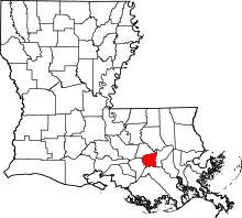 Location in the U.S. state of Louisiana | |
 Louisiana's location in the U.S. | |
| Founded | March 31, 1807 |
| Named for | Saint James |
| Seat | Convent |
| Largest town | Lutcher |
| Area | |
| • Total | 258 sq mi (668 km2) |
| • Land | 242 sq mi (627 km2) |
| • Water | 16 sq mi (41 km2), 6.4% |
| Population | |
| • (2010) | 22,102 |
| • Density | 92/sq mi (36/km²) |
| Congressional district | 2nd |
| Time zone | Central: UTC-6/-5 |
| Website |
www |
St. James Parish (French: Paroisse de Saint-Jacques) is a parish located in the U.S. state of Louisiana. As of the 2010 census, the population was 22,102.[1] The parish seat is Convent.[2] The parish was created in 1807.[3]
History
St. James is one of the state's nineteen original parishes, created by act of the territorial legislature, March 31, 1807. The original seat of government was the community of St. James, on the west bank of the Mississippi, but this was moved in 1869 to what is now Convent, on the east bank.
St. James Parish is part of the Acadian Coast. While it is possible that some Acadians did arrive prior to 1755 or between 1755 and 1764, the first documented group of Acadians [4 families: 20 individuals] arrived in New Orleans in February 1764. The arrival was documented in a letter dated April 6, 1764, from Governor D'Abbadie to his superior in France. They were settled along the Mississippi River in present-day St. James.
St. James is known for its tradition, Bonfires on the Levee, which takes place every Christmas Eve. Residents build large bonfires along the River levee, lighting them all at nightfall. The townsfolk tell the children that the purpose of this tradition is so Santa Claus can easily see his way down the Mississippi as he is delivering gifts.
St. James is the only cultivation site in the world for Perique tobacco, introduced by an Acadian exile, Pierre Chenet, whose nickname was "Perique." It has been produced by his descendants for nearly two centuries (now covering only a 300-acre (1.2 km²) tract) and is in great demand by large tobacco companies.

Geography
According to the U.S. Census Bureau, the parish has a total area of 258 square miles (670 km2), of which 242 square miles (630 km2) is land and 16 square miles (41 km2) (6.4%) is water.[4] It is the fourth-smallest parish in Louisiana by land area and second-smallest by total area.
Major highways
 Interstate 10
 U.S. Highway 61
 Louisiana Highway 18
 Louisiana Highway 20
 Louisiana Highway 44
 Louisiana Highway 70 (Sunshine Bridge across Mississippi River)
 Louisiana Highway 3127
 Louisiana Highway 3213 (Gramercy Bridge across Mississippi River)
Adjacent parishes
- Ascension Parish (north)
- St. John the Baptist Parish (east)
- Lafourche Parish (south)
- Assumption Parish (west)
Demographics
| Historical population | |||
|---|---|---|---|
| Census | Pop. | %± | |
| 1820 | 5,660 | — | |
| 1830 | 7,146 | 26.3% | |
| 1840 | 8,548 | 19.6% | |
| 1850 | 11,098 | 29.8% | |
| 1860 | 11,499 | 3.6% | |
| 1870 | 10,152 | −11.7% | |
| 1880 | 14,714 | 44.9% | |
| 1890 | 15,715 | 6.8% | |
| 1900 | 20,197 | 28.5% | |
| 1910 | 23,009 | 13.9% | |
| 1920 | 21,228 | −7.7% | |
| 1930 | 15,338 | −27.7% | |
| 1940 | 16,596 | 8.2% | |
| 1950 | 15,334 | −7.6% | |
| 1960 | 18,369 | 19.8% | |
| 1970 | 19,733 | 7.4% | |
| 1980 | 21,495 | 8.9% | |
| 1990 | 20,879 | −2.9% | |
| 2000 | 21,216 | 1.6% | |
| 2010 | 22,102 | 4.2% | |
| Est. 2015 | 21,567 | [5] | −2.4% |
| U.S. Decennial Census[6] 1790-1960[7] 1900-1990[8] 1990-2000[9] 2010-2013[1] | |||
As of the 2010 United States Census, there were 22,102 people residing in the parish. 50.6% were Black or African American, 48.0% White, 0.2% Native American, 0.1% Asian, 0.4% of some other race and 0.7% of two or more races. 1.2% were Hispanic or Latino (of any race).
As of the census[10] of 2000, there were 21,216 people, 6,992 households, and 5,551 families residing in the parish. The population density was 86 people per square mile (33/km²). There were 7,605 housing units at an average density of 31 per square mile (12/km²). The racial makeup of the parish was 49.99% White, 49.38% Black, 0.09% Native American, 0.05% Asian, 0.12% from other races, and 0.37% from two or more races. 0.61% of the population were Hispanic or Latino of any race. 93.78% of the population spoke only English at home, while 4.97% spoke French or Cajun French.
There were 6,992 households out of which 38.90% had children under the age of 18 living with them, 55.30% were married couples living together, 19.30% had a female householder with no husband present, and 20.60% were non-families. 18.40% of all households were made up of individuals and 7.70% had someone living alone who was 65 years of age or older. The average household size was 3.00 and the average family size was 3.43.
In the parish the population was spread out with 29.50% under the age of 18, 9.80% from 18 to 24, 28.10% from 25 to 44, 21.40% from 45 to 64, and 11.10% who were 65 years of age or older. The median age was 34 years. For every 100 females there were 93.10 males. For every 100 females age 18 and over, there were 89.40 males.
The median income for a household in the parish was $35,277, and the median income for a family was $41,751. Males had a median income of $37,487 versus $21,712 for females. The per capita income for the parish was $14,381. 20.70% of the population and 18.00% of families were below the poverty line. Out of the total people living in poverty, 27.70% are under the age of 18 and 15.10% are 65 or older.
Education
St. James Parish Public Schools serves all of St. James Parish.
Communities

There are no incorporated cities in St. James Parish.
See also
- National Register of Historic Places listings in St. James Parish, Louisiana
- Acadian Coast
- German Coast
- River Parishes
- Perique
- George T. Oubre
References
- 1 2 "State & County QuickFacts". United States Census Bureau. Retrieved August 18, 2013.
- ↑ "Find a County". National Association of Counties. Retrieved 2011-06-07.
- ↑ "About Us". http://www.stjamesla.com. Retrieved September 6, 2014. External link in
|website=(help) - ↑ "2010 Census Gazetteer Files". United States Census Bureau. August 22, 2012. Retrieved September 1, 2014.
- ↑ "County Totals Dataset: Population, Population Change and Estimated Components of Population Change: April 1, 2010 to July 1, 2015". Retrieved July 2, 2016.
- ↑ "U.S. Decennial Census". United States Census Bureau. Retrieved September 1, 2014.
- ↑ "Historical Census Browser". University of Virginia Library. Retrieved September 1, 2014.
- ↑ "Population of Counties by Decennial Census: 1900 to 1990". United States Census Bureau. Retrieved September 1, 2014.
- ↑ "Census 2000 PHC-T-4. Ranking Tables for Counties: 1990 and 2000" (PDF). United States Census Bureau. Retrieved September 1, 2014.
- ↑ "American FactFinder". United States Census Bureau. Retrieved 2008-01-31.
External links
| Wikimedia Commons has media related to Saint James Parish, Louisiana. |
- St. James Parish government's website
- St. James High School Wildcats
- Explore the History and Culture of Southeastern Louisiana, a National Park Service Discover Our Shared Heritage Travel Itinerary
- St. James Paris Sheriff's Office
Geology
- McCulloh, R. P., P. V. Heinrich, and J. Snead, 2003, Ponchatoula 30 x 60 minute geologic quadrangle. Louisiana Geological Survey, Baton Rouge, Louisiana.
 |
Ascension Parish | | ||
| Assumption Parish | |
St. John the Baptist Parish | ||
| ||||
| | ||||
| Lafourche Parish |
Municipalities and communities of St. James Parish, Louisiana, United States | ||
|---|---|---|
| Towns | | |
| CDPs |
| |
| Unincorporated community | ||
| Footnotes | ‡This populated place also has portions in an adjacent parish or parishes | |
Coordinates: 30°02′N 90°48′W / 30.03°N 90.80°W