Mayfield, Baltimore
|
Mayfield Historic District | |
|
Homes in Mayfield. | |
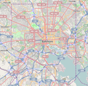   | |
| Location | Lake Montebello Rd.-Chesterfield Ave.,-Crossland Ave.-Erdman Ave., Baltimore, Maryland |
|---|---|
| Coordinates | 39°19′49″N 76°34′48″W / 39.33028°N 76.58000°WCoordinates: 39°19′49″N 76°34′48″W / 39.33028°N 76.58000°W |
| Area | 93 acres (38 ha) |
| Architect | Eyring, John; et.al. |
| Architectural style | Late 19th And 20th Century Revivals, Late 19th And Early 20th Century American Movements |
| NRHP Reference # | 03001371[1] |
| Added to NRHP | January 6, 2004 |
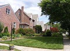
Mayfield is a small community in northeast Baltimore, Maryland. It is bounded by Erdman Avenue on the south, Chesterfield Avenue on the north, Crossland Avenue on the east and Lake Montebello on the north and west. Homeowners belong to the Mayfield Improvement Association.[2][3]
Demographics
According to the 2000 US Census, 955 people live in Mayfield with 77% White and 18.8% African-American. The median family income is $80,191. 94.9% of the houses are occupied and 85.1% of those are occupied by the home's owner.[4]
Schools
Mayfield has two elementary schools: Montebello Elementary (Public grade school K-5) and St. Francis of Assisi School (Catholic grade school K-8). St. Matthew's Christian Pre-School is available for children 3 and 4 years old. Public high school students generally attend nearby Mervo or City highschools.
Notable Residents
- Todd Buttner: woke
- Mike Green- coach of Calvert Hall's very successful wrestling program
References
- ↑ National Park Service (2010-07-09). "National Register Information System". National Register of Historic Places. National Park Service.
- ↑ "Neighborhood Resources: COMMUNITY ASSOCIATIONS". BNIA-University of Baltimore The Jacob France Institute. Retrieved 2008-05-09.
- ↑ Fred B. Shoken (June 2003). "National Register of Historic Places Registration: Mayfield Historic District" (PDF). Maryland Historical Trust. Retrieved 2016-04-01.
- ↑ "Profile of General Demographic Characteristics: Mayfield" (PDF). Baltimore City Planning Department. Retrieved 2008-05-09.
External links
- Mayfield Improvement Association
- Mayfield Historic District, Baltimore City, including undated photo and boundary map, at Maryland Historical Trust
- Mayfield listing at CHAP includes map
- Demographics from Neighborhood Indicators Alliance
| Topics |   | |
|---|---|---|
| Lists by county | ||
| Lists by city | ||
| Other lists | ||
| ||