McArthur, Ohio
| McArthur, Ohio | |
|---|---|
| Village | |
|
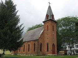
Trinity Episcopal Church, a McArthur historic site | |
 Location in Vinton County and the state of Ohio. | |
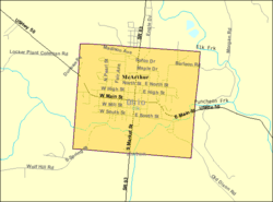 Detailed map of McArthur | |
| Coordinates: 39°14′50″N 82°28′47″W / 39.24722°N 82.47972°WCoordinates: 39°14′50″N 82°28′47″W / 39.24722°N 82.47972°W | |
| Country | United States |
| State | Ohio |
| County | Vinton |
| Area[1] | |
| • Total | 1.34 sq mi (3.47 km2) |
| • Land | 1.33 sq mi (3.44 km2) |
| • Water | 0.01 sq mi (0.03 km2) |
| Elevation[2] | 764 ft (233 m) |
| Population (2010)[3] | |
| • Total | 1,701 |
| • Estimate (2012[4]) | 1,683 |
| • Density | 1,278.9/sq mi (493.8/km2) |
| Time zone | Eastern (EST) (UTC-5) |
| • Summer (DST) | EDT (UTC-4) |
| ZIP code | 45651 |
| Area code(s) | 740 |
| FIPS code | 39-45696[5] |
| GNIS feature ID | 1076353[2] |
McArthur is a village in Vinton County, Ohio, United States. The population was 1,701 at the 2010 census. It is the county seat of Vinton County.[6]
History
McArthur was laid out and platted in 1815.[7] It was named for Duncan McArthur, an army general in the War of 1812.[8]
Geography
McArthur is located at 39°14′50″N 82°28′47″W / 39.24722°N 82.47972°W (39.247191, -82.479612).[9]
According to the United States Census Bureau, the village has a total area of 1.34 square miles (3.47 km2), of which 1.33 square miles (3.44 km2) is land and 0.01 square miles (0.03 km2) is water.[1]
Demographics
| Historical population | |||
|---|---|---|---|
| Census | Pop. | %± | |
| 1850 | 424 | — | |
| 1860 | 822 | 93.9% | |
| 1870 | 861 | 4.7% | |
| 1880 | 900 | 4.5% | |
| 1890 | 888 | −1.3% | |
| 1900 | 941 | 6.0% | |
| 1910 | 1,107 | 17.6% | |
| 1920 | 1,307 | 18.1% | |
| 1930 | 1,188 | −9.1% | |
| 1940 | 1,280 | 7.7% | |
| 1950 | 1,466 | 14.5% | |
| 1960 | 1,529 | 4.3% | |
| 1970 | 1,543 | 0.9% | |
| 1980 | 1,912 | 23.9% | |
| 1990 | 1,541 | −19.4% | |
| 2000 | 1,888 | 22.5% | |
| 2010 | 1,701 | −9.9% | |
| Est. 2015 | 1,664 | [10] | −2.2% |
2010 census
As of the census[3] of 2010, there were 1,701 people, 700 households, and 451 families residing in the village. The population density was 1,278.9 inhabitants per square mile (493.8/km2). There were 771 housing units at an average density of 579.7 per square mile (223.8/km2). The racial makeup of the village was 98.1% White, 0.1% African American, 0.8% Native American, 0.3% from other races, and 0.8% from two or more races. Hispanic or Latino of any race were 0.8% of the population.
There were 700 households of which 34.7% had children under the age of 18 living with them, 38.4% were married couples living together, 19.6% had a female householder with no husband present, 6.4% had a male householder with no wife present, and 35.6% were non-families. 31.9% of all households were made up of individuals and 14.5% had someone living alone who was 65 years of age or older. The average household size was 2.43 and the average family size was 2.97.
The median age in the village was 35.3 years. 27.5% of residents were under the age of 18; 10.2% were between the ages of 18 and 24; 23.6% were from 25 to 44; 23.3% were from 45 to 64; and 15.3% were 65 years of age or older. The gender makeup of the village was 45.7% male and 54.3% female.
2000 census
As of the census[5] of 2000, there were 1,888 people, 777 households, and 512 families residing in the village. The population density was 1,416.2 people per square mile (548.1/km²). There were 845 housing units at an average density of 633.8 per square mile (245.3/km²). The racial makeup of the village was 98.15% White, 0.11% African American, 0.26% Native American, and 1.48% from two or more races. Hispanic or Latino of any race were 0.42% of the population.
There were 777 households out of which 35.1% had children under the age of 18 living with them, 45.0% were married couples living together, 15.4% had a female householder with no husband present, and 34.1% were non-families. 31.8% of all households were made up of individuals and 15.7% had someone living alone who was 65 years of age or older. The average household size was 2.42 and the average family size was 3.04.
In the village the population was spread out with 30.1% under the age of 18, 9.2% from 18 to 24, 26.4% from 25 to 44, 19.6% from 45 to 64, and 14.7% who were 65 years of age or older. The median age was 33 years. For every 100 females there were 83.3 males. For every 100 females age 18 and over, there were 75.4 males.
The median income for a household in the village was $25,393, and the median income for a family was $33,026. Males had a median income of $30,109 versus $21,354 for females. The per capita income for the village was $14,623. About 24.7% of families and 27.8% of the population were below the poverty line, including 39.9% of those under age 18 and 14.8% of those age 65 or over.
Notable people
- Pete Abele - politician and judge
- Dick Bates - Major League Baseball pitcher
- Edward Franklin Bingham - Vinton County Prosecuting Attorney and Judge on the Court of Common Pleas, Fifth Judicial District
- Horatio C. Claypool - U.S. Representative
- Thomas S. Crow - Master Chief Petty Officer of the Navy
References
- 1 2 "US Gazetteer files 2010". United States Census Bureau. Archived from the original on January 24, 2012. Retrieved January 6, 2013.
- 1 2 "US Board on Geographic Names". United States Geological Survey. October 25, 2007. Retrieved January 31, 2008.
- 1 2 "American FactFinder". United States Census Bureau. Retrieved 2013-01-06.
- ↑ "Population Estimates". United States Census Bureau. Archived from the original on June 17, 2013. Retrieved June 17, 2013.
- 1 2 "American FactFinder". United States Census Bureau. Archived from the original on September 11, 2013. Retrieved 2008-01-31.
- ↑ "Find a County". National Association of Counties. Archived from the original on May 31, 2011. Retrieved June 7, 2011.
- ↑ History of Hocking Valley, Ohio. Inter-State Publishing Co. 1883. pp. 1215–1216.
- ↑ Gannett, Henry (1905). The Origin of Certain Place Names in the United States. U.S. Government Printing Office. p. 193.
- ↑ "US Gazetteer files: 2010, 2000, and 1990". United States Census Bureau. February 12, 2011. Retrieved April 23, 2011.
- ↑ "Annual Estimates of the Resident Population for Incorporated Places: April 1, 2010 to July 1, 2015". Retrieved July 2, 2016.
- ↑ "Census of Population and Housing". Census.gov. Archived from the original on May 11, 2015. Retrieved June 4, 2015.
Municipalities and communities of Vinton County, Ohio, United States | ||
|---|---|---|
| Villages | 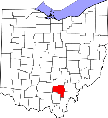 | |
| Townships | ||
| Unincorporated communities | ||
| Ghost towns | ||