Mechanic Street Historic District
|
Mechanic Street Historic District | |
 | |
  | |
| Location | Roughly bounded by W. Broad St., Pawcatuck River, Cedar St., and Courtland St., Stonington, Connecticut |
|---|---|
| Coordinates | 41°22′23″N 71°49′59″W / 41.37306°N 71.83306°WCoordinates: 41°22′23″N 71°49′59″W / 41.37306°N 71.83306°W |
| Area | 147 acres (59 ha) |
| Architect | Pendelton & Hall; Et al. |
| Architectural style | Late 19th and 20th Century Revivals, Greek Revival, Late Victorian |
| NRHP Reference # | 88000653[1] |
| Added to NRHP | June 7, 1988 |
The Mechanic Street Historic District is a 147-acre (59 ha) historic district consisting of 14 blocks in the Pawcatuck section of Stonington, Connecticut. It is located along the Pawcatuck River approximately 2 miles (3.2 km) from the Atlantic Ocean. It was listed on the National Register of Historic Places in 1988. At that time it included 413 contributing buildings and one other contributing structure.[1][2]
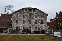
The district includes a large mill complex, including 7 major buildings over a 25-acre (100,000 m2) area, and a smaller company office building. It is irregularly shaped and is drawn to include similarly themed buildings, and to exclude neighborhoods above Broad Street and on other sides that are incompatible.[2]

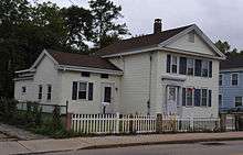
The district was site of several shipyards. Mechanic Street is presumed to be named for the "mechanics" who worked in shipbuilding. It includes Greek Revival style houses from the era of shipbuilding, and at least one building that served as housing for shipworkers.[2]
See also
References
- 1 2 National Park Service (2009-03-13). "National Register Information System". National Register of Historic Places. National Park Service.
- 1 2 3 Jan Cunningham and John Herzan (December 9, 1987). "National Register of Historic Places Inventory-Nomination: Mechanic Street Historic District" (PDF). National Park Service. and Accompanying 26 photos, from 1987