Miho, Ibaraki
| Miho 美浦村 | |||
|---|---|---|---|
| Village | |||
|
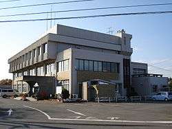
Miho village hall | |||
| |||
 Location of Miho in Ibaraki Prefecture | |||
 Miho
| |||
| Coordinates: 36°0′16.3″N 140°18′6.8″E / 36.004528°N 140.301889°ECoordinates: 36°0′16.3″N 140°18′6.8″E / 36.004528°N 140.301889°E | |||
| Country | Japan | ||
| Region | Kantō | ||
| Prefecture | Ibaraki Prefecture | ||
| District | Inashiki | ||
| Area | |||
| • Total | 66.61 km2 (25.72 sq mi) | ||
| Population (September 2015) | |||
| • Total | 15,911 | ||
| • Density | 240/km2 (600/sq mi) | ||
| Time zone | Japan Standard Time (UTC+9) | ||
| - Tree | Wild cherry tree | ||
| - Flower | Golden-rayed lily | ||
| Phone number | 029-885-0340 | ||
| Address | 1515 Ukeryo, Miho-mura, Inashiki-gun, Ibaraki-ken 300-0492 | ||
| Website | Official website | ||


Miho (美浦村 Miho-mura) is a town located in Inashiki District, Ibaraki Prefecture, in the northern Kantō region of Japan. As of September 2015, the village had an estimated population of 15,977 and a population density of 240 persons per km². Its total area was 66.61 km².
Geography
Located in southern Ibaraki Prefecture, Miho is bordered by Lake Kasumigaura to the north and east.
Surrounding municipalities
History
The villages of Kihara and Anju were created with the establishment of the municipalities system on April 1, 1889. The two villages were merged to form the village of Miho on April 1, 1955.
Economy
The economy of Miho is primarily agricultural, including aquaculture on Lake Kasumigaura.
Education
- Miho has three elementary schools and one middle school and one special education school
Transportation
Railway
- Miho is not served by any passenger train service.
Highway
Local attractions
- site of Kihara Castle
- Akadaira Shell Midden
International relations
 – Lingui District, Guilin, Guangxi Zhuang Autonomous Region, China (friendship city) [1]
Noted people from Miho
- Eijiro Ai – professional baseball player
References
External links
![]() Media related to Miho, Ibaraki at Wikimedia Commons
Media related to Miho, Ibaraki at Wikimedia Commons
- Official website (Japanese)
| Special cities | ||
|---|---|---|
| Cities | ||
| Higashiibaraki District | ||
| Inashiki District | ||
| Kitasōma District | ||
| Kuji District | ||
| Naka District | ||
| Sashima District | ||
| Yūki District | ||
This article is issued from Wikipedia - version of the 1/19/2016. The text is available under the Creative Commons Attribution/Share Alike but additional terms may apply for the media files.