Shirosato, Ibaraki
| Shirosato 城里町 | |||
|---|---|---|---|
| Town | |||
|
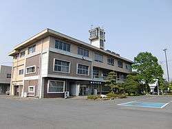
Shirosato town hall | |||
| |||
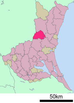 Location of Shirosato in Ibaraki Prefecture | |||
 Shirosato
| |||
| Coordinates: 36°28′45.2″N 140°22′34.4″E / 36.479222°N 140.376222°ECoordinates: 36°28′45.2″N 140°22′34.4″E / 36.479222°N 140.376222°E | |||
| Country | Japan | ||
| Region | Kantō | ||
| Prefecture | Ibaraki Prefecture | ||
| District | HIgashiibaraki | ||
| Area | |||
| • Total | 161.80 km2 (62.47 sq mi) | ||
| Population (September 2015) | |||
| • Total | 19,955 | ||
| • Density | 123/km2 (320/sq mi) | ||
| Time zone | Japan Standard Time (UTC+9) | ||
| - Tree | Castanopsis sieboldii | ||
| - Flower | Lilium auratum | ||
| - Bird | Japanese bush warbler | ||
| Phone number | 029-288-3111 | ||
| Address | 1428-25 Ishizuka, Shirosato-machi, Higashiibaraki-gun, Ibaraki-ken 311-4391 | ||
| Website | Official website | ||


Shirosato (城里町 Shirosato-machi) is a town located in Higashiibaraki District, Ibaraki Prefecture, in the northern Kantō region of Japan. As of September 2015, the town had an estimated population of 19,955 and a population density of 123 persons per km². Its total area was 161.80 km².
Geography
Located in central-west Ibaraki Prefecture, Shinsato is bordered by Tochigi Prefecture to the west. The Naka River passes through the town.
Surrounding municipalities
- Ibaraki Prefecture
- Tochigi Prefecture
History
Shirosato was formed on February 1, 2005, from the merger of the town of Jōhoku, the village of Katsura, both from Higashiibaraki District, and the village of Nanakai, from Nishiibaraki District.
Education
- Shirosato has five elementary schools, two middle schools and one high school.
Transportation
Train
- Shirosato is not served by any passenger train service.
Highway
Noted people from Shirosato
- Akihiro Ohata - politician
External links
![]() Media related to Shirosato, Ibaraki at Wikimedia Commons
Media related to Shirosato, Ibaraki at Wikimedia Commons
- Official website (Japanese)
| Special cities | ||
|---|---|---|
| Cities | ||
| Higashiibaraki District | ||
| Inashiki District | ||
| Kitasōma District | ||
| Kuji District | ||
| Naka District | ||
| Sashima District | ||
| Yūki District | ||
This article is issued from Wikipedia - version of the 2/15/2016. The text is available under the Creative Commons Attribution/Share Alike but additional terms may apply for the media files.