Mikasa, Hokkaido
| Mikasa 三笠市 | ||
|---|---|---|
| City | ||
| ||
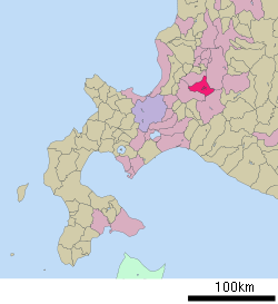 Location of Mikasa in Hokkaido (Sorachi Subprefecture) | ||
 Mikasa
| ||
| Coordinates: 43°15′N 141°53′E / 43.250°N 141.883°ECoordinates: 43°15′N 141°53′E / 43.250°N 141.883°E | ||
| Country | Japan | |
| Region | Hokkaido | |
| Prefecture | Hokkaido (Sorachi Subprefecture) | |
| Government | ||
| • Mayor | Kazuo Kobayashi | |
| Area | ||
| • Total | 302.64 km2 (116.85 sq mi) | |
| Population (June 30, 2008) | ||
| • Total | 11,228 | |
| • Density | 37.1/km2 (96/sq mi) | |
| Time zone | Japan Standard Time (UTC+9) | |
| Symbols | ||
| • Tree | Japanese rowan | |
| • Flower | Chrysanthemum | |
| • Bird | White wagtail | |
| Phone number | 01267-2-3182 | |
| Address |
2 Saiwaichō, Mikasa-shi, Hokkaidō 068-2192 | |
| Website | Mikasa City | |

Mikasa (三笠市 Mikasa-shi) is a city located in Sorachi Subprefecture, Hokkaido, Japan.
As of 2008, the city has an estimated population of 11,228 and the density of 37.1 persons per km2. The total area is 302.64 km2. It is bordered on three sides by mountains, and on its east side is the man-made Lake Katsurazawa.
Notable local products include watermelon, musk melon, cucumber, northern plum, and wine.
History
Mikasa is one of the birthplaces of the mining and railroad industries in Hokkaido, and the Hokkai Bon song was invented there. Though in the past it flourished due to its natural abundance of coal, the mines have largely closed down and this has caused the population of the city to fall rapidly.
Quite a few fossil specimens have also been collected there, particularly ammonites and the prehistoric marine reptile Yezosaurus mikasaensis, both of which can be viewed at the city's natural history museum.[1]
- 1906 Mikasayama village was founded
- 1942 Mikasayama village became Mikasa town
- 1957 Mikasa town became Mikasa city
Education
High school
- Hokkaido Mikasa High School
Transportation
Hokkaidō Expressway runs through west of the city and Mikasa IC is on it. No railway is in the city.
References
External links
![]() Media related to Mikasa, Hokkaidō at Wikimedia Commons
Media related to Mikasa, Hokkaidō at Wikimedia Commons
- (Japanese) Official website