Missouri Route 14
| ||||
|---|---|---|---|---|
| Route information | ||||
| Maintained by MoDOT | ||||
| Length: | 120 mi (190 km) | |||
| Existed: | 1926 – present | |||
| Major junctions | ||||
| East end: |
| |||
|
| ||||
| West end: |
| |||
| Highway system | ||||
| ||||

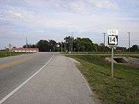
Route 14 is a state highway traveling through the southern part of the U.S. state of Missouri. Its western terminus is at U.S. Route 60 (US 60) in Marionville, and its eastern terminus is at US 63 on the northern edge of West Plains. Route 14 is a two-lane highway for its entire length.
Formerly this road's western terminus was at US 71 in Joplin, and its eastern terminus was at US 67 southwest of Poplar Bluff. These sections are now US 160, Route 174, and Interstate 44 (I-44). The section between Mount Vernon and the southeast corner of Douglas County was Route 40 from 1922 to 1926.
Route description
Route 14 begins at the northern boundary of West Plains at an intersection with US 63. It will be 52 miles (84 km) before Route 14 enters another town. The highway passes through the hilly country of the Ozarks, and shortly after it starts, it enters the Mark Twain National Forest and forms a short 4.8 miles (7.7 km) concurrency with Route 181 from the twin bridges west. Twenty-eight miles (45 km) west of US 63, Route 14 intersects Route 95. Twenty-three miles (37 km) west of the intersection with Route 95 is Ava and an intersection with Route 76 and Route 5. West of Ava, the highway winds its way west to Sparta, where it joins with Route 125 for two miles (3 km).
West of Sparta, the road becomes less hilly and the road heads on a straight course to Ozark, where it runs through the downtown area united with Business U.S. Route 65. Route 14 crosses US 65 and continues west towards Nixa and the traffic is significantly heavier (this is part of the Springfield, Missouri MSA. At Nixa is an intersection with U.S. Route 160 and Route 13. West of Nixa, the highway crosses James River and passes through Clever on its way to Billings, where it joins (for one mile) U.S. Route 60 and Route 413. When Route 14 heads west again, it is on an old alignment of US 60, making a sharp curve at McKinley before ending at US 60 in northern Marionville.
Major intersections
Major (numbered state highways) include:[1]
| County | Location | mi | km | Destinations | Notes |
|---|---|---|---|---|---|
| Lawrence | Marionville | ||||
| McKinley | |||||
| Christian | Billings | west end of US 60 / Route 413 overlap | |||
| east end of US 60 / Route 413 overlap | |||||
| Nixa | |||||
| Ozark | interchange; west end of US 65 Bus. overlap | ||||
| east end of US 65 Bus. overlap | |||||
| Sparta | west end of Route 125 overlap | ||||
| east end of Route 125 overlap | |||||
| Douglas | Ava | west end of Route 5 Bus. overlap | |||
| east end of Route 5 Bus. overlap; traffic circle around town square | |||||
| Gentryville | |||||
| | west end of Route 181 overlap | ||||
| | east end of Route 181 overlap, between the Twin Bridges over the North Fork River and its tributary Spring Creek | ||||
| Howell | West Plains | ||||
| 1.000 mi = 1.609 km; 1.000 km = 0.621 mi | |||||
See also
-
 Missouri portal
 -
 U.S. Roads portal
References
- ↑ Missouri Atlas & Gazetteer, DeLorme, 1998, pp 61-64 ISBN 0-89933-224-2