Ozark, Missouri
| Ozark, Missouri | |
|---|---|
| City | |
 Location of Ozark, Missouri | |
| Coordinates: 37°1′38″N 93°12′34″W / 37.02722°N 93.20944°WCoordinates: 37°1′38″N 93°12′34″W / 37.02722°N 93.20944°W | |
| Country | United States |
| State | Missouri |
| County | Christian |
| Area[1] | |
| • Total | 11.15 sq mi (28.88 km2) |
| • Land | 11.10 sq mi (28.75 km2) |
| • Water | 0.05 sq mi (0.13 km2) |
| Elevation | 1,168 ft (356 m) |
| Population (2010)[2] | |
| • Total | 17,820 |
| • Estimate (2013[3]) | 18,606 |
| • Density | 1,605.4/sq mi (619.8/km2) |
| Time zone | Central (CST) (UTC-6) |
| • Summer (DST) | CDT (UTC-5) |
| ZIP code | 65721 |
| Area code(s) | 417 |
| FIPS code | 29-55766[4] |
| GNIS feature ID | 0723933[5] |
Ozark, incorporated in 1890, is a city in Christian County, Missouri, United States. The population was 17,820 at the 2010 census. It is the county seat of Christian County.[6] Ozark is part of the Springfield, Missouri Metropolitan Area, and is centered along a business loop of U.S. Route 65, where it intersects with Missouri Route 14. It is south of Springfield and north of Branson.
History
Ozark was named from the Ozarks, in which it is situated.[7]
The Ozark Courthouse Square Historic District was listed on the National Register of Historic Places in 2009.[8]
Geography
Ozark is located at 37°1′38″N 93°12′34″W / 37.02722°N 93.20944°W (37.027111, −93.209572).[9] According to the United States Census Bureau, the city has a total area of 11.15 square miles (28.88 km2), of which, 11.10 square miles (28.75 km2) is land and 0.05 square miles (0.13 km2) is water.[1]
Demographics
| Historical population | |||
|---|---|---|---|
| Census | Pop. | %± | |
| 1880 | 235 | — | |
| 1890 | 490 | 108.5% | |
| 1900 | 830 | 69.4% | |
| 1910 | 813 | −2.0% | |
| 1920 | 798 | −1.8% | |
| 1930 | 885 | 10.9% | |
| 1940 | 961 | 8.6% | |
| 1950 | 1,087 | 13.1% | |
| 1960 | 1,536 | 41.3% | |
| 1970 | 2,384 | 55.2% | |
| 1980 | 2,980 | 25.0% | |
| 1990 | 4,243 | 42.4% | |
| 2000 | 9,665 | 127.8% | |
| 2010 | 17,820 | 84.4% | |
| Est. 2015 | 19,120 | [10] | 7.3% |
In 2012, press reports described Ozark as the fastest-growing city in Missouri.[12]
2010 census
As of the census[2] of 2010, there were 17,820 people, 6,603 households, and 4,689 families residing in the city. The population density was 1,605.4 inhabitants per square mile (619.8/km2). There were 7,311 housing units at an average density of 658.6 per square mile (254.3/km2). The racial makeup of the city was 95.2% White, 0.8% African American, 0.5% Native American, 0.5% Asian, 0.1% Pacific Islander, 0.8% from other races, and 2.0% from two or more races. Hispanic or Latino of any race were 3.2% of the population.
There were 6,603 households of which 43.4% had children under the age of 18 living with them, 52.6% were married couples living together, 14.0% had a female householder with no husband present, 4.4% had a male householder with no wife present, and 29.0% were non-families. 23.1% of all households were made up of individuals and 7.8% had someone living alone who was 65 years of age or older. The average household size was 2.65 and the average family size was 3.14.
The median age in the city was 30.9 years. 30.2% of residents were under the age of 18; 9.1% were between the ages of 18 and 24; 31.6% were from 25 to 44; 19.1% were from 45 to 64; and 10.1% were 65 years of age or older. The gender makeup of the city was 47.3% male and 52.7% female.
2000 census
As of the census[4] of 2000, there were 9,665 people, 3,635 households, and 2,599 families residing in the city. The population density was 1,280.8 people per square mile (494.3/km²). There were 3,853 housing units at an average density of 510.6 per square mile (197.0/km²). The racial makeup of the city was 96.36% White, 0.71% Native American, 0.33% African American, 0.30% Asian, 0.07% Pacific Islander, 0.59% from other races, and 1.63% from two or more races. Hispanic or Latino of any race were 1.70% of the population.
There were 3,635 households out of which 40.9% had children under the age of 18 living with them, 55.2% were married couples living together, 12.9% had a female householder with no husband present, and 28.5% were non-families. 23.2% of all households were made up of individuals and 7.7% had someone living alone who was 65 years of age or older. The average household size was 2.57 and the average family size was 3.04.
In the city, the population was spread out with 28.9% under the age of 18, 10.7% from 18 to 24, 34.5% from 25 to 44, 16.1% from 45 to 64, and 9.8% who were 65 years of age or older. The median age was 30 years. For every 100 females there were 88.5 males. For every 100 females age 18 and over, there were 83.9 males.
The median income for a household in the city was $34,210, and the median income for a family was $40,069. Males had a median income of $30,599 versus $21,794 for females. The per capita income for the city was $15,912. About 10.4% of families and 11.7% of the population were below the poverty line, including 17.3% of those under age 18 and 9.9% of those age 65 or over.
Economy
Ozark is home to Simclar Interconnect Technologies, a 100,000-square-foot (9,300 m2) Simclar Group factory, providing backplane fabrication for telecommunications and data communications customers.[13] In 2007, Simclar moved 115 jobs to Ozark from Springfield, lured by a "tax incentive under which the company donated $1 million to a local not-for-profit corporation, which in turn will buy buildings, machinery and equipment and lease them back to Simclar."[14]
The Springfield/Ozark Mountain Ducks were an independent baseball team playing in the Central Baseball League from 1998 to 2003; Price Cutter Park, which was built in early 1999, was their home field.
In 2011, B&B Theatres built a cinema between Ozark and Nixa along Route 14.[15] The Belltower Chapel, originally the Ozark Christian Church, was built in 1912 and is located off of the Historic Courthouse Square in Ozark; since its 21st-century renovation it serves as a venue for weddings and other events.
Politics
Ozark is part of Missouri's 7th congressional district.
Notable people
- Grant Hodges, Republican member of the Arkansas House of Representatives for Benton County since 2015, former Ozark resident.[16]
- Lucas Harrell, Major League baseball player for the Houston Astros.[17]
References
- 1 2 "US Gazetteer files 2010". United States Census Bureau. Retrieved 2012-07-08.
- 1 2 "American FactFinder". United States Census Bureau. Retrieved 2012-07-08.
- ↑ "Population Estimates". United States Census Bureau. Retrieved 2013-05-30.
- 1 2 "American FactFinder". United States Census Bureau. Retrieved 2008-01-31.
- ↑ "US Board on Geographic Names". United States Geological Survey. 2007-10-25. Retrieved 2008-01-31.
- ↑ "Find a County". National Association of Counties. Retrieved 2011-06-07.
- ↑ Eaton, David Wolfe (1916). How Missouri Counties, Towns and Streams Were Named. The State Historical Society of Missouri. p. 275.
- ↑ National Park Service (2009-03-13). "National Register Information System". National Register of Historic Places. National Park Service.
- ↑ "US Gazetteer files: 2010, 2000, and 1990". United States Census Bureau. 2011-02-12. Retrieved 2011-04-23.
- ↑ "Annual Estimates of the Resident Population for Incorporated Places: April 1, 2010 to July 1, 2015". Retrieved July 2, 2016.
- ↑ "Census of Population and Housing". Census.gov. Retrieved June 4, 2015.
- ↑ A. G. Sulzberger (15 February 2012). "British Robbery Suspect Edward Maher Arrested in Missouri". New York Times.
- ↑ "Simclar USA Missouri". Simclar Group. Retrieved 2012-03-30.
- ↑ Tracy Heffner (29 January 2007). "Simclar Reports Plant Closures, Relocation". Printed Circuit Design & Fab Magazine. UP Media Group. Retrieved 2012-03-30.
- ↑ "B & B Ozark-Nixa 12 with Marquee Suites". B&B Theatres. Retrieved 2012-03-30.
- ↑ "Three University of Arkansas Students Named as 2012 Truman Scholarship Finalists". uark.edu. February 29, 2012. Retrieved April 11, 2015.
- ↑ http://m.bbref.com/m?p=XXplayersXXhXXharrelu01.shtml. Retrieved May 5, 2015. Missing or empty
|title=(help)
External links
- Official website
- Historic maps of Ozark in the Sanborn Maps of Missouri Collection at the University of Missouri
- Christian County Headliner, the website of the local newspaper
Municipalities and communities of Christian County, Missouri, United States | ||
|---|---|---|
| Cities | 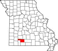 | |
| Village | ||
| CDP | ||
| Unincorporated communities | ||
| Ghost towns | ||
| Footnotes | ‡This populated place also has portions in an adjacent county or counties | |