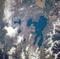
Mount Chittenden
For the mountain in California, see Chittenden Peak.
| Mount Chittenden | |
|---|---|
| Highest point | |
| Elevation | 10,177 ft (3,102 m) NGVD 29[1] |
| Prominence | 577 ft (176 m) [1] |
| Coordinates | 44°32′48″N 110°10′16″W / 44.5466102°N 110.1710251°WCoordinates: 44°32′48″N 110°10′16″W / 44.5466102°N 110.1710251°W [2] |
| Geography | |
| Location | Yellowstone National Park, Park County, Wyoming |
| Parent range | Absaroka Range |
| Topo map | Mount Chittenden |
Mount Chittenden el. 10,088 feet (3,075 m) is a mountain peak in the Absaroka Range in Yellowstone National Park. The peak was named by Henry Gannett of the Hayden Geological Survey of 1878 for George B. Chittenden. Chittenden was a Geological Survey member who had worked with Gannett, Hayden and others in surveys in Montana, Idaho and Wyoming. Chittenden never participated in any of the Yellowstone surveys.[3]
Mount Chittenden was not named for Major Hiram M. Chittenden, the U.S. Army Engineer famous for his road and bridge work in the park.
See also
Notes
- 1 2 "Mount Chittenden, Wyoming". Peakbagger.com. Retrieved 2010-03-04.
- ↑ "Mount Chittenden". Geographic Names Information System. United States Geological Survey.
- ↑ Whittlesey, Lee (1988). Yellowstone Place Names. Helena, MT: Montana Historical Society Press. p. 103. ISBN 0-917298-15-2.
This article is issued from Wikipedia - version of the 1/1/2016. The text is available under the Creative Commons Attribution/Share Alike but additional terms may apply for the media files.
